Trachonitis
VIEW:19 DATA:01-04-2020
sto
Hitchcock's Bible Names Dictionary
TRACHONITIS.Mentioned in Luk_3:1 as the name of the tetrarchy of Philip. It is to be identified with the lava region S.E. of Damascus, known to the Greeks as Trachon, and to modern Arabs as the Lejâ. An inscription discovered by Burckhardt in 1810 at Mismiyeh dispels all doubt as to the identity of this region with Trachon. It has ever been regarded as a refuge from invaders. Josephus frequently speaks of the inhabitants of these parts as predatory (Ant. XVI. ix. 1, x. 1). Philips rule, on the other hand, he describes as just and gentle (Ib. XVIII. iv. 6). Trajan in a.d. 106 transformed Trachonitis into a new province, which he called Arabia, making Bosra its capital.
George L. Robinson.
Hastings' Dictionary of the Bible
Edited by James Hastings, D.D. Published in 1909
Luk_3:1. The Trachonite region (the old Bashan) included parrs of Auranitis, Gaulanitis, and Batanaea besides Trachonitis proper, which lay S. of Damascus and E. of Gaulanitis. (Josephus Ant. 17:8, section 1; 11, section 4). Philip was tetrarch of Trachonitis and Ituraea. (See PHILIP.) Trachonitis is the Greek for the Aramaic Argob ("heap of stones"), "the rugged region," abounding in caves, some of vast extent. Jerome places Trachonitis rightly between Damascus and Bostra; having Kenath among its chief towns. Trachonitis included el Lejah and part of the western slopes of jebel Hauran. (See ARGOB.)
On the northern border of Trachonitis are the large ruins of Musmeih, which an inscription on a temple door identifies with Phocus (Phoeno) the old capital (Burckhardt, Trav. Syriac 117). The Lejah is bounded on the E. by the mountains of Batanaea (jebel Hauran) whereon lie the ruins of Kenath, on the S. by Auranitis (Hauran) whereon are the ruins of Bostra, on the N. by Ituraea (Jedur) and Damascus. Josephus (Ant. 15:10, section 1) says "the inhabitants dwelt in caves that served as a refuge for themselves and their flocks; they had cisterns of water, and stored granaries, and so were able to defy their enemies. The cave doors are so narrow that but one can enter at a time, while within they are incredibly large; the ground above abounds in rugged rocks with many windings, and difficult of access except with a guide." From Josephus' time until the present day it has been the haunt and asylum of robbers.
Fausset's Bible Dictionary
By Andrew Robert Fausset, co-Author of Jamieson, Fausset and Brown's 1888.
Trachoni'tis. (a rugged region). Luk_3:1. Trachonitis is, in all probability, the Greek equivalent for the Aramaic, Argob, one of the five Roman provinces, into which the country northeast of the Jordan, was divided in New Testament times. See Argob.
Smith's Bible Dictionary
By Dr. William Smith.Published in 1863
Luk_3:1. This province had Arabia Deserta to the east, Batanea to the west, Iturea to the south, and the country of Damascus to the north. It belonged rather to Arabia than Palestine; was a rocky province, and served as a shelter for thieves and depredators.
Biblical and Theological Dictionary by Richard Watson
PRINTER 1849.
The region of Trachonitis lay to the north-east of Palestine, between Lake Galilee and Damascus. It was on the northern edge of the territory known in Old Testament times as Bashan (Num_32:33; Deu_32:14; see BASHAN). At the time Jesus began his public ministry, the governor of Trachonitis was Philip, a son of Herod the Great (Luk_3:1). (For map and other details see HEROD.)
Bridgeway Bible Dictionary by Don Fleming
PRINTER 1990.
trak-ṓ-nı̄?tis: Appears in Scripture only in the phrase τῆς Ἰτουραίας καὶ Τραχωνίτιδος χώρακ, tḗs Itouraı́as kaı́ Trachōnı́tidos chṓras, literally, ?of the Iturean and Trachonian region? (Luk_3:1). Trachonitis signifies the land associated with the trachōn, ?a rugged stony tract.? There are two volcanic districts South and East of Damascus, to which the Greeks applied this name: that to the Northwest of the mountain of Bashan (Jebel ed-Drūze) is now called el-Lejā', ?the refuge? or ?asylum.? It lies in the midst of an arable and pastoral country; and although it could never have supported a large population, it has probably always been inhabited. The other is away to the Northeast of the mountain, and is called in Arabic eṣ-Ṣafā. This covers much the larger area. It is a wild and inhospitable desert tract, remote from the dwellings of men. It was well known to the ancients; but there was nothing to attract even a sparse population to its dark and forbidding rocks, burning under the suns of the wilderness. It therefore plays no part in the history. These are the two Trachons of Strabo (xvi. 2, 20). They are entirely volcanic in origin, consisting of lava belched forth by volcanoes that have been extinct for ages. In cooling, the lava has split up and crumbled into the most weird and fantastic forms. The average elevation of these districts above the surrounding country is about 30 ft. Eṣ-Ṣafā is quite waterless. There are springs around the border of el-Lejā', but in the interior, water-supply depends entirely upon cisterns. Certain great hollows in the rocks also form natural reservoirs, in which the rain water is preserved through the summer months.
El-Lejā' is roughly triangular in shape, with its apex to the North. The sides are about 25 miles in length, and the base about 20. The present writer has described this region as he saw it during two somewhat lengthened visits: From Zor'a our course lay Northeast by East ... What a wild solitude it is! Far on every hand stretched a veritable land of stone. The first hour or two of our march no living thing was seen.... Wherever we looked, before or behind, lay wide fields of volcanic rock, black and repulsive,... with here and there a deep circular depression, through which in the dim past red destruction belched forth, now carefully walled round the lip to prevent wandering sheep or goat from falling in by night. The general impression conveyed was as if the dark waters of a great sea, lashed to fury by a storm, had been suddenly petrified.... At times we passed over vast sheets of lava which in cooling had cracked in nearly regular lines, and which, broken through in parts, appeared to rest on a stratum of different character, like pieces of cyclopaean pavement. Curious rounded rocks were occasionally seen by the wayside, like gigantic black soap bubbles blown up by the subterranean steam and gases of the active volcanic age; often, with the side broken out as if burst by escaping vapor, the mass, having cooled too far to collapse, remained an enduring monument of the force that formed it. Scanty vegetation peeped from the fissures in the rocks, or preserved a precarious existence in the scanty soil sometimes seen in a hollow between opposing slopes. In a dreary waterless land where the cloudless sun, beating down on fiery stones, creates a heat like that of an oven, it were indeed a wonder if anything less hardy than the ubiquitous thistle could long hold up its head.... When the traveler has fairly penetrated the rough barriers that surround el-Lejā' he finds not a little pleasant land within - fertile soil which, if only freed a little from overlying stones, might support a moderate population. In ancient times it was partly cleared, and the work of the old-world agriculturists remains in gigantic banks of stones built along the edges of the patches they cultivated? (Arab and Druze at Home, 30 ff).
In some parts, especially those occupied by the Druzes, fair crops are grown. Where the Arabs are masters, poverty reigns. They also have an evil reputation. As one said to the present writer, ?They will even slay the guest.? 'Arab el-Lejā' anjas ma yakūn is a common saying, which may be freely rendered: ?Than the Arabs of el-Lejā' greater rascals do not exist.? Until comparatively recent years there were great breadths of oak and terebinth. These have disappeared, largely owing to the enterprise of the charcoal burners. The region to the Northeast was described by a native as bass wa‛r, ?nothing but barren rocky tracts? (compare Hebrew ya‛ar), over which in summer, he said, not even a bird would fly. There are many ruined sites. A list of 71 names collected by the present writer will be found in PEFS, 1895, 366 ff. In many cases the houses, strongly built of stone, are still practically complete, after centuries of desertion.
There may possibly be a reference to the Trachons in the Old Testament where Jeremiah speaks of the hărērı̄m, ?parched places? (Jer_17:6). The cognate el-Ḥarrah is the word used by the Arabs for such a burned, rocky area. For theory that el-Lejā' corresponds to the Old Testament ?Argob,? see ARGOB.
The robbers who infested the place, making use of the numerous caves, were routed out by Herod the Great (Ant., XV, x, 1 ff; XVI, ix, 1; XVII, ii, 1 f). Trachonitis was included in the tetrarchy of Philip (viii, 1; ix, 4). At his death without heirs it was joined to the province of Syria (XVIII, iv, 6). Caligula gave it to Agrippa I. After his death in 44 AD, and during the minority of his son, it was administered by Roman officers. From 53 till 100 AD it was ruled by Agrippa II. In 106 AD it was incorporated in the new province of Arabia. Under the Romans the district enjoyed a period of great prosperity, to which the Greek inscriptions amply testify. To this time belong practically all the remains to be seen today. The theaters, temples, public buildings and great roads speak of a high civilization. That Christianity also made its way into these fastnesses is vouched for by the ruins of churches. Evil days came with the advent of the Moslems. Small Christian communities are still found at Khabab on the western Luḥf, and at Ṣūr in the interior. The southeastern district, with the chief town of Dāmet el-‛Alia, is in the hands of the Druzes; the rest is dominated by the Arabs.
International Standard Bible Encyclopedia
PRINTER 1915.
Trachoni?tis was, in the days of the Herodian dynasty, the name of the country situated between the Antilibanus and the Arabian mountains south of Damascus and west of the provinces of Batanaea, Gaulonitis, Ituraea, and Auranitis, under about the thirty-third degree of northern latitude. It is at present called Ledja. The eastern range of mountains is now called Jebel Manai, and contains great caverns in chalk rocks. The southern portions of the ancient Trachonitis, or the present Ledja, consist chiefly of basalt rocks.
The Popular Cyclopedia of Biblical Literature
by John Kitto.
(Τραχωνῖτις) is mentioned in the Scriptures only in describing the political divisions of Palestine at the time of John the Baptist's first public appearance: Philip was then tetrarch of Itursea and the region (χώρας) of Trachonitis (Luk_3:1). Although Trachonitis was a distinct and vell- defined province, yet it appears that in this passage the phrase region of Trachonitis is used in a wider sense, and included two or three other, adjoining provinces. As considerable misapprehension has existed among geographers regarding Trachonitis, and as its exact position and boundaries were first clearly ascertained by the researches of recent writers, it may he well in this place to give a brief resume of the ancient notices of the province, and then to show how they can be applied in setting aside modern errors and establishing correct views. Josephus states that Uz, the son of Aram, founded Trachonitis and Damascus, which lay between Palestine and Coele-Syria (Ant. 1, 6, 4). His next reference to it is when it was held by Zenodorils; the bandit chief. Then its inhabitants made frequent raids, as their successors do still upon the territories of Damascus (Ant. 15, 1). Augustus took it from Zenodorus, and gave it to Herod the Great, on condition that he should repress the robbers (Ant. 16:9, 1). Herod bequeathed it to his son Philip, and his will was confirmed by Caesar (War, 2, 6, 3). This is the Philip referred to in Luke 3, 1. At a later period it passed-into the hands of Herod Agrippa (War, 3, 5). After the conquest of this part of Syria by Cornelius Palma, in the beginning of the 2nd century, we hear no more of Trachonitis.
From various incidental remarks anti descriptions in Josephus's writings, the position of Trachonitis in relation to the other Transjordanic proivinces may be ascertained. It lay on the east of Gaulonitis, while it bordered on both. Anranitis and Batanaea (War, 4:1, 1; 1, 20, 4). It extended, farther north than Gaulonitis, reaching to the territory of Damascus (Ant. 15:10, 3, and 10, 1; War, 3, 10,7), Ptolemy-locates the Trachonitic Arabs along-the base of Mount Alsadamus, and he includes this mountain in the province of Batanea, of which Saccea was a chief town (Geogr 5; 15). Stabo states that there were two Trachons (δύο Τραχῶνες), amid he groups Damascus and Trachon together and states that the latter country is rugged and wild, and the people daring robbers (Geogr. 16:11). Jerome, speaking of Kenath, calls it a city of Trachonitis near Bozrah (Onomast. s.v. Canath); and the writers of the Talmud extend Trachon as far as Bobzrah (Lightfoot, Opp. 2, 473; comp. Jerome, Onomast. s.v. Ituraea; Reland, Palest. p. 109 sq.).
From these statements, compared with the results of modern research, the exact position and boundaries of this ancient province can be determined. It extended from the southern confines of Damascus, near the bank of the River Awaj (Pharpar), on the north, to Busrah (Bostra and Bozrah), on the south. Bozrah was the capital of Auranitis, and consequently that province lay along the southern end of Trachon. The province of Gaulanitis (now Jaulan) was its western boundary. Batanaea has been identified With Ard el-Bathanyeh, which embraces the whole ridge of Jebel Hauran, at whose western base lie the splendid ruins of Kenath, one of the ancient cities of Trachon (Jerome, Ozomnast. s.v. Canath,' Kenath). Consequently the ridge of Jebel Hauran formed the eastern boundary of Trachon, which extended southward to Busrah in the plain, near the south-western extremity of the range (Porter, Damascus, 2, 259 sq.; also in Journal of Sac. Lit. for July, 1854). The region thus marked out embraces the modern district of the Lejoah, which may be considered the nucleus of Trachonitis; also the smooth plain extending from its northern border to the ranges of Khiyarah and Maiia. The rocky strip of land running along the western base of Jebel Hauran, and separating the mountain range from the smooth expanse of Auranitis, was likewise included in Trachonitis. This may explain Strabo's two Trachons. In the ruins of Muosmeih, on the northern edge of Lejah, Burckhardt discovered a Greek inscription, which proves that that city was Phaeno, the ancient metropolis of Trachon (Triavels in Syria, p. 117; see also Preface, p. 11).
At first sight it might appear as if Trachon, or Trachonitis (Τραχών.or Τραχωνῖτις), were only a Greek name applied to one of the subdivisions of the ancient kingdom of Bashan; yet there is evidence to show that it is a translation of a more ancient Shemitic appellation, descriptive of the physical nature of the region. Τραχών signifies rough and rugged; and Τραχωνῖτις is a rugged region (τραχὺς καὶ πετρώδης τόπος), and peculiarly applicable to the district under notice. The Hebrew equivalent. is Argob (אִרַגֹּב, a heap of stones ; from רגב= רגם), which was the ancient name of an important part of Og's kingdom in Bashan. The identity of Trachon and Argob cannot now be questioned. It was admitted by, the Jewish rabbins, for the Targums read תרכונא(Trachona) instead of ארגב(Argob) in Deu_3:14 and 1Ki_4:13 (Lightfoot, Opp. 2, 473); and it is confirmed by the fact that Kenath, one of the threescore great cities of Argob (1Ch_2:23), was also, as has been seen, a city of Trachon. Eusebius, led doubtless by similarity of names, confounded Argob with the castle of Erga or Ragaba, near the confluence of the Jordan and Jabbok. In this he has been followed by Reland (Palcest. p. 959, 201), Ritter (Pal. 2znd Syr. 2, 1041), and even Robinson (Bibl. Res. App. p. 166, 1st ed.). Nothing can be more clear, however, than that Argob, a large province of Bashan containing sixty great cities, was quite distinct from Ragaba, an obscure castle in Gilead (Porter, Dmnascus, 2, 271). Eusebius alsno confounded Trachonitis and Itiraea (Onomast. s.v. Itureea); a manifest error. William of Tyre gives a curious etymology of the word Trachonitis: Videtur autem nobis a traconibus dicta. Tracones enim dicuntur occulti et subterranei meatus, quibusista regio abundat (Gesta Dei pelr Fsrancos, p. 895). Be this as it may, there can be no doubt that the whole region abounds in caverns, some of which are of vast extent. Strabo refers to the caves in the mountains beyond Trachon (Geogr. 16), and he affirms that one of them is so large that it would contain 4000 men. Travelers have visited some spacious caves in Jebel Hauran, and in the interior of the Lejah.
The province of the Lejah (Arab. the Retreat) comprises the principal part of the Hebrew Argob and Greek Trachon. It is oval in form, about twenty-two miles long by fourteen wide. Its physical features are unparalleled in Western Asia. It is a plain, but its surface is elevated above the surrounding plain to an average height of thirty feet or more. It is entirely composed of a thick stratum of black basalt, which appears to have been emitted from pores in the earth in a liquid state, and to have flowed out on every side until the surface of the plain was covered. Before completely cooling, it seems to have been agitated as by a tempest, and then rent and shattered by internal convulsions. The cup-like cavities from which the liquid mass was projected are still seen; and likewise the wavy surface such as a thick liquid generally assumes which cools while flowing. There are deep fissures and yawning gulfs with rugged broken edges; and there are jagged mounds that seem not to have been sufficiently heated to flow, but which were forced up by some mighty agency, and then rent and shattered to their centers. The rock is filled with air-bubbles and is almost as hard as iron. In the interior parts of the Lejah, says Burckhardt, the rocks are in many places cleft asunder, so that the whole hill appears shivered and in the act of falling down; the layers are generally horizontal, from six to eight feet or more in thickness, sometimes covering the hills, and inclining to their curve, as appears from the fissures which traverse the rock from top to bottom (Travels in Syria, p. 112).
It is worthy of note how minutely this description accords -with that of Josephus, who says of the inhabitants of Trachon that it was extremely difficult to conquer them or check their depredations, as they had neither towns nor fields, but dwelt in caves that served as a refuge both for themselves and their flocks. They had, besides, cisterns of water and well- stored granaries, and were thus able to remain long in obscurity and to defy their enemies. The doors of their caves are so narrow that but one man can enter at a time, while within they are incredibly large and spacious. The ground above is almost a plain, but it is covered with rugged rocks, and is difficult of access, except when a guide points out the paths. These paths do not run in a straight course, but have many windings and turns (Ant. 15:10, 1). The character of the inhabitants remains unchanged as the features of their country. They are wild, lawless robbers, and they afford a ready asylum to murderers, rebels, and outlaws from every part of Syria. It seems to have been so in Old-Test, times; for when Absalom murdered his brother, he fled to his mother's kindred in Geshur (a part of Trachon), and was there three years (2 Samuel 15:37, 38). SEE GESHUR.
It is a remarkable fact that the great cities of Argob, famed at the time of the Exodus for their strength, exist still. The houses in many of them are perfect. The massive city walls are standing; and the streets, though long silent and deserted, are in some places complete as those of a modern town. The city gates, and the doors and roofs of the houses, are all of stone, bearing the marks of the most remote antiquity. It is not too much to say that, in an antiquarian point of view, Trachon is one of the most interesting provinces in Palestine (Porter, Bashaz's Giant Cities; Burckhardt, Travels in Syria; Graham, in the Journal of R. G. S. vol. 28; and Camb. Essays, 1858; Wetzstein, Reisebericht iiber Hauran ulid die Trachonen). Such as desire to compare with the above account the views previously set forth by geographers may consult Lightfoot, loc. cit.; Reland, Palaest. p. 108 sq.; Cellarius, Geogr. Ant. 2, 617 sq. SEE ARGOB.
CYCLOPEDIA OF BIBLICAL, THEOLOGICAL AND ECCLESIASTICAL
press 1895.


BUSCADAVERDADE
Visite o nosso canal youtube.com/buscadaverdade e se INSCREVA agora mesmo! Lá temos uma diversidade de temas interessantes sobre: Saúde, Receitas Saudáveis, Benefícios dos Alimentos, Benefícios das Vitaminas e Sais Minerais... Dê uma olhadinha, você vai gostar! E não se esqueça, dê o seu like e se INSCREVA! Clique abaixo e vá direto ao canal!
Saiba Mais
-
 Nutrição
Vegetarianismo e a Vitamina B12 -
 Receita
Como preparar a Proteína Vegetal Texturizada -
 Arqueologia
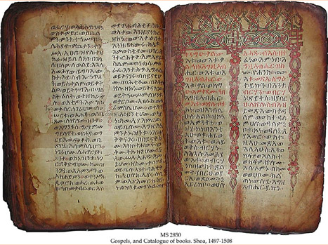
Livro de Enoque é um livro profético?
Tags