Palestine
VIEW:68 DATA:01-04-2020
PALESTINE
1. Situation and name.The land of Palestine is the territory which lies between the Mediterranean Sea and the Arabian Desert as E. and W. boundaries, and whose N. and S. boundaries may be approximately stated at 31° and 33° 20 N. Lat. respectively. These boundaries have not always been clearly fixed; but the convention is generally agreed upon that Palestine is separated from Egypt by the Wady el-Arîsh or River of Egypt, and from Syria by the Kasmiyeh or Lîtani River, the classical Leontes. Biblical writers fixed the limits of the territory by the towns Dan and Beersheba, which are constantly coupled when the author desires to express in a picturesque manner that a certain event affected the whole of the Israelite country (e.g. Jdg_20:1). The name Palestine [AV [Note: Authorized Version.] in Joe_3:4; in Exo_15:14, Isa_14:29; Isa_14:31 Peteralestina; RV [Note: Revised Version.] Philistia], being derived from that of the Philistines, properly belongs only to the strip of coast-land south of Carmel, which was the ancient territory of that people. There is no ancient geographical term covering the whole region now known as Palestine: the different provincesCanaan, Judah, Israel, Moab, Edom, etc.are enumerated separately when necessary. The extension of the word to include the entire Holy Land, both west and east of the Jordan, is subsequent to the introduction of Christianity.
2. Geology and geography.The greater part of the country is of a chalky limestone formation, which overlies a layer of red sandstone that appears on the E. shore of the Dead Sea and elsewhere. Under the red sandstone are the archæan granitic rocks which form a large part of the Sinai Peninsula. Above the chalk is a layer of nummulitic limestone, which appears on some mountains. Volcanic rock, the result of ancient eruptions, appears in the Hauran, Galilee (especially in the neighbourhood of Safed), and elsewhere. For fuller information on the geology of the country, see art. Geology. With respect to the surface, Palestine divides naturally into a series of narrow strips of country running from north to south, and differing materially from one another in character. (a) The first of these is the Maritime Plain running along the coast of the Mediterranean from the neighbourhood of Sidon and Tyre southward, and disappearing only at the promontory of Carmel. This plain widens southward from Carmel to a maximum breadth of about 20 miles, while to the north of that promontory it develops into the great plain of Esdraelon, which intersects the mountain region and affords the most easy passage into the heart of the country. This plain is covered with a most fertile alluvial soil. (b) The second strip is the mountainous ridge of Judæa and Samaria, on the summit of which are Hebron, Jerusalem, and other important towns and villages; and which, with the single interruption of the piain of Esdraelon, runs continuously from the south border of the country to join the system of the Lebanon. (c) The third strip is the deep depression known as the Ghôr, down which runs the Jordan with its lakes. (d) The fourth strip is the great plateau of Bashan, Moab, and Edom, with a lofty and precipitous face towards the west, and running eastward till it is lost in the desert.
3. Water supply, climats, natural products.There is no conspicuous river in Palestine except the Jordan and its eastern tributaries, and these, being for the greater part of their course in a deep hollow, are of little or no service for irrigation. In consequence, Palestine is dependent as a whole for its water supply on springs, or on artificial means of storage of its winter rains. Countless examples of both exist, the former especially in Galilee, parts of which are abundantly fertile by nature, and would probably repay beyond all expectation a judicious expenditure of capital. The case of Judæa is a little different, for here there are extensive tracts which are nearly or quite waterless, and are more or less desert in consequence.
The climate of Palestine is, on the whole, that of the sub-tropical zone, though, owing to the extraordinary variation of altitudes, there is probably a greater range of average local temperature than in any other region of its size on the worlds surface. On the one hand, the summits of Hermon and of certain peaks of the Lebanon are covered with snow for the greater part of the year; on the other hand, the tremendous depression, in the bottom of which lies the Dead Sea, is practically tropical, both in climate and in vegetation. The mean local temperature is said to range from about 62° F. in the upland district to almost 100° F. in the region of Jericho.
Rainfall is confined to the winter months of the year. Usually in the end of October or November the rainy season is ushered in with a heavy thunderstorm, which softens the hard-baked surface of the land. This part of the rainy season is the former rain of the Bible (as in Joe_2:23). Ploughing commences immediately after the rains have thus begun. The following months have heavy showers, alternating with days of beautiful sunshine, till March or April, when the latter rain falls and gives the crops their final fertilization before the commencement of the dry season. During this part of the year, except by the rarest exception, no rain falls: its place is supplied by night dews, which in some years are extraordinarily heavy. Scantiness of the rainfall, however, is invariably succeeded by poverty or even destruction of the crops, and the rain is watched for as anxiously now as it was in the time of Ahab.
Soon after the cessation of the rains, the wild flowers, which in early spring decorate Palestine like a carpet, become rapidly burnt up, and the country assumes an appearance of barrenness that gives no true idea of its actual fertility. The dry summer is rendered further unpleasant by hot east winds, blowing from over the Arabian Desert, which have a depressing and enervating effect. The south wind is also dry, and the west wind damp (cf. 1Ki_18:45, Luk_12:54). The north wind, which blows from over the Lebanon snows, is always cold, often piercingly so.
As already hinted, the flora displays an extraordinary range and richness, owing to the great varieties of the climate at different points. The plants of the S. and of the Jordan Valley resemble those found in Abyssinia or in Nubia: those of the upper levels of Lebanon are of the kinds peculiar to snow-clad regions. Wheat, barley, millet, maize, peas, beans, lentils, olives, figs, mulberries, vines, and other fruit; cotton, nuts of various species; the ordinary vegetables, and some (such as solanum or egg-plant) that do not, as a rule, find their way to western markets; sesame, and tobaccowhich is grown in some districtsare the most characteristic crops produced by the country. The prickly pear and the orange, though of comparatively recent introduction, are now among its staple products. The fauna includes (among wild animals) the bat, hyæna, wolf, jackal, wild cat, ibex, gazelle, wild boar, hare, and other smaller animals. The bear is now confined to Hermon, and possibly one or two places in Lebanon; the cheetah is rare, and the lion (1Sa_17:34, 1Ki_13:24 etc.) is extinct. So also is the hippopotamus, bones of which have been found in excavations. Among wild birds we may mention the eagle, vulture, stork, and partridge: there is a great variety of smaller birds. Snakes and lizards abouod, and crocodiles are occasionally to be seen in the Nahr ez-Zerka near Cæsarea. The domesticated animals are the camel, cow, buffalo (only in the Jordan Valley), sheep, horse, donkey, swine (only among Christians), and domestic fowl. The dog can scarcely be called domesticated: it is kept by shepherds for their flocks, but otherwise prowls about the streets of towns and villages seeking a living among the rubbish thrown from the houses.
4. History, races, antiquities.The earliest dawn of history in Palestine has left no trace in the country itself, so far as we can tell from the limited range of excavations hitherto carried out. There was, however, a Babylonian supremacy over the country in the fourth millennium b.c., of which the records left by the kings of Agade speak. These records are as yet only imperfectly known, and their discussion in a short article like the present would be out of place. A very full account of all that is as yet known of these remote waifs of history will be found in L. B. Patons excellent History of Syria and Palestine.
About b.c. 3000 we first reach a period where excavation in Palestine has some information to give. It appears that the inhabitants were then still in the neolithic stage of culture, dwelling in caves, natural or artificial. The excavation of Gezer has shown that the site of that city was occupied by an extensive community of this race. They were non-Semitic; but as they practised cremation, the bones were too much destroyed to make it possible to assign them to their proper place among the Mediterranean races. Further discoveries may ultimately lead to this question being settled. It is possible that the Horites of Gen_14:6 and elsewhere may have been the survivors of this race.
About b.c. 2500 the first Semitic settlers seem to have established themselves in the country. These were the people known to Bible students as Canaanites or Amorites. The success of attempts that have been made to distinguish these names, as indicating two separate stocks must be considered doubtful, and it is perhaps safer to treat the two names as synonymous. About b.c. 2000, as appears by the reference to Amraphel, king of Shinar (= Hammurabi), occurred the battle of the four kings and five recorded in Gen_14:1-24the first event on Palestinian soil of which a Palestinian record is preserved.
The dominion of Egypt over S. Palestine, or at least the influence of Egyptian civilization, must early have been felt, though no definite records of Egyptian conquest older than Tabutmes iii. (about b.c 1500) have come to light. But scarabs and other objects referable to the Usertesens (about b.c. 28002500, according to the opinions of various chronologists) are not infrequently found in excavations, which speak of close intercourse between the Canaanites and the civilization of the Nile valley. Of the Canaanites very extensive remains yet await the spade of the excavator in the mounds that cover the remains of the ancient cities of Palestine. The modern peasantry of the country closely resemble the ancient Canaanites in physical character, to judge from the remains of the latter that excavation has revealed; indeed, in all probability the substratum of the population has remained unchanged in racial affinities throughout the vicissitudes that the country has suffered. By the conquests of Tahutmes iii. (c. 1500), and Amenhotep iii. (c. 1450), Palestine became virtually an Egyptian province, its urban communities governed by kings (i.e. local sheiks) answerable to the Pharaoh, but always quarrelling among themselves. The heretic king Amenhotep iv. was too busy with his religious innovations to pay attention to his foreign possessions, and, city by city, his rule in Palestine crumbled away before the Aramæan tribes, named in the Tell el-Amarna tablets the Khabiri. This name is identical with that of the Biblical Hebrews; but it has not yet been possible to put the Khabiri and the Hebrews into their proper mutual relations. The Hebrews represent themselves as escaped slaves from Egypt who (about the 13th cent. b.c.) were led as a solid whole under a single leader (Joshua) to the complete conquest of Canaanthis is the account of the Book of Joshua. According to the older tradition preserved in Jdg_1:1-36, they entered the country without an individual leader, as a number of more or less independent tribes or clans, and effected only a partial conquest, being baffled by the superior strength of certain specified cities. This account is more in accordance with the events as related by the Tell el-Amarna tablets, but further discoveries must be made before the very obscure history of the Israelite immigration can be clearly made out.
The Israelite occupation was only partial. The important Maritime Plain was in the hands of a totally distinct people, the Philistines. The favourite, and most probable, modern theory regarding the Philistines is that they were of Cretan origin; but everything respecting that mysterious race is veiled in obscurity. As above mentioned, it is not likely that the change of ownership affected the peasantsthe Gibeonites were probably not the only hewers of wood and drawers of water (Jos_9:21) that survived of the older stock. And lastly, we cannot doubt that an extensive Canaanite occupation remained in the towns expressly mentioned in Jdg_1:1-36, as those from which the various tribes drave not out their original inhabitants. So far as we can infer from excavationan inference thoroughly confirmed by a consideration of the barbarous history of the Judgesthe effect of the Israelite entrance into Canaan was a retrogression in civilization, from which the country took centuries to recover.
The history of the development of these incoherent units into a kingdom is one of ever-fresh interest. It is recorded for us in the Books of Judges and 1Samuel, and the course of events being known to every reader, it is unnecessary to recapitulate them here. It is not unimportant to notice that the split of the short-lived single kingdom into two, after the death of Solomon, was a rupture that had been foreshadowed from time to timeas in the brief reign of Abimelech over the northern province (Jdg_9:1-57), and the attempt of the northerners to set up Ish-bosheth as king against David (2Sa_2:3), frustrated by Ish-bosheths ill-timed insult to Abner (2Sa_3:7): Abners answer (v. 10) recognizes the dichotomy of Judah and Israel as already existing. This division must have had its roots in the original peopling of the country by the Hebrews, when the children of Judah went southward, and the children of Joseph northward (Jdg_1:3-28).
Space will not permit us to trace at length the fortunes of the rival kingdoms, to their highest glory under the contemporary kings Uzziah and Jeroboarn ii., and their rapid decline and final extinction by the great Mesopotamian empires. We may, however, pause to notice that, as in the case of the Canaanites, many remains of the Israelite dominion await the excavator in such towns as lay within Israelite territory; and the Siloam Tunnel epigraph, and one or two of minor importance, promise the welcome addition of a few inscriptions. On the other hand, the remains of the population are scantierfor it need hardly be said that the modern Jewish inhabitants of Palestine are all more or less recent importations.
The Northern Kingdom fell before Assyria, and was never heard of again. Tangible remains of the Assyrian domination were found at Gezer, in the shape of a couple of contract-tablets written there in the Assyrian language and formulæ about b.c. 650; and the modern sect of Samaritans is a living testimony to the story of the re-settling of the Northern Kingdom under Assyrian auspices (2Ki_17:24-41).
The Southern Kingdom had a different fate. It was extinguished by Babylon about 135 years later, in b.c. 586. In 538 the captives were permitted to return to their land by Cyrus, after his conquest of Babylon. They re-built Jerusalem and the Temple: the Books of Ezra and Nehemiah are the record of this work of restoration.
In b.c. 333 Syria fell to Alexander the Great after the battle of Issus. After his death followed a distracting and complicated period of conflict between his successors, which, so far as Palestine was concerned, had the effect of opening the country for the first time to the influence of Greek culture, art, and religion. From this time onward we find evidence of the foundation of such buildings as theatres, previously quite unknown, and other novelties of Western origin. Although many of the Jews adopted the Greek tongue, there was a staunch puritan party who rigidly set their faces against all such Gentile contaminations. In this they found themselves opposed to the Seleucid princes of Syria, among whom Antiochus Epiphanes especially set himself deliberately to destroy the religion of Judaism. This led to the great revolt headed by Mattathias the priest and his sons, which secured for the Jews a brief period of independence that lasted during the second half of the 2nd cent. b.c., under John Hyrcanus (grandson of Mattathias) and his successors. The kingdom was weakened by family disputes; in the end Rome stepped in, Pompey captured Jerusalem in b.c. 63, and henceforth Palestine lay under Roman suzerainty. Several important tombs near Jerusalem, and elsewhere, and a large number of remains of cities and fortresses, survive from the age of the family of Mattathias. The conquest of Joppa, under the auspices of Simon Maccabæus, son of Mattathias (1Ma_13:11), was the first capture of a seaport in S. Palestine throughout the whole of Israelite history.
The Hasmonæan dynasty gave place to the Idumæan dynasty of the Herods in the middle of the 1st cent. b.c., Herod the Great becoming sole governor of Judæa (under Roman suzerainty) in b.c. 40. It was into this political situation that Christ was born b.c. 4. Remains of the building activities of Herod are still to be seen in the sub-structures of the Temple, the Herodian towers of Jerusalem, and (possibly) a magnificent tomb near Jerusalem traditionally called the Tomb of Mariamme. Herod died shortly after Christs birth, and his dominions were subdivided into provinces, each under a separate ruler: but the native rulers rapidly declined in power, and the Roman governors as rapidly advanced. The Jews became more and more embittered against the Roman yoke, and at last a violent rebellion broke out, which was quelled by Titus in a.d. 70, when Jerusalem was destroyed and a large part of the Jews slain or dispersed. A remnant remained, which about 60 years later again essayed to revolt under their leader Bar Cochba: the suppression of this rebellion was the final deathblow to Jewish nationality. After the destruction of Jerusalem many settled in Tiberias, and formed the nucleus of the important Galilæan Rabbinic schools, remains of which are still to be seen in the shape of the synagogues of Galilee. These interesting buildings appear to date from the second century a.d.
After the partition of the Roman Empire, Palestine formed part of the Empire of the East, and with it was Christianized. Many ancient settlements, with tombs and small churchessome of them with beautiful mosaic pavementssurvive in various parts of the country: these are relics of the Byzantine Christians of the 5th and 6th centuries. The native Christians of Syria, whose families were never absorbed into Islam, are their representatives. These, though Aramæan by race, now habitually speak Arabic, except in Malula and one or two other places in N. Lebanon, where a Syriac dialect survives.
This early Christianity received a severe blow in 611, when the country was ravaged by Chosroës ii., king of Persia. Monastic settlements were massacred and plundered, and the whole country reduced to such a state of weakness that without much resistance it fell to Omar, the second Caliph of Islam. He became master of Syria and Palestine in the second quarter of the seventh century. Palestine thus became a Moslem country, and its population received the Arab element which is still dominant within it. It may be mentioned in passing that coins of Chosroës are occasionally found in Palestine; and that of the early Arab domination many noteworthy buildings survive, chief of which is the glorious dome that occupies the site of the Hebrew Temple at Jerusalem.
The Moslem rule was at first by no means tyrannical; but, as the spirit of intolerance developed, the Christian inhabitants were compelled to undergo many sufferings and indignities. This, and the desire to wrest the holy places of Christendom from the hands of the infidel, were the ostensible reasons for the in vasions of the brigands who called themselves Crusaders, and who established in Jerusalem a kingdom on a feudal basis that lasted throughout the 12th century. An institution so exotic, supported by men morally and physically unfit for life in a sub-tropical climate, could not outlast the first enthusiasm which called it into being. Worn out by immorality, by leprosy and other diseases, and by mutual dissensions, the unworthy champions of the Cross disappeared before the heroic Saladin, leaving as their legacy to the country a score or so of place names; a quantity of worthless ecclesiastical traditions; a number of castles and churches, few of which possess any special architectural interest, and many of which, by a strange irony, have been converted into mosques; and, among the Arab natives, an unquenchable hatred of Christianity.
We must pass over the barbarous Mongolian invasions, the last of which was under Timur or Tamerlane at the end of the 14th century. But we must not omit to mention the Turkish conquest in 1516, when Syria obtained the place which it still holds in the Ottoman Empire.
R. A. S. Macalister.
Hastings' Dictionary of the Bible
Edited by James Hastings, D.D. Published in 1909
Peleshet. Four times in KJV, found always in poetry (Exo_15:34; Isa_14:29; Isa_14:31; Joe_3:4); same as Philistia (Psa_60:8; Psa_87:4; Psa_83:7 "the Philistines".) The long strip of seacoast plain held by the Philistines. The Assyrian king Ivalush's inscription distinguishes "Palaztu on the western sea" from Tyre, Samaria, etc. (Rawlinson, Herodotus 1:467.) So in the Egyptian Karnak inscriptions Pulusata is deciphered. The Scriptures never use it as we do, of the whole Holy Land. (See CANAAN for the physical divisions, etc.) "The land of the Hebrew" Joseph calls it, because of Abraham's, Isaac's, and Jacob's settlements at Mamre, Hebron, and Shechem (Gen_40:15). "the land of the Hittites" (Jos_1:4); so Chita or Cheta means the whole of lower and middle Syria in the Egyptian records of Rameses II. In his inscriptions, and those of Thothmes III, Tu-netz, "Holy Land," occurs, whether meaning "Phoenicia" or "Palestine". In Hos_9:3 "land of Jehovah," compare Lev_25:23; Isa_62:4.
"The holy land," Zec_2:12; Zec_7:14, "land of desire"; Dan_8:9. "the pleasant land"; Dan_11:16; Dan_11:41, "the glorious (or goodly) land"; Eze_20:6; Eze_20:15, "a land that I had espied for them flowing with milk and honey, which is the glory of all lands." God's choice of it as peculiarly His own was its special glory (Psa_132:13; Psa_48:2; Jer_3:19 margin "a good land, a land of brooks of water (wadies often now dry, but a few perennial), of fountains and depths that spring out of valleys and hills (the deep blue pools, the sources of streams), a land of wheat, barley, vines, figtrees, pomegranates, oil olive, honey (dibs, the syrup prepared from the grape lees, a common food now) ... wherein thou shalt eat bread without scarceness, thou shalt not lack anything in it; whose stones are iron, and out of whose hills thou mayest dig brass" (Deu_8:7-9). "The land of the Amorite" (Amo_2:10).
"The land of Israel" in the larger sense (1Sa_13:19); in the narrower sense of the northern kingdom it occurs 2Ch_30:25. After the return from Babylon "Judaea" was applied to the whole country S. and N., and E. beyond Jordan (Mat_19:1). "The land of promise" (Heb_11:9). "Judaea" in the Roman sense was part of the province "Syria," which comprised the seaboard from the bay of Issus to Egypt, and meant the country from Idumea on the S. to the territories of the free cities on the N. and W., Scythopolis, Sebaste, Joppa, Azotus, etc. The land E. of Jordan between it and the desert, except the territory of the free cities Poilu, Gadara, Philadelphia, was "Perea." From Dan (Banias) in the far N. to Beersheba on the S. is 139 English miles, two degrees or 120 geographical miles. The breadth at Gaza from the Mediterranean to the Dead Sea is 48 geographical miles; at the Litany, from the coast to Jordan is 20 miles; the average is 34 geographical or 40 English miles. About the size of Wales. The length of country under dominion in Solomon's days was probably 170 miles, the breadth 90, the area 12,000 or 13,000 square miles.
The population, anciently from three to six millions, is now under one million. The Jordan valley with its deep depression separates it from the Moab and Gilead highlands. Lebanon, Antilebanon, and the Litany ravine at their feet form the northern bound. On the S. the dry desert of Paran and "the river of Egypt" bound it. On the western verge of Asia, and severed from the main body of Asia by the desert between Palestine and the regions of Mesopotamia and Arabia, it looks on the other side to the Mediterranean and western world, which it was destined by Providence so powerfully to affect; oriental and reflective, yet free from the stagnant and retrogressive tendencies of Asia, it bore the precious spiritual treasure of which it was the repository to the energetic and progressive W. It consists mainly of undulating highlands, bordered E. and W. by a broad belt of deep sunk lowland.
The three main features, plains, hills, and torrent beds, are specified (Num_13:29; Jos_11:16; Jos_12:8). Mount Carmel, rising to the height of above 1,700 ft., crosses the maritime plain half way up the coast with a long ridge from the central chain, and juts out into the Mediterranean as a bold headland. The plain of Jezreel or Esdraelon on its northern side, separating the Ephraim mountains from those of Galilee, and stretching across from the Mediterranean to the Jordan valley, was the great battlefield of Palestine. Galilee is the northern portion, Samaria the middle, Judaea the southern. The long purple wall of Gilead and Moab's hills on the eastern side is everywhere to be seen. The bright light and transparent air enable one from the top of Tabor, Gerizim or Bethel at once to see Moab on the E. and the Mediterranean on the W. On a line E. of the axis of the country and running N. and S. lie certain elevations: Hebron 3,029 ft. above the sea; Jerusalem, 2,610; Olivet, 2,724; Neby Samwil on the N., 2,650; Bethel, 2,400; Ebal and Gerizim, 2,700; Little Hermon and Tabor, N. of the Esdraelon plain, 1,900.
The watershed sends off the drainage of the country in streams running W. to the Mediterranean and E. to the Jordan, except at the Esdraelon plain and the far N. where the drainage is to the Litany. Had the Jews been military in character, they would easily have prevented their conquerors from advancing up the precipitous defiles from the E., the only entrances to the central highlands of Judah, Benjamin, and Ephraim, from the Jordan valley; as Engedi (2Ch_20:1-2; 2Ch_20:16) and Adummim, the route between Jericho and Jerusalem by which Pompey advanced when he took the capital. The slope from the western valleys is more gradual, as the level of the plain is higher, and the distance up the hills longer, than from the eastern Jordan depression; still the passes would be formidable for any army with baggage to pass. From Jaffa up to Jerusalem there are two roads: the one to the right by Ramleh and the wady Aly; the other the historic one by Lydda and the Bethorons, or the wady Suleiman, and Gibeon.
By this Joshua drove the Canaanites to the plains; the Philistines went up to Michmash, and fled back past Ajalon. The rival empires, Egypt and Babylon-Assyria, could march against one another only along the maritime western plain of Palestine and the Lebanon plain leading toward and from the Euphrates. Thus Rameses II marched against the Chitti or Hittites in northern Syria, and Pharaoh Necho fought at Mefiddo in the Esdraelon plain, the battlefield of Palestine; they did not meddle with the central highlands, "The S. country" being near the desert, destitute of trees, and away from the mountain streams, is drier than the N., where springs abound. (See PHARAOH NECHO; MEGIDDO.) The region below Hebron between the hills and the desert is called the Negeb (the later Daroma) from its dryness. Hence Caleb's daughter, having her portion in it, begged from him springs, i.e. land having springs (Jdg_1:15). The "upper and lower springs" spring from the hard formation in the N.W. corner of the Negeb (Jos_15:19); here too Nabal lived, so reluctant to give "his water" (1Sa_25:11).
The verdure and blaze of scarlet flowers which cover the highlands of Judah and Benjamin in spring, while streams pour down the ravines, give place to dreary barrenness in the summit. Rounded low hills, with coarse gray stone, clumps of oak bushes, and the remains of ancient terraces running round them, meet one on each side, or else the terraces are reconstructed and bear olives and figs, and vineyards are surrounded by rough walls with watchtowers. Large oak roots are all that attest the former existence of trees along the road between Bethlehem and Hebron. Corn or dourra fills many of the valleys, and the stalks left until the ensuing seedtime give a dry neglected look to the scene. More vegetation appears in the W. and N.W. The wady es Sumt is named from its acacias. Olives, terebinths, pines, and laurels here and ten miles to the N. at Kirjath Jearim ("city of forests") give a wooded aspect to the scenery.
The tract, nine miles wide and 35 long, between the center and the sudden descent to the Dead Sea, is desolate at all seasons, a series of hills without vegetation, water, and almost life, with no ruins save Masada and one or two watchtowers. (On the caves, see CAVES.) No provision is made in the S. for preserving the water of the heavy winter and spring rains, as in Malta and Bermuda. The valley of Urtas, S. of Bethlehem, abounding in springs, and the pools of Solomon, are exceptions to the general dryness of the S. The ruins on every hill, the remains of ancient terraces which kept the soil up from being washed into the valleys, and the forests that once were in many parts of Judea until invasions and bad government cleared them away, and which preserved the moistness in the wadies, confirm the truth of the Bible account of the large population once maintained in Judah and Benjamin. The springs and vegetation as one advances N. toward Mount Ephraim especially strike the eye. (See FOUNTAINS; EN HAKKORE; GIHON; ENGEDI; HAROD; ENGANNIM; ENDOR; JEZREEL.)
Such springs as Ain Jalud or Rasel Mukatta, welling forth as a considerable stream from the limestone, or Tel el Kady forming a deep clear pool issuing from a woody mound, or Banias where a river issues roaring from its cave, or Jenin bubbling from the level ground, are sights striking by their rarity. Mount Ephraim (jebel Nablus) contains some of the most productive land in Palestine. Fine streams, with oleanders and other flowering trees on their banks, run through the valleys which are often well cultivated. N.W. of Nablus is the large, rich, grain abounding, and partly wooded district toward Carmel, which reaches to where the mountains slope down to Sharon plain under Mount Carmel. Extensive woods there are none, and the olives which are found everywhere but little improve the landscape. This absence of woods elsewhere makes their presence on Carmel's sides, and parklike slopes, the more striking. N. of Esdraelon the Galilee hills abound in timber, the land round Tabor is clad in dark oak, forming a contrast to jebel ed Duhy (Little Hermon) and Nazareth's white hills.
Oaks, terebinths, maples, arbutus, sumach, etc., cover the ravines and slopes of the numerous swelling hills, and supply the timber carried to Tyre for export as fuel to the seacoast towns. The hills throughout Palestine are crowned with remains of fenced cities, scarcely a town existed in the valleys. Inaccessibility was their object, for security; also the treacherous nature of the alluvial sand made the lower position unsafe in times of torrent floods from the hills, whereas the rock afforded a firm foundation (Mat_7:24-27). Unlike ordinary conquests, the Israelite conquerors took the hills, but the conquered Canaanites kept the plains where their chariots could maneuver (Jdg_1:19-35). Appropriately a highland coloring tinges their literature (Psa_72:3; Psa_72:16; Isa_2:2; Eze_36:1,; 1Ki_20:28). The hills were the sites also of the forbidden "high places." The panoramic views from many hills, trodden by patriarchs, prophets, and heroes, as Olivet, Bethel, Gerizim, Carmel, Tabor, etc., are remarkable for their wide extent, comprising so many places of historic interest at once, owing to the clearness of the air.
The seacoast lowland between the hills and sea stretches from El Arish ("river of Egypt") to Carmel. The lower half, Philistia, is wider; the upper, or Sharon, narrower. This region from the sea looks a low undulating strip of white sand. Attached to the plain is the shephelah or "region of lower hills" intermediate between the plain and the mountains of Judah. Low calcareous hills, covered with villages and ruins, and largely planted with olives, rise above broad arable valleys. Olive, sycamore, and palm encircle Gaza and Ashdod in the plain along the shore. The soil is fertile brown loam, almost without a stone. Brick made of the loam and stubble being the material of the houses, these have been washed away by rains, so that the ancient villages have left few traces. The plain is one vast grainfield, produced without manure, save that supplied by the deposits washed down by the streams from the hills, without irrigation, and with only the simplest agriculture. Sharon is ten miles wide from the sea to the mountain base; there are no intermediate hills, as the shephelah in Philistia.
Its undulations are crossed by perennial streams from the central hills, which instead of spreading into marshes, as now, might be utilized for irrigation. The ancient irrigatory system, with passes cut through the solid wall of cliff near the sea for drainage, is choked up. The rich soil varies from red to black, and on the borders of the marshes and streams are rank meadows where herds still feed, as in David's days (1Ch_27:29). The white sand is encroaching on the coast. In the N. between Jaffa and Caesarea sand dunes are reported to exist, three miles wide, 300 ft. high. The Jews, though this region with its towns was assigned to them (Jos_15:45-47; Jos_13:3-6; Jos_16:3 Gezer, Jos_17:11 Dor), never permanently occupied it. The Philistines kept their five cities independent of, and sometimes supreme over, Israel (1 Samuel 5; 1Sa_21:10; 1Sa_27:2; 1Ki_2:39; 2Ki_8:2-3).
The Canaanites held Dor (Jdg_1:27) and Gezer until Pharaoh took it and gave it to his daughter, Solomon's wife (1Ki_9:16). Lod (Lydda) and Ono were in Benjamin's possession toward the end of the monarchy and after the return from Babylon (Neh_11:34; 2Ch_28:18). Gaza and Askelon had regular ports (majumas, Kenrick, Phoen. 27-29). Ashdod was strong enough to withstand the whole Egyptian force for 29 years. Under Rome Caesarea, (now a ruin washed by the sea) and Antipatris in this region were leading cities of the province. Joppa between Philistia and Sharon. is still the seaport for travelers from the W. to Jerusalem, and was Israel's only harbor. They had no word for harbor, so unversed in commerce were they; yet their sacred poets show their appreciation of the phenomena of the sea (Psa_104:25-26; Psa_107:23-30). Bedouin marauders and Turkish misrule have closed the old coast route between N. and S., and left the fertile and to be comparatively uncultivated. The Jordan valley is the special feature of Palestine.
Syria is divided, from Antioch in the N. to Akaba on the eastern extremity of the Red Sea, by a deep valley parallel to the Mediterranean and separating the central highlands from the eastern ones. The range of Lebanon and Hermon crosses this valley between its northern portion, the valley of the Orontes. and its main portion the valley of Jordan (the Arabah of the Hebrew, the Aulon of the Greeks, and the Ghor of the Arabs.) Again, the high ground S. of the Dead Sea crosses between the valley of the Jordan and the wady el Arabah running to the Red Sea. The Jordan valley divides Galilee, Ephraim, and Judah from Bashan, Gilead, and Moab respectively. The bottom of Jordan valley is actually more than 2,600 ft. below the level of the Mediterranean, and must have once been far deeper, being now covered with sediment accumulated by the Jordan. The steepness of the descent front Olivet is great, but not unparalleled; the peculiarity which is unique is that the descent is into the bowels of the earth; one standing at the Dead Sea shore is almost as far below the ocean surface as the miner in the lowest depths of any mine.
The climate of the Jordan valley is tropical and enervating, and the men of Jericho a feeble race. "The region round about Jordan" was used of the vicinity of Jericho (Mat_3:5). The Jordan is perennial, but most of the so-called "rivers" are mere "winter torrents" (nachal), dry during fully half the year (Job_6:15-17). The land of promise must have been a delightful exchange for the dreary desert, especially as the Israelites entered it at Passover (Jos_5:10-11), i.e. springtime, when the country is lovely with verdure and flowers. There is a remarkable variety of climate and natural aspect, due to the differences of level between the different parts, and also to the vicinity of snowy Hermon and Lebanon on the N. and of the parched desert of the S., and lastly to the proximity of the ever fresh and changing sea. The Jordan valley, in its light fertile soil and torrid atmosphere where breezes never penetrate, somewhat resembles the valley of the Nile (Gen_13:10). The contrast between highland and lowland is marked by the phraseology "going up" to Judah, Jerusalem.
Hebron; "going down" to Jericho, Gaza, Egypt. "The mountain of Judah," "of Ephraim," "of Naphtali," designate the three great groups of highlands. In these the characteristic names occur, Gibeah, Geba, Gibeon (hill), Ramah, Ramathaim ("brow"), Mizpeh, Zonhim (watchtower, watchers). The lower hills and southern part of the seacoast plain is the "shephelah"; the northern part Sharon; the Jordan valley Ha-Arabah; the "ravines", "torrent beds", and "small valleys" ('eemeq, nachal, gay) of the highlands are never confounded. The variations in temperature, from the heat of midday and the dryness of summer to the rain, snow, and frosts of winter, are often alluded to (Psa_19:6; Psa_32:4; Psa_147:16-18; Isa_4:6; Isa_25:5; Gen_18:1; 1Sa_11:9; Neh_7:3; Jer_36:30). The Bible by its endless variety of such illusions, familiar to the people of the W. and suggested by Palestine which stands between E. and W., partaking of the characteristics of both, suits itself to the men of every land.
ANTIQUITIES. In contrast to Egypt, Assyria, and Greece, Palestine does not contain an edifice older than the Roman occupation. There are but few remains left illustrating Israelite art. The coins, rude and insignificant, the oldest, being possibly of the Maccabean era, are the solitary exception. The enclosure round Abraham's tomb at Hebron we know not the date of Solomon's work still remains in some places. Wilson's arch is probably Solomonic, and the part of the sanctuary wall on E. side. (See JERUSALEM.) The "beveling," thought to be Jewish, is really common throughout Asia Minor; it is found at Persepolis, Cnidus, and Athens. The prohibition (1) of making graven images or likenesses of living creatures, and (2) of building any other temple than that at Jerusalem, restricted art. Solomon's temple was built under Hiram's guidance. The synagogues of the Maccabean times were built in the Greek style of architecture. Tent life left its permanent impression on Israel (2Sa_20:1; 1Ki_12:16; 2Ch_10:16; 2Ki_14:12; Jer_30:18; Zec_12:7; Psa_78:55; Psa_84:1; Isa_16:5).
GEOLOGY. Palestine is a much disturbed mountainous tract of limestone, of the secondary or jurassic and cretaceous period. It is an offshoot from Lebanon, much raised above the sea, with partial interruptions from tertiary and basaltic deposits. The crevasse of the Jordan is possibly volcanic in origin, an upheaval tilting the limestone so as to leave a vast split in the strata, but stopping without intruding volcanic rocks into the fissure. The basins of the sea of Galilee and the Dead Sea resemble craters. Others attribute the chasm to the ocean's gradual action in immense periods. The hills range mainly N. and S. The limestone consists of two groups of strata. The upper is a solid stone varying from white to reddish brown, with few fossils, and abounding in caverns; the strata sometimes level for terraces, oftener violently disarranged, and twisted into various forms, as on the road from Jerusalem to Jericho.
This limestone is often topped with flint-abounding chalk, as on the western side of the Dead Sea, where it has many salt and sulfurous springs. Dolomite or magnesian limestone, a send-crystalline rock, white or brown with glistening surface, blends with the mass of limestone, near Jerusalem. The lower limestone group has two series of beds: the upper darkish, cavernous, and ferruginous; the lower dark gray, solid, abounding in the fossil cidaris, an extinct echinus, the spines of which are the "olives" of the convents. This is the substratum of the whole country E. and W. of Jordan. The ravine from Olivet to Jericho affords an opportunity of examining the strata through which it cuts. After the limestone had assumed its present outline, lava burst, from beneath and overflowed the stratified beds, as basalt or trap, long before historic times. These volcanic rocks are found in the cis-Jordanic country, only N. of the Samaria mountains, e.g. S.W. of Esdraelon plain and N. of Tabor. The two centers of eruption were:
(1) The older about Kuru Hattin, the traditional mount of beatitudes, from whence the lava flowed forming the cliffs at the back of Tiberius; the disintegration of the basalt formed the fertile black soil of the plain of Gennesaret.
(2) The more recent, near Safed, where three craters have become the lakes el Jish, Taiteba, and Delata.
The earthquake in Uzziah's time (Zec_14:5), which injured the temple and brought down a mass of rock from Olivet (Josephus, Ant. 9:10, section 4), shows that volcanic action has continued in historic times. From the 13th to the 17th centuries A.D. earthquakes were unknown in Syria and Judaea, but the Archipelago and southern Italy suffered greatly. Since than their activity has been resumed, destroying Aleppo in 1616 and 1822. Antioch in 1737, and Tiberius and Safed in 1837. See Amo_4:11; compare Mat_27:51; Psa_46:1-2. The hot salt and fetid springs at Tiberias, Callirrhoe (wady Zerka Main, E. of the Dead Sea), and other places along the Jordan valley, and round the lakes, as Ain Tabighah N.E. of lake Tiberias, the rock salt, niter, and sulphur of the Dead Sea, evidence volcanic agency. The Tiberias hot springs flowed more abundantly and increased in temperature during the earthquake of 1837. W. of the lower Jordan and Dead Sea no volcanic formations appear. The igneous rocks first appear in situ near the water level at wady Hemarah, a little N. of wady Zerka Main N.E. of the Dead Sea.
Here and E. of the upper Jordan the most remarkable igneous rocks are found; the limestone lies underneath. The Lejah, anciently Argob or Trachonitis, has scarcely anything exactly like it on the earth. (See ARGOB.) Traces of two terraces appear in the Jordan valley. The upper is the broader and older; the second, 50 to 150 ft. lower, reaching to the channel of the Jordan, was excavated by the river before it fell to its present level, when it filled the space between the eastern and western faces of the upper terrace. The inner side of both terraces is furrowed by the descending rains into conical hillocks. The lower terrace has much vegetation, oleanders, etc. The tertiary beds, marls, and conglomerates prevail round the margin of the Dead Sea; at its S.E. corner sandstone begins and stretches N. to wady Zerka Main. The alluvial soil of Philistia is formed of washings from the highlands by winter rains. It is loamy sand, red or black, formed of sandstone disintegrated by the waves and cast on the shore, or, as Josephus (Ant. 15:9, section 6) states, brought from Egypt by the S.S.W. wind.
It chokes the streams in places, and forms marshes which might be utilized for promoting fertility. The plain of Gennesaret is richer land, owing to the streams flowing all the year round, and to the decay of volcanic rocks on the surrounding heights. Esdraelon plain is watered by the finest springs of Palestine, and has a volcanic soil. Asphalt or bitumen is only met with in the valley of the Jordan, and in fragments floating on the water or at the shore of the Dead Sea. Bituminous limestone probably exists in thick strata near neby Musa; thence bitumen escapes from its lower beds into the Dead Sea, and there accumulates till, becoming accidentally detached, it rises to the surface. Sulphur is found on the W., S., and S.E. shore of the Dead Sea, a sulfurous crust spreading over the beach. Niter is rare. Rock salt abounds. The Khasm Usdum, a mound at the S. of the Dead Sea, is five miles and a half long by two and a half broad, and several hundred feet high; the lower part rock salt, the upper Sulphate of lime and salt with alumina.
BOTANY. Palestine is the southern and eastern limit of the Asia Minor flora, one of the richest in the earth, and contains many trees and herbs as the pine, oak, elder, bramble, dogrose, hawthorn, which do not grow further S. and E. owing to the dryness and heat of the regions beyond hilly Judaea. Persian forms appear on the eastern frontier, Arabian and Egyptian on the southern. Arabian and Indian tropical plants of about 100 different kinds are the remarkable anomaly in the torrid depression of the Jordan and Dead Sea. The general characteristics, owing to the geographical position and mountains of Asia Minor and Syria, are Mediterranean European, not Asiatic. Palestine was once covered with forests which still remain on the mountains, but in the lower grounds have disappeared or given place to brush wood.
Herbaceous plants deck the hills and lowlands from Christmas to June, afterward the heat withers all. The mountains, unlike our own, have no alpine or arctic plants, mosses, lichens, or ferns. Volney objected to the sacred history on the ground of Judaea's present barrenness, whereas Scripture represents it as flowing with milk and honey; but this is strong testimony for its truth, for the barrenness is the fulfillment of Scripture prophecies. Besides our English fruits, the apple, vine, pear, apricot, plum, mulberry, and fig, there are dates, pomegranates, oranges, limes, banana, almond, prickly pear, and pistachio nut, etc.; out no gooseberry, strawberry, raspberry, currant, cherry, Besides our cereals and vegetables there are cotton, millet, rice, sugar cane, maize, melons, cummin, sweet potato, tobacco, yam, etc. Three principal regions are distinguishable:
(1) the western half of Syria and Palestine, resembling the flora of Spain;
(2) the desert and eastern half, resembling the flora of western India and Persia;
(3) the middle and upper mountain regions, the flora of which resembles that of northern Europe. The trans-jordanic region stretching to Mesopotamia is botanically unexplored.
(1) In western, Syria and the commonest tree is the Quercus pseudococcifera Oak, then the pistacia, the carob tree (Ceratona siliqua), the oriental plane, the sycamore fig, Arbutus Andrachne, Zizyphus spina Christi ("Christ's thorn"), tamarisk, the blossoming oleander along the banks of streams and lakes, gum cistus, the caper plant. (See OAK; HUSKS.) The vine is cultivated in all directions; the enormous bunches of grapes at Eshcol are still fatuous; those near Hebron are so long as to reach the ground when hung on a stick resting between two men's shoulders. (See OLIVE and FIG thereon.) Of more than 2,000 plants in this botanical division, 500 are British wild flowers.
Legum nosae abound in all situations. Of the Compositae, centauries and thistles. The hills of Galilee and Samaria are perfumed with the Labiatae, marjoram, thyme, lavender, sage, etc. Of Cruciferae, the giant mustard and rose of Jericho. Of Umbelliferae, the fennels. Of the Caryophylleae, pinks and sabonaria. Of Boragineae, the beautiful echiums, anchusas, and onosmas. Of Scrophularineae, veronica and vebascum. The grasses seldom form a sward as in humid and colder countries; the pasture in the East is afforded by herbs and herbaceous shrubs. The Arundo donax, Saccharum, Aegyptiacum, and Erianthus Rarennoe are gigantic in size, and bear silky flower plumes of great beauty. Of Liliaceae, there is a beautiful variety, tulips, fritillaries, and squills.
The Violaceae and Resaceae (except the Poterium spinosum) and Lobeliaeceae are scarce, the Geraniaceae beautiful and abundant, also the Campauulaceae, Euphorbiaceae, and Convolvuli. Ferns are scarce, owing to the dryness of the climate. The papyrus is the most remarkable of all. Once it grew along the Nile, but now it grows nowhere in Africa N. of the tropics. Syria is its only habitat besides, except one spot in Sicily. It forms tufts of triangled smooth stems, six to ten feet high, crowned by atop of pendulous threads; it abounds by the lake of Tiberius. The Cucurbitaceae abound, including gourds, pumpkins, the colocynth apple which yields the drug, and the squirting cucumber. The landscape in spring is one mass of beauty with adonis, the Ranunculus Asiaticus, phloxes, mallows, scabicea, orchis; narcissus, iris, gladiolus, crocuses, colchicum, star of Bethlehem, etc.
(2) The difference of the flora of eastern Syria and Palestine from the western appears strikingly in going down from Olivet to the Dead Sea. In the valleys W. and S. of Jerusalem there are dwarf oaks, pistacia, smilax, arbutus rose, bramble, and Cratoegus Aronia; the last alone is on Olivet. Not one of these appears eastward. Toward the Dead Sea salsolas, Capparideae, rues, tamarisks, etc., appear. In the sunken valley of the Jordan the Zizyphus spina Christi, the Balanites Aegyptiaca yielding the zuk oil, the Ochradenus baccatus, the Acacia Furnesiana with fragrant yellow flowers, the mistletoe Loranthus acacioe with flaming scarlet flowers, the Alhagi Maurorum, the prickly Solanum Sodomoeum with yellow fruit called the Dead Sea apple.
On the Jordan banks the Populus Euphratica, found all over central Asia but not W. of Jordan. In the saline grounds Atriplex halimus, statices (sea pinks), salicornias. Other tropical plants are Zygophyllum coccineum, Astragali, Cassias, and Nitraria. In Engedi valley alone Sida nautica and Asiatica, Calotropis procera, Amberboa, Batatas littoralis, Aerva Javanica, Pluchea Dioscoridis, and Salvadora Persica "mustard", found as far S. as Abyssinia and E. as India, but not W. or N. of the Dead Sea. (See MUSTARD.) In reascending from the N.W. shore on reaching the level of the Mediterranean the Poterium spinosum, anchusa, pink, of the Mediterranean coast, are seen, but no trees until the longitude of Jerusalem is reached.
(3) Middle and upper mountains region. Above the height of 5,000 feet the Quercus cerris of S. Europe, the Quercus Ehrenbergii or Castanaefolia, Quercus Toza, Quercus Libani, Quercus manifera are found, junipers, and cedars. The dry climate and sterile limestone, and the warm age that succeeded the glacial (the moraines of the cedar valley attesting the former existence: of glaciers), account for the flora of Lebanon being unlike to that of the Alps of Europe, India, and N. America. The most boreal forms are restricted to clefts of rocks or the neighborhood of snow, above 9,000 feet, namely, Drabas, Arenaria, one Potentilla, a Festuca, an Arabis, and the Oxyria reniformis, the only arctic type surviving the glacial period. The prevalent forms up to the summit are astragali, Acantholimon statices, and the small white Nocea.
ZOOLOGY. Palestine epitomizes the natural features of all regions, mountain and desert, temperate and tropical, seacoast and interior, pastoral, arable and volcanic; nowhere are the typical fauna of so many regions and zones brought together. This was divinely ordered that the Bible might be the book of mankind, not of Israel alone. The bear of Lebanon (Ursus Syriacus) and the gazelle of the desert, the wolf of the N. and the leopard (Leopardus varius in the central mountains) of the tropics; the falcons, linnets, and buntings of England, and the Palestine sun bird (Cinnyris osea), the grackle of the glen (Amydrus Tristramii), "the glossy starling" in the Kedron gorge (whose music rolls like that of the organ bird of Australia, a purely African type), the jay of Palestine, and the Palestine nightingale (Icos xanthopygos), the sweetest songster of the country.
Of 322 species of birds noted by Tristram, 79 are common to the British isles, 260 are in European lists, 31 of eastern Africa, 7 of eastern Asia, 4 of northern Asia, 4 of Russia, 27 peculiar to Palestine. He obtained a specimen of ostrich (Struthio camelus) from the Belka E. of the Dead Sea. Jackals and foxes abound, the hyena and wolf are not numerous. (See LION thereon.) Of the pachyderms, the wild boar (Sus scrofa) on Tabor and Little Hermon, also the Syrian hyrax. (See CONEY.) A kind of squirrel (Sciurus Syriacus) on Lebanon, the Syrian and the Egyptian hare, the jerboa (Dipus Aegyptius), the porcupine, the short-tailed field mouse, and rats, etc., represent the Rodentia. The gazelle is the antelope of Palestine. The fallow deer is not uncommon. The Persian ibex Canon Tristram found S. of Hebron. (See UNICORN as to the wild ox, urus, or bison.)
The buffalo is used for draught and plowing. The ox is small. The sheep is the broad tailed. Of reptiles: the stellio lizard, which the Turks kill as they think that it mimics them saying prayers; the chameleon; the gecko (Tarentola); the Greek tortoise. Of serpents and snakes, the Naia, Coluber, and Cerastes Hasselquistii, etc. Large frogs. Of fish in the sea of Galilee the binny, a bird of barbel, is the most common. The fish there resemble those of the Nile. The land mollusks are very numerous, in the N. the genus Clausilia and opaque bulimi. In the S. and hills of Judah the genus Helix like that of Egypt and the African Sahara. In the valley of Jordan the bulimus. No mollusk can exist in the Dead Sea owing to its bitter saltiness. The butterflies of southern Europe are represented in Sharon; the Apollo of the Alps is represented on Olivet by the Parnassius Apollinis. The Thais and Glorious Vanessa abound.
CLIMATE. January (temperature average 49 degrees F., greatest cold 28 degrees F.) is the coldest month; July and August the hottest (average 78 degrees F.; greatest heat in shade, 92 degrees F.; in sun, 148 degrees F.). The mean annual temperature is 65 degrees F. The temperature and seasons resemble California. A sea breeze from the N.W. from 10 a.m. to 10 p.m. mitigates the four months' midsummer heat. The khamsin or sirocco blows in February, March, and April. When it comes from the E. it darkens the air and fills everything with fine dust. Snow often falls in January and February (Psa_68:14; Isa_55:10; 2Sa_23:20); but plants do not need shelter from the frost. The average fall of rain at Jerusalem is 61.6 inches; whereas the London mean is only 25. Rain comes most from S. or S.W. (Luk_12:54) It begins in October or early in November, and continues to the end of February or middle of March, rarely to the end of April.
Not a continuous rain, but a succession of showers or storms with intervals of fine weather for a few weeks in December and January. A drought of three months before harvest is fatal to the crops (Amo_4:7). None falls from April to October or November. Thus but two seasons are specified, "winter and summer," "cold and heat," "seedtime and harvest." But heavy saturating dews fall in summer, and thick fogs often prevail at night. In Jericho and the Ghor, sunk so deep below the sea level, the heat is much greater, owing to the absence of breeze, the enclosure by heights, the sandy soil, and the earth's internal heat; the harvest is a month in advance of that of the highland. The seacoast lowland has the heat mitigated by sea breeze, but it is hotter than the uplands. The Bible nomenclature of places still exists almost unchanged. Israel accepted it front the Canaanites; as is proved by the correspondence between it as recorded in Joshua and the nomenclature in the lists and conquests of Thothmes III. Thus the modern fellaheen seem to be the mixed descendants of the old Canaanites.
Fausset's Bible Dictionary
By Andrew Robert Fausset, co-Author of Jamieson, Fausset and Brown's 1888.
Pal'estine. (land of strangers). These two forms, [Palesti'na and Pal'estine], occur in the Authorized Version, but four times in all, always in poetical passages; the first in Exo_15:14 and Isa_14:29, the second in Joe_3:4. In each case, the Hebrew is Pelesheth, a word found, besides the above, only in Psa_60:8; Psa_83:7; Psa_87:4 and Psa_108:9. In all of which, our translators have rendered as "Philistia" or "Philistines." Palestine, in the Authorized Version, really means nothing, but Philistia. The original Hebrew word, Pelesheth, to the Hebrews signified merely the long and broad strip of maritime plain inhabited by their encroaching neighbors; nor does it appear that, at first, it signified more to the Greeks.
As lying next the sea, and as being also the high road from Egypt to Phoenicia and the richer regions, take note of it, but the Philistine plain became sooner known to the western world than the country farther inland, and was called by them, Syria Palestina (Philistine Syria). From thence, it was gradually extended to the country farther inland, till in the Roman and later Greek authors, both heathen sad Christian, it became the usual appellation for the whole country of the Jews, both west and east of Jordan. The word is now so commonly employed, in our more familiar language, to destinate the whole country of Israel that, although biblically a misnomer, it has been chosen here as the most convenient heading under which to give a general description of The Holy Land, embracing those points which have not been treated under the separate headings of cities or tribes.
This description will most conveniently divide itself Into three sections: ? I. The Names applied to the country of Israel in the Bible and elsewhere. II. The Land; its situation, aspect, climb, physical characteristics in connection with its history, its structure, botany and natural history. III. The History of the country is so fully given, under its various headings throughout the work, that it is unnecessary to recapitulate it here.
I. The Names. ? Palestine, then, is designated in the Bible by more than one name. During the patriarchal period, the conquest and the age of the Judges, and also where those early periods are referred to in the later literature (as in) Psa_105:11, it is spoken of as "Canaan", or more frequently, "the land of Canaan", meaning thereby, the country west of the Jordan, as opposed to "the land of Gilead", on the east.
During the monarchy, the name usually, though not frequently, employed is "the land of Israel". 1Sa_13:19.
Between the captivity and the time of our Lord, the name "Judea" had extended itself, from the southern portion, to the whole of the country, and even that beyond the Jordan. Mat_19:1; Mar_10:1.
The Roman division of the country hardly coincided with the biblical one, and it does not appear that the Romans had any distinct name for that which we understand by Palestine.
Soon after the Christian era, we find the name "Palestina" in possession of the country.
The name most frequently used throughout the middle ages, and down to our own time, is Terra Sancta ? The Holy Land.
II. The Land. ? The Holy Land is not, in size or physical characteristics, proportioned to its moral and historical position as the theatre of the most momentous events in the world's history. It is but a strip of country about the size of Wales, less than 140 miles in length and barely 40 miles in average breadth, on the very frontier of the East, hemmed in between the Mediterranean Sea, on the one hand, and the enormous trench of the Jordan valley, on the other, by which it is effectually cut off from the mainland of Asia behind it. On the north, it is shut in by the high ranges of Lebanon and Anti-Lebanon, and by the chasm of the Litany. On the south, it is no less enclosed by the arid and inhospitable deserts of the upper pert of the peninsula of Sinai.
Its position. ? Its position on the map of the world ? as the world was when the Holy Land first made its appearance in history ? is a remarkable one.
(a) It was on the very outpost ? and the extremist western edge of the East. On the shore of the Mediterranean it stands, as if it had advanced as far as possible toward the west, separated therefrom by that which, when the time arrived, proved to be no barrier, but the readiest medium of communication: the wide waters of the "great sea." Thus, it was open to all the gradual influences of the rising communities of the West, while it was saved from the retrogression and decrepitude, which have ultimately been the doom of all purely eastern states whose connections were limited to the East only.
(b) There was, however, one channel, and but one, by which it could reach and be reached by the great Oriental empires. The rivals road by which the two great rivals of the ancient world could approach one another ? by which alone, Egypt could get to Assyria and Assyria to lay along the broad flat strip of coast which formed the maritime portion of the Holy Land, and thence, by the plain of the Lebanon to the Euphrates.
(c) After this, the Holy Land became, (like the Netherlands in Europe), the convenient arena on which, in successive ages, the hostile powers who contended for the empire of the East fought their battles.
Physical features. ? Palestine is essentially a mountainous country. Not that if contains independent mountain chains, as in Greece, for example, but that every part of the highland is in greater or less undulation. But it is not only a mountainous country. The mass of hills which occupies the centre of the country is bordered or framed on both sides, east and west, by a broad belt of Shefelah, or lowland, sunk deep below its own level. The slopes or cliffs, which form, as if it were, the retaining walls of this depression, are furrowed and cleft by the torrent beds, which discharge the waters of the hills, and form the means of communication between the upper and lower level.
On the west, this Shefelah, or lowland, interposes between the mountains and the sea, and is the plain of Philistia and of Sharon. On the east, it is the broad bottom of the Jordan valley, deep down in which rushed the one river of Palestine to its grave in, the Dead Sea. Such is the first general impression of the physiognomy of the land. It is a physiognomy compounded of the three main features already named ? the plains, the highland hills, and the torrent beds features, which are marked in the words of its earliest describers, Num_13:29; Jos_11:16; Jos_12:8, and which must be comprehended by every one who wishes to understand the countrym and the intimate connection existing between its structure and its history.
About halfway up the coast, the maritime plain is suddenly interrupted by a long ridge thrown out from the central mass, rising considerably to shove up the general level, and terminating in a bold promontory on the very edge of the Mediterranean. This ridge is Mount Carmel. On its upper side, the plain, as if to compensate for its temporary displacement, invades the centre of the country, and forms an undulating hollow right across it from the Mediterranean to the Jordan valley.
This central Shefelah, or lowland, which divides, with its broad depression, the mountains of Ephraim from the mountains of Galilee, is the plain of Esdraelon or Jezreel: the great battle-field of Palestine. North of Carmel, the Shefelah, or lowland resumes its position by the seaside till it is again interrupted, and finally put an end to, by the northern mountains, which push their way out of the sea, ending in the white promontory of the Ras Nakhura.
Above this is the ancient Phoenicia. The country, thus roughly portrayed, is, to all intents and purposes, the whole land of israel. The northern portion is Galilee; the centre is Samaria; and the south is Judea. This is the land of Canaan, which was bestowed on Abraham, ? the covenanted home of his descendants.
The highland district, surrounded and intersected by its broad Shefelah, or lowland plains, preserves, from north to south, a remarkably even and horizontal profile. Its average height may betaken as 1600 to 1800 feet above the Mediterranean. It can hardly be denominated a plateau; yet, so evenly is the general level preserved and so thickly do the hills stand behind and between one another, that, when seen from the coast, or the western part of the maritime plain, it has quite the appearance of a wall. This general monotony of profile is however, relieved at intervals, by certain centers of elevation.
Between these elevated points runs the watershed of the country, sending off on either hand ? to the Jordan valley on the east, and the Mediterranean on the west ? the long, tortuous arms of ifs many torrent beds. The valleys, on the two sides of the watershed, differ considerably in character. Those on the east are extremely steep and rugged, while the western valleys are more gradual in their slope.
Fertility. ? When the highlands of the country are more closely examined, a considerable difference will be found to exist in the natural condition and appearance of their different portions. The south, as being nearer the arid desert and farther removed from the drainage of the mountains, is drier and less productive than the north. The tract below Hebron, which forms the link between the hills of Judah and the desert, was known to the ancient Hebrews by a term originally derived from its dryness ? Negeb. This was the south country.
As the traveller advances north of this tract, there is an improvement; but perhaps no country equally cultivated is more monotonous, bare or uninviting in its aspect than a great part of the highlands of Judah and Benjamin, during the larger portion of the year. The spring covers even those bald gray rocks with verdure and color, and fills the ravines with torrents of rushing water; but in summer and autumn, the look of the country from Hebron up to Bethel is very dreary and desolate. At Jerusalem, this reaches its climax.
To the west and northwest of the highlands, where the sea-breezes are felt, there is considerably more vegetation. Hitherto, we have spoken of the central and northern portions of Judea. Its eastern portion ? a tract some nine or ten miles in width by about thirty-five miles in length, which intervenes between the centre and the abrupt descent to the Dead Sea ? is far more wild and desolate, and that, not for a portion of the year only, but throughout it. This must have been always what it is now ? an uninhabited desert, because uninhabitable.
No descriptive sketch of this part of the country can be complete which does not allude to the caverns, characteristic of all limestone districts, but here, existing in astonishing numbers. Every hill and ravine is pierced with them, some very large and of curious formation ? perhaps partly natural, partly artificial ? others mere grottos. Many of them are connected with most important, and interesting events of the ancient history of the country. Especially is this true of the district now under consideration. Machpelah, Makkedah, Adullam En-gedi, names inseparably connected with the lives, adventures and deaths of Abraham, Joshua, David and other Old Testament worthies, are all within the small circle of the territory of Judea.
The bareness and dryness which prevail more or less in Judea are owing partly to the absence of wood, partly to its proximity to the desert, and partly to a scarcity of water, arising from its distance from the Lebanon. But to this discouraging aspect, there are some important exceptions. The valley of Urtas, south of Bethlehem, contains springs which, in abundance and excellence, rival even those of Nablus. The huge "Pools of Solomon" are enough to supply a district for many miles round them; and the cultivation, now going on in that neighborhood, shows what might be done with a soil which required only irrigation, and a moderate amount of labor, to evoke a boundless produce.
It is obvious that, in the ancient days of the nation, when Judah and Benjamin possessed the teeming population indicated in the Bible, the condition and aspect of the country must have been very different. Of this, there are, not wanting, sure evidences. There is no country in which the ruined towns bear so large a proportion to those still existing. Hardly a hill-top of the many within sight that is not covered with vestiges of some fortress or city. But, besides this, forests appear to have stood in many parts of Judea until the repeated invasions and sieges caused their fall; and all this vegetation must have reacted on the moisture of the climate, and, by preserving the water in many a ravine and natural reservoir where now it is rapidly dried by the fierce sun of the early summer, must have influenced, materially , the look and the resources of the country.
Advancing northward from Judea, the country, (Samaria), becomes gradually more open and pleasant. Plains of good soil occur between the hills, at first, small, but afterward, comparatively large. The hills assume here a more varied aspect than in the southern districts, springs are more abundant and more permanent until at last, when the district of Jebel Nablus is reached ? the ancient Mount Ephraim ? the traveller encounters an atmosphere and an amount of vegetation and water which are greatly superior to anything he has met with in Judea, and even sufficient to recall much of the scenery of the West.
Perhaps the springs are the only objects which in themselves, and apart from their associations, really strike an English traveller with astonishment and admiration. Such glorious fountains as those of Ain-jalud or the Ras el-Mukatta ? where a great body of the dearest water wells silently but swiftly out from deep blue recesses worn in the foot of a low cliff of limestone rock, and at once, forms a considerable stream ? are rarely to be met with out of irregular, rocky, mountainous countries, and being such unusual sights can hardly be looked on by the traveler, without surprise and emotion.
The valleys which lead down from the upper level in this district to the valley of the Jordan are less precipitous than in Judea. The eastern district of the Jebel Nablus contains some of the most fertile end valuable spots in the Holy Land. Hardly less rich is the extensive region which lies northwest of the city of Shechem (Nablus), between it and Carmel, in which the mountains gradually break down into the plain of Sharon.
But with all its richness and all its advance on the southern part of the country, there is a strange dearth of natural wood about this central district. It is this which makes the wooded sides of Carmel and the park-like scenery of the adjacent slopes and plains so remarkable. No sooner, however, is the plain of Eadraelon passed than a considerable improvement is perceptible. The low hills which spread down from the mountains of Galilee, and form the barrier between the plains of Akka and Esdraelon, are covered with timber, of moderate size, it is true, but of thick, vigorous growth, and pleasant to the eye. Eastward of these hills, rises the round mass of Tabor dark with its copses of oak, and set on, by contrast, with the bare slopes of Jebel ed-Duhy, (the so called "Little Hermon") and the white hills of Nazareth.
A few words must be said in general description of the Shefelah, or maritime lowland, which intervenes between the sea and the highlands. This region, only slightly elevated above the level of the Mediterranean, extends without interruption from el-Arish, south of Gaza, to Mount Carmel. It naturally divides itself into two portions, each of about half its length; the lower one, the wider, and the upper one, the narrower. The lower half is the plain of the Philistines-Philistia, or, as the Hebrews called it, the Shefelah, or Lowland. The upper half is the Sharon, or Saron, of the Old and New Testaments.
The Philistine plain is on an average 15 or 16 miles in width, from the coast to the beginning of the belt of hills, which forms the gradual approach to the high land of the mountains of Judah. The larger towns, as Gaza and Ashdod, which stand near the shore, are surrounded with huge groves of olive, and sycamore, as in the days King David. 1Ch_27:28.
The whole plain appears to consist of brown, loamy soil, light, but rich, and almost without a stone. It is now, as it was when the Philistines possessed it, one enormous cornfield; an ocean of wheat covers the wide expense between the hills and the sand dunes of the seashore, without interruption of any kind ? no break or hedge, hardly even a single olive tree. Its fertility is marvellous; for the prodigious crops which if raises are produced, and probably have been produced. Almost year by year. For the last forty centuries, without any of the appliances which we find necessary for success.
The plain of Sharon is much narrower than the plain of the Philistines-Philistia. It is about 10 miles wide from the sea to the foot of the mountains, which are, here, of a more abrupt character than those of Philistia, and without the intermediate hilly region there occurring.
The one ancient port of the Jews, the "beautiful", city of Joppa, occupied a position central between the Shefelah and Sharon. Roads led from these various cities to each other to Jerusalem, Neapolis and Sebaste in the interior, and to Ptolemais and Gaza on the north and south. The commerce of Damascus, and beyond Damascus, of Persia and India, passed this way to Egypt, Rome and the infant colonies of the West; and that traffic and the constant movement of troops backward and forward must have made this plain, at the time of Christ, one of the busiest and most populous regions of Syria.
The Jordan valley. ? The chacteristics already described are hardly peculiar to Palestine, but there is one feature, as yet only alluded to, in which she stands alone. This feature is the Jordan ? the one river of the country. The river is elsewhere described; see Jordan, but it and the valley through which it rushes down its extraordinary descent must be here briefly characterized. This valley begins with the river at its remotest springs of Hasbeiya, on the northwest side of Hermon, and accompanies it to the lower end of the Dead Sea, a length of about 150 miles. During the whole of this distance, its course is straight and its direction nearly due north and south.
The springs of Hasbeiya are 1700 feet above the level of the Mediterranean and the northern end of the Dead Sea is 1317 feet below it, so that, between these two points, the valley falls with more or less regularity, through a height of more than 3000 feet. But though the river disappears at this point, the valley still continues its descent below the waters of the Dead Sea till it reaches a further depth of 1308 feet. So that the bottom of this extraordinary crevasse is actually more than 2600 feet below the surface of the ocean.
In width, the valley varies. In its upper and shallower portion, as between Banias and the lake of Merom (Huleh), it is about five miles across. Between the lake of Merom and the Sea or Galilee, it contracts, and becomes more of an ordinary ravine or glen. It is in its third and lower portion that the valley assumes its more definite and regular character. During the greater part of this portion, it is about seven miles wide from the one wall to the other.
The eastern mountains preserve their straight line of direction, and their massive horizontal wall-like aspect, during almost the whole distance. The western mountains are more irregular in height, their slopes less vertical. North of Jericho, they recede in a kind of wide amphitheatre, and the valley becomes twelve miles broad ? a breadth which it, thenceforward, retains to the southern extremity of the Dead Sea.
Buried, as it is, between such lofty ranges, and shielded from every breeze, the climate of the Jordan valley is extremely hot and relaxing. Its enervating influence is shown by the inhabitants of Jericho. All the irrigation necessary for the cultivation, which formerly existed, is obtained front the torrents of the western mountains. For all purposes to which a river ordinarily applied the Jordan is useless. The Dead Sea, which is the final receptacle of the Jordan, is described elsewhere.
See Sea, The Salt.
Climate. ? "Probably there is no country in the world of the same extent which has a greater variety of climate than Palestine. On Mount Hermon, at its northern border, there is perpetual snow. From this, we descend successively by the peaks of Bashan and upper Galilee, where the oak and pine flourish, to the hills of Judah and Samaria, where the vine and fig tree are at home, to the plains of the seaboard, where the palm and banana produce their fruit, down to the sultry shores of the Sea, on which we find tropical heat and tropical vegetation." ? McClintock and Strong.
As, in the time of our Saviour, Luk_12:64, the rains come chiefly from the south or southwest. They commence at the end of October or beginning of November, and continue, with greater or less constancy, till the end of February or March. It is not a heavy, continuous rain, so much as a succession of severe showers or storms, with intervening periods of fine, bright weather. Between April and November, there is, with the rarest exceptions, an uninterrupted succession of fine weather and skies without a cloud. Thus, the year divides itself into two, and only two, seasons ? as indeed we see it constantly divided in the Bible ? "winter and summer;" "cold and heat;" "seed-time and harvest."
Botany. ? The botany of Syria and Palestine differs but little from that of Asia Minor, which is one of the most rich and varied on the globe. Among trees, the oak is by far the most prevalent. The trees of the genus Pistacia rank next to the oak in abundance, and of these there are three species in Syria. There is also the carob or locust tree (Ceratonia siliqua), the pine, sycamore, poplar and walnut.
Of planted trees and large shrubs, the first in importance is the vine, which is most abundantly cultivated all over the country, and produces, as in the time of the Canaanites, enormous bunches of grapes. This is especially the case in the southern districts, those of Eshcol being still particularly famous. Next to the vine, or even in some respects, its superior in importance, ranks the olive, which nowhere grows in greater luxuriance and abundance than in Palestine, where the olive orchards form a prominent feature throughout the landscape, and have done so from time immemorial. The fig forms another most important crop in Syria and Palestine.
(Besides these are the almond, pomegranate, orange, pear, banana, quince and mulberry among fruit trees. Of vegetables, there are many varieties, such as the egg plant, pumpkin, asparagus, lettuce, melon and cucumber. Palestine is especially distinguished for its wild flowers, of which there are more than five hundred varieties. The geranium, pink, poppy, narcissus, honeysuckle, oleander, jessamine, tulip and iris are abundant. The various grains are also very largely cultivated. ? Editor).
Zoology. ? It will be sufficient, in this article, to give a general survey of the fauna of Palestine, as the reader will find more particular information in the several articles, which treat of the various animals, under their respective names. Jackals and foxes are common; the hyena and wolf are also occasionally observed; the lion is no longer a resident in Palestine or Syria. A species of squirrel of which the term orkidaun, "the leaper", has been noticed on the lower and middle parts of Lebanon. Two kinds of hare, rats and mice, which are said to abound, the jerboa, the porcupine, the short-tailed field-mouse, may be considered as the representatives of the Rodentia.
Of the Pachydermata, the wild boar, which is frequently met with on Taber and Little Hermon, appears to be the only living wild example. There does not appear to be at present any wild ox in Palestine. Of domestic animals, we need only mention the Arabian or one-humped camel, the ass, the mule and the horse, all of which are in general use. The buffalo (Bubalus buffalo) is common. The ox of the country is small and unsightly in the neighborhood of Jerusalem, but in the richer pastures, the cattle, though small, are not unsightly. The common sheep of Palestine is the broadtail, with its varieties. Goats are extremely common everywhere.
Palestine abounds in numerous kinds of birds. Vultures, eagles, falcons, kites, owls of different kinds represent the Raptorial order. In the south of Palestine especially, reptiles of various kinds abound. It has been remarked that, in its physical character, Palestine presents on a small scale, an epitome of the natural features of all regions, mountainous and desert, northern and tropical, maritime and inland, pastoral, arable and volcanic.
Antiquities. ? In the preceding descriptions, allusion has been made to many of the characteristic features of the Holy Land; but it is impossible to close this account, without mentioning a defect which is even more characteristic ? its lack of monuments and personal relics of the nation, which possessed it for so many centuries, and gave it its claim to our veneration and affection. When compared with other nations of equal antiquity ? Egypt, Greece, Assyria ? the contrast is truly remarkable.
In Egypt and Greece, and also in Assyria, as far as our knowledge at present extends, we find a series of buildings reaching down from the most remote and mysterious antiquity, a chain of which hardly a link is wanting, and which records the progress of the people in civilization, art and religion, as certainly as the buildings of the medieval architects do that of the various nations of modern Europe.
But in Palestine, it is not too much to say that, there does not exist a single edifice, or part of an edifice, of which we can be sure that it is of a date, anterior to the Christian era. And as with the buildings, so with other memorials.
With one exception, the museums of Europe do not possess a single piece of pottery or metal work, a single weapon or household utensil, an ornament or a piece of armor of Israelite make, which can give us the least conception of the manners or outward appliances of the nation before the date of the destruction of Jerusalem by Titus.
The coins form the single exception. M. Renan has named two circumstances, which must have had a great effect in suppressing art or architecture amongst the ancient Israelites, while their very existence proves that the people had no genius in that direction. These are
(1) the prohibition of sculptured representations of living creatures, and
(2) the command not to build a Temple anywhere, but at Jerusalem.
Smith's Bible Dictionary
By Dr. William Smith.Published in 1863
taken in a limited sense, denotes the country of the Philistines or Palestines, including that part of the land of promise which extended along the Mediterranean Sea, from Gaza south to Lydda north. The LXX were of opinion that the word Philistiim, which they generally translate Allophyli, signified strangers, or men of another tribe. Palestine, taken in a more general sense, signifies the whole country of Canaan, the whole land of promise, as well beyond as on this side Jordan, though pretty frequently it is restrained to the country on this side that river; so that in later times the words Judea and Palestine were synonymous. We find, also, the name of Syria Palestine given to the land of promise, and even sometimes this province is comprehended in Coelo-Syria, or the Lower Syria. Herodotus is the most ancient writer we know that speaks of Syria Palestine. He places it between Phenicia and Egypt. See Canaan.
Biblical and Theological Dictionary by Richard Watson
PRINTER 1849.
Palestine is the name commonly used for the land that in ancient times was known as Canaan. When the Israelites first occupied Canaan, they met some of their strongest opposition from the Philistines, the people from whom Palestine takes its name (see CANAAN; PHILISTIA). The natural boundaries of the land were the Mediterranean Sea in the west, the Jordan River in the east, the Lebanon Range in the north and the Sinai Desert in the south.
The main physical features of Palestine ran approximately north-south in more or less parallel lines. Bordering the Mediterranean Sea was a coastal plain rising into an area of low foothills called the Shephelah, which rose further into the broad central mountains. These mountains then fell away into a deep valley called the Arabah, through the northern section of which flowed the Jordan River. East of Jordan the land rose sharply, then opened on to an uneven tableland. (For Palestines vegetation, animal life, climate and agriculture see ANIMALS; BIRDS; FARMING; FLOWERS; FOOD; TREES; WEATHER.)
Coastal plain
Palestines coastal plain, from the Phoenician town of Tyre in the north to the Israelite town of Gaza in the south, was about 220 kilometres in length. In Phoenicia, where the Lebanon Range was close to the coast, the plain was very narrow (see LEBANON; PHOENICIA), but south from Lebanon it gradually widened till interrupted by the Mt Carmel Range.
Extending inland from the Mt Carmel Range to Jezreel was the Plain of Esdraelon, through which flowed the Kishon River (Jdg_5:21; Hos_1:5). From Jezreel the plain led into the Valley of Jezreel, which extended east as far as the town of Bethshan near the Jordan River. Other towns of the region were Jokneam, Megiddo, Ibleam and Shunem (Jos_17:11; 1Sa_28:4; 1Ki_4:12). (For details of towns mentioned in this article see entries under the names of the towns.)
This whole area (i.e. the Plain of Esdraelon and the Valley of Jezreel) was sometimes referred to as the Valley of Jezreel and played an important part in Israels history. To the north of the valley was Mt Tabor, and to the south Mt Gilboa. Many of Israels battles were fought in this area, partly because the main north-south (Syria to Philistia) and east-west (Bethshan to Mt Carmel) roads passed through the valley. Megiddo, where the two roads crossed, also commanded the western entrance to the Plain of Esdraelon and consequently was of strategic importance to Israel (Jdg_4:6; Jdg_5:19-21; Jdg_6:33; 1Sa_29:1; 1Sa_31:1; 1Sa_31:8; 1Sa_31:12; 2Ki_9:16; 2Ki_9:27; 2Ki_9:30; 2Ki_23:29; Zec_12:11).
Along the coast immediately to the south of Mt Carmel was the small Plain of Dor (Jos_17:11; 1Ch_7:29) and farther south the larger Plain of Sharon. Though much of Sharon was marshy, it had some pastoral and forestry lands. In Old Testament times it was fairly thinly populated (1Ch_27:29; Song of Son_2:1; Isa_35:2).
Because of sandy shores and shallow waters, there were no good sites for harbours south of Mt Carmel. A low headland enabled a small harbour to be built at Joppa, and in Old Testament times this was Israels only Mediterranean port. Other towns in the area were Ono and Lod (or Lydda) (2Ch_2:16; Ezr_3:7; Neh_11:35; Jon_1:3; Act_9:35-36; Act_9:38; Act_10:5-8). In New Testament times the magnificent city of Caesarea, built by Herod the Great and equipped with an artificial harbour, became the administrative centre and chief port of the Roman province of Judea (Act_18:22; Act_25:1-6).
From Joppa south to Gaza was the Plain of the Philistines, whose five main towns were Ekron, Ashdod, Ashkelon, Gaza and Gath. The plain and its lowland hills were good for farming, but became drier and less fertile towards the south. (For further details of this region see PHILISTIA.)
Shephelah
The low hill country between the narrow coastal plain and the high central range was called the Shephelah (Deu_1:7; Jos_9:1-2; Jos_10:40; Jos_12:8; Jer_17:26; Oba_1:19). It consisted of many hills and valleys, down which flowed swift mountain streams. This produced a fertile region that was suitable for growing sycamore trees and raising sheep and cattle (1Ki_10:27; 1Ch_27:28; 2Ch_9:27; 2Ch_26:10).
Certain valleys in the Shephelah provided the only convenient routes from the coastal plain up to the central highlands, and consequently were the scene of many battles. The most important of these valleys was the Valley of Aijalon, where the main route from the coastal plain climbed up through Gezer and Beth-horon to the chief highland towns (Jos_10:11-12; Jos_16:3; 1Ki_9:16-17; see Central mountains below).
To the south of the Valley of Aijalon was the Valley of Elah leading up through Libnah (Jos_10:29-31; 1Sa_17:2; 2Ki_19:8), and slightly farther south another valley leading up through Lachish (2Ki_18:13-17). Of lesser importance were the valleys of Sorek and Zephathah (Jdg_16:4; 2Ch_14:10).
Central mountains
Rising from the coastal plain/Shephelah on the west and the Jordan Valley/Arabah on the east were the central mountains of Palestine. For convenience they may be considered a single mountain range broken into two unequal sections.
The smaller northern section consisted mainly of the mountains of Galilee and was separated from the remaining section by the Plain of Esdraelon and its associated Valley of Jezreel. These hills and the adjacent plain and valley covered much of the tribal areas of Dan, Naphtali, Issachar, Zebulun and Asher (Jos_20:7; Isa_9:1).
In the north of Galilee the mountains were higher than those in the south, more thickly forested and more thinly populated. In Old Testament times the chief city of the northern part was Hazor, originally a Canaanite stronghold but later one of Israels northern defence outposts (Jdg_4:2; 1Ki_9:15). Towards the south the mountains were more suited to farming. This south Galilean hill country was the region where Jesus grew up and where he spent most of the three and a half years of his public ministry. Some of the towns of the region were Nazareth, Cana and Nain (Mat_21:11; Luk_2:39; Luk_4:16; Luk_7:11; Joh_2:1-11; Joh_4:46; Joh_21:2). (For other towns in Galilee see Upper Jordan and Sea of Galilee below.)
Hills to the south of the Plain of Esdraelon marked the beginning of the long section of the range that stretched through central and southern Palestine. First were the hills of Samaria. These were not as high as those of north Galilee, the only prominent mountains being Mt Gerizim and Mt Ebal, which stood on opposite sides of the town of Shechem (Deu_27:12-13; Jdg_9:7). Other important towns were Tirzah and Samaria. In the early days of the divided Israelite kingdom, Tirzah was the northern capital (1Ki_14:17; 1Ki_15:33; 1Ki_16:6-8; 1Ki_16:15-19). Samaria was made the capital after Tirzah and remained so till the end of the northern kingdom. The citys position on a hill overlooking the surrounding territory made it an excellent site for a capital (1Ki_16:23-24; 1Ki_20:1; 2Ki_6:24; 2Ki_17:5). North of Samaria was the small Plain of Dothan, which provided an alternative route from Jezreel to the coast (Gen_37:17; Gen_37:28; 2Ki_6:13).
Further south was the hill country of Ephraim, Benjamin and part of neighbouring Judah. This was a fertile forest region broken by steep valleys. These valleys proved to be good defences against attackers, particularly in the days after Joshuas conquest when the Israelites were struggling to keep hold of their newly won territory (Jos_17:17-18; Jdg_5:14; Jdg_7:24; Jdg_12:15).
To the west the Valley of Aijalon led down from the towns of Beth-horon and Gezer through the Shephelah to the Philistine coastal plain (Jos_10:9-12; Jos_16:3; Jos_16:5; Jos_18:13-14). Since this valley provided a main route from the coastal plain to Israels highlands, it was a frequent battlefield and became well fortified with Israelite defence outposts (1Sa_13:17-18; 1Ki_9:16-17; 2Ch_8:5; 2Ch_11:10; 2Ch_25:13; 2Ch_28:18).
On the other side of the highlands another valley provided the way down to the east. The route went from Bethel through Ai and Michmash to Jericho on the broad plain of the Jordan Valley (Jos_16:1-2; Jos_18:11-13; 1Sa_13:2-5; 1Sa_13:23; 1Sa_14:1-5; Luk_10:30; Luk_19:1).
This part of the central highlands was one of the most thickly populated regions of Canaan. Some of its other well known towns were Shiloh, Mizpah, Ramah, Gibeon, Gibeah, Kiriath-jearim, Beth-shemesh, Emmaus, Jerusalem, Bethlehem and Bethany (Jos_9:3; Jos_9:17; Jos_18:25-28; 1Sa_6:12; 1Sa_7:15-17; 1Sa_14:1-3; 1Sa_17:12; Mat_2:1; Mar_11:1; Luk_24:13).
To the south of this collection of towns the hills gradually flattened, the rainfall decreased, the land became less fertile and the population was more thinly spread. The chief town in this region was Hebron (Gen_23:17-19; 2Sa_2:11; 2Sa_3:20; 2Sa_15:10). It was situated about half way between Jerusalem and Beersheba and was on the main route from Jerusalem to Egypt (Num_13:21-22).
Another route led west from Hebron through Lachish down to Ashkelon and Gaza on the main coastal route to Egypt. Because of their strategic positions, Hebron and Lachish were heavily fortified (2Ch_11:5-12).
This barren region of southern Judah was the place to which David fled in escaping from Saul. Some of the places mentioned in the story are Adullam, Keilah, Ziph, En-gedi, Maon, Horesh and Ziklag (1Sa_22:1; 1Sa_23:13-15; 1Sa_23:25; 1Sa_23:29; 1Sa_24:1-2; 1Sa_25:1-2; 1Sa_27:6-10; for map see DAVID). The central mountains had by now flattened into a broad tableland that stretched south into the Negeb.
Negeb
The Negeb is literally the dry, and was the name given to the dry southern part of Palestine between the Dead Sea and the Sinai Desert. Its approximate northern boundary ran from Gaza on the coast east to the Dead Sea. Its approximate southern boundary ran from Ezion-geber at the north-eastern tip of the Red Sea to the Brook of Egypt (Wadi El-Arish), which it followed to the coast. The chief towns of the Negeb were Beersheba in the north and Kadesh-barnea in the south. The Wilderness of Zin fell within the Negeb, and the Wildernesses of Shur and Paran bordered it to the west and south respectively (Gen_20:1; Exo_15:22; Num_10:12; Num_13:26; Num_20:1; Num_32:8; Num_33:35-37; Num_34:4).
In Old Testament times much of the Negeb was occupied by the tribe of Judah. The northern part attracted more people than the southern, because it was more suitable for grazing and farming. The Philistines continued to occupy much of the coastal plain, and other tribal groups occupied various areas at different times (Gen_20:1; Gen_26:1; Num_13:29; 1Sa_27:10; 1Sa_30:14). Water was always a problem in this dry region (Gen_16:7; Gen_26:17-23; Jos_15:19).
Two main roads linked Egypt and Palestine. The Way of the land of the Philistines went along the coast (Exo_13:17), the Way of the Wilderness of Shur went through the centre of the Negeb (Gen_16:7). This latter route passed through the towns of Kadesh-barnea, Beersheba, Hebron, Jerusalem, Shiloh and Shechem, and was a well used route even as early as the time of Abraham (Gen_20:1; Gen_21:32; Gen_37:14; Gen_46:1). It may have been used by some of the twelve spies when they went north to spy out Canaan (Num_13:21-23), and was probably used by Joseph and Mary when they fled to Egypt to escape from Herod (Mat_2:13-15).
This north-south road was crossed at Beersheba by a west-east road connecting Gaza on the coast with Edom inland. The section of the road that went east from Beersheba through the Valley of Salt and the Wilderness of Zin to Edom was known as the Way of the Wilderness of Edom (2Sa_8:13; 2Ki_3:8; 2Ki_14:7).
Upper Jordan and Sea of Galilee
The Jordan River rose in the region of Mt Hermon in the Lebanon Range. From there it flowed south through a region that was quiet and isolated, till the tribe of Dan conquered the people and seized the territory for itself. In Old Testament times the town of Laish, which the Danites renamed Dan, became the northernmost town of Israel (Jdg_18:27-29; 1Sa_3:20; 1Ki_12:29). In the New Testament record the town of Caesarea Philippi, which was in the same locality, was the northernmost point that Jesus visited (Mat_16:13).
South of Dan the Jordan flowed through a small lake, then into a second and larger lake known in the Old Testament as the Sea of Chinnereth and in the New Testament as the Sea (or Lake) of Galilee, the Lake of Gennesaret, and the Sea of Tiberias (Num_34:11; Mat_15:29; Luk_5:1; Joh_6:1). The hills around the Sea of Galilee, particularly those to the north-west, provided Jesus with some quiet spots where he went to pray and teach his disciples (Mat_5:1; Mat_14:23; Mat_15:29; Mat_28:16).
The lake itself was 200 metres below sea level and contained plenty of fish (Mat_4:18; Luk_5:1-9; Joh_21:1-8). The area around the lake was well populated and was the scene of much of Jesus public ministry. On the northern shore of the lake were two towns, each with a large Jewish population, Capernaum and Bethsaida. Capernaum seems to have been Jesus base for his northern ministry (Mat_4:13; Mar_2:1; Mar_6:45; Mar_9:33; Joh_6:17). In the hills behind Capernaum was another town that Jesus visited, Chorazin (Mat_11:21-23).
On the western shore of Lake Galilee were the largely Gentile towns of Magdala and Tiberias. Also bordering the lake to the west was the small Plain of Gennesaret (or Chinnereth) (Mat_15:39; Mar_6:53; Joh_6:23).
To the east of the lake was the less populous district of Gadara, where the land rose steeply from the waters edge and opened on to good farming country. The people of the district were mainly Gentiles, some of them pig farmers, and were known as Gadarenes (after the local district) or Gerasenes (after the larger district where Gadara was located) (Mat_8:28; Mat_8:30-32; Mar_5:1; Mar_5:11-13). Spreading out farther to the north and east was the rich pastoral land of Bashan. Two of its main towns were Golan and Edrei (Deu_32:14; Jos_12:1-5; Jos_21:27; Jer_50:19; see BASHAN).
Jordan Valley and Dead Sea
From the Sea of Galilee the Jordan flowed south through a deep valley till it entered the Dead Sea, 400 metres below sea level. The valley immediately south of the Sea of Galilee was fertile and good for farming, but further south it began to become desolate, till it was little better than a desert where the Jordan entered the Dead Sea (Mar_1:4-5; Mar_1:9-13).
For much of its length the river was difficult to cross, and so formed a good barrier against invasion from the east. There was thick jungle along the waters edge on either side of the river, from where steep banks rose up to the floor of the main valley (Jer_12:5; Jer_49:19; Zec_11:3). These banks collapsed at times and damned the stream, which was probably what happened at the time of Israels crossing under Joshua (Jos_3:14-17). Normally, people could cross the river only at certain places where there were natural fords (Jos_2:7; Jdg_3:28; Jdg_7:24; Jdg_12:5; 2Sa_19:15; 2Sa_19:18).
Between the Sea of Galilee and the Dead Sea a number of streams fed the Jordan from the east, the most important of them being the Yarmuk and the Jabbok. Another, of lesser importance, was the Cherith (Deu_3:16; 1Ki_17:3). Two towns of the region, Succoth and Penuel, were strategically located close to the Jordan and Jabbok Rivers. A ford crossed the Jordan nearby, and defence fortifications were built at Penuel (Gen_32:22; Gen_32:31; Gen_33:17; Jdg_8:8; Jdg_8:16-17; 1Ki_12:25).
The region east of Jordan, particularly the central part, was commonly known as Gilead. In the time of Moses, Israel had taken the land from the Amorites, but the earlier occupants were the Ammonites (in the central region) and the Moabites (in the southern region). Their respective capitals were Rabbah and Heshbon (Num_21:24-26; Deu_3:11; Deu_4:46). The Israelites chief defence outpost on the eastern frontier was at Ramoth-gilead (2Ki_8:28; 2Ki_9:14). (For maps and other details see AMMON; GILEAD; MOAB.)
In the Jordan Valley and to the west of the river were the towns of Gilgal and Jericho (Jos_4:19). Because of a natural spring of freshwater at Jericho, the town had the appearance of an oasis and was called the city of palm trees (Deu_34:3). Another natural product of the Jordan Valley was a special kind of clay that was used in making articles of bronze (1Ki_7:46).
The Dead Sea was known also as the Salt Sea, because of the large amounts of salt and other chemicals in the water (Jos_15:5; Jos_18:19). No fish could live in it and no vegetation grew around its shores, except at places where fresh water entered from streams on the eastern side. There were no streams on the western side, but cultivation was possible at isolated points where there were freshwater springs, such as at En-gedi (Song of Son_1:14).
It is believed that Sodom and Gomorrah were located near the southern end of the Dead Sea. Through earthquake activity the sea apparently spread further south, covering whatever may have remained of the ancient cities (Gen_19:24-28).
Arabah
From the eastern side of the central highlands, the land fell away sharply into a deep valley that ran from the Sea of Chinnereth (Sea of Galilee) along the Jordan River to the Dead Sea, from where it continued south to Ezion-geber on the Gulf of Aqabah (the north-eastern arm of the Red Sea). The section north of the Dead Sea was commonly known as the Jordan Valley, and the section south as the Arabah.
Originally, arabah was a common Hebrew word meaning burnt or dried up, and was used of dry or semi-desert wasteland. It was a fitting word to give as a name to the barren valley south of the Dead Sea (Deu_1:1; Deu_2:8).
The name Arabah was not restricted to this one region. On occasions the whole valley, both north and south of the Dead Sea, was called the Arabah. The Dead Sea was known as the Sea of the Arabah, and a small stream that entered the Jordan near its entrance to the Dead Sea was known as the Brook of the Arabah (Deu_3:17; Deu_4:48-49; Jos_3:16; Jos_11:2; Jos_12:1-3; Amo_6:14). In the days of Israels expansion under Jeroboam II, the Sea of the Arabah marked Israels southern boundary (2Ki_14:25).
An important road called the Kings Highway ran from Ezion-geber along the plateau on the eastern side of the Arabah through Edom, Moab and Ammon into Syria. The Israelites under Moses wanted to use this road on their journey to Canaan, but Edom and Moab refused permission, forcing the Israelites to make a lengthy and tiring detour around the borders (Num_20:14-21; Num_21:10-13; Num_21:21-26; Jdg_11:15-24).
The Arabah contained good quantities of iron and copper (Deu_8:9). Workers mined and smelted the minerals at various places along the valley, then transported them down the Kings Highway (the Arabah road; Deu_2:8) to a refinery at Ezion-geber, from where large ocean-going ships carried them east (cf. 1Ki_9:26-28; 1Ki_10:22).
Political divisions
For details of the history of Palestine and its political divisions in Old Testament times see AMORITES; CANAAN; ISRAEL; JUDAH, TRIBE AND KINGDOM; and articles under the names of the various Israelite tribes and towns. In New Testament times there were three commonly recognized regions in Palestine itself (northern, central and southern; see GALILEE; SAMARIA; JUDEA), and two in the former Israelite territory to the east of Jordan (northern and southern; see DECAPOLIS; PEREA).
Bridgeway Bible Dictionary by Don Fleming
PRINTER 1990.
pal?es-tı̄n (פּלשׁת, pelesheth; Φυλιστιείμ, Phulistieı́m, Ἀλλόφυλοι, Allóphuloi; the King James Version Joe_3:4 (the Revised Version (British and American) ?Philistia?), ?Palestina?; the King James Version Exo_15:14; Isa_14:29, Isa_14:31; compare Psa_60:8; Psa_83:7; Psa_87:4; Psa_108:9):
I. PHYSICAL CONDITIONS
1. General Geographical Features
2. Water-Supply
3. Geological Conditions
4. Fauna and Flora
5. Climate
6. Rainfall
7. Drought and Famine
II. PALESTINE IN THE PENTATEUCH
1. Places Visited by Abraham
2. Places Visited by Isaac
3. Places Visited by Jacob
4. Mentioned in Connection with Judah
5. Review of Geography of Genesis
6. Exodus and Leviticus
7. Numbers
8. Deuteronomy
III. PALESTINE IN THE HISTORIC BOOKS OF THE OLD TESTAMENT
1. Book of Joshua
2. Book of Judges
3. Book of Ruth
4. Books of Samuel
5. Books of Kings
6. Post-exilic Historical Books
IV. PALESTINE IN THE POETIC BOOKS OF THE OLD TESTAMENT
1. Book of Job
2. Book of Psalms
3. Book of Proverbs
4. Song of Songs
V. PALESTINE IN THE PROPHETS
1. Isaiah
2. Jeremiah
3. Ezekiel
4. Minor Prophets
VI. PALESTINE IN THE APOCRYPHA
1. Book of Judith
2. Book of Wisdom
3. 1 Maccabees
4. 2 Maccabees
VII. PALESTINE IN THE NEW TESTAMENT
1. Synoptic Gospels
2. Fourth Gospel
3. Book of Acts
LITERATURE
The word properly means ?Philistia,? but appears to be first used in the extended sense, as meaning all the ?Land of Israel? or ?Holy Land? (Zec_2:12), by Philo and by Ovid and later Roman authors (Reland, Palestine Illustr., I, 38-42).
I. Physical Conditions.
The Bible in general may be said to breathe air of Palestine; and it is here intended to show how important for sound criticism is the consideration of its geography, and of the numerous incidental allusions to the natural features, fauna, flora, cultivation, and climate of the land in which most of the Bible books were written. With the later history and topography of Palestine, after 70 AD, we are not here concerned, but a short account of its present physical and geological conditions is needed for our purpose.
1. General Geographical Features:
Palestine West of the Jordan, between Dan and Beersheba, has an area of about 6,000 square miles, the length from Hermon southward being nearly 150 miles, and the width gradually increasing from 20 miles on the North to 60 miles on the South. It is thus about the size of Wales, and the height of the Palestinian mountains is about the same as that of the Welsh. East of the Jordan an area of about 4,000 square miles was included in the land of Israel. The general geographical features are familiar to all.
(1) The land is divided by the deep chasm of the Jordan valley - an ancient geological fault continuing in the Dead Sea, where its depth (at the bottom of the lake) is 2,600 ft. below the Mediterranean.
(2) West of the valley the mountain ridge, which is a continuation of Lebanon, has very steep slopes on the East and long spurs on the West, on which side the foothills (Hebrew shephēlāh or ?lowland?) form a distinct district, widening gradually southward, while between this region and the sea the plains of Sharon and Philistia stretch to the sandhills and low cliffs of a harborless coast.
(3) In Upper Galilee, on the North, the mountain ridge rises to 4,000 ft. above the Mediterranean. Lower Galilee, to the South, includes rounded hills less than 1,000 ft. above the sea, and the triangular plain of Esdraelon drained by the River Kishon between the Gilboa watershed on the East and the long spur of Carmel on the West.
(4) In Samaria the mountains are extremely rugged, but a small plain near Dothan adjoins that of Esdraelon, and another stretches East of Shechem, 2,500 ft. above the level of the Jordan valley. In Judea the main ridge rises toward Hebron and then sinks to the level of the Beersheba plains about 1,000 ft. above the sea. The desert of Judah forms a plateau (500 ft. above sea-level), between this ridge and the Dead Sea, and is throughout barren and waterless; but the mountains - which average about 3,000 ft. above the sea - are full of good springs and suitable for the cultivation of the vine, fig and olive. The richest lands are found in the shephēlāh region - especially in Judea - and in the corn plains of Esdraelon, Sharon, and Philistia.
(5) East of the Jordan the plateau of Bashan (averaging 1,500 ft. above the sea) is also a fine corn country. South of this, Gilead presents a mountain region rising to 3,600 ft. above sea-level at Jebel Osha', and sloping gently on the East to the desert. The steep western slopes are watered by the Jabbok River, and by many perennial brooks. In North Gilead especially the wooded hills present some of the most picturesque scenery of the Holy Land. South of Gilead, the Moab plateau (about 2,700 ft. above sea-level) is now a desert, but is fitted for raising grain, and, in places, for vines. A lower shelf or plateau (about 500 to 1,000 ft. above sea-level) intervenes between the main plateau and the Dead Sea cliffs, and answers to the Desert of Judah West of the lake.
2. Water-Supply:
The water-supply of Palestine is abundant, except in the desert regions above noticed, which include only a small part of its area. The Jordan runs into the Dead Sea, which has no outlet and which maintains its level solely by evaporation, being consequently very salt; the surface is nearly 1,300 ft. below the Mediterranean, whereas the Sea of Galilee (680 ft. below sea-level) is sweet and full of fish. The Jordan is fed, not only by the snows of Hermon, but by many affluent streams from both sides. There are several streams also in Sharon, including the Crocodile River under Carmel. In the mountains, where the hard dolomite limestone is on the surface, perennial springs are numerous. In the lower hills, where this limestone is covered by a softer chalky stone, the supply depends on wells and cisterns. In the Beersheba plains the water, running under the surface, is reached by scooping shallow pits - especially those near Gerar, to be noticed later.
3. Geological Conditions:
The fertility and cultivation of any country depends mainly on its geological conditions. These are comparatively simple in Palestine, and have undergone no change since the age when man first appeared, or since the days of the Hebrew patriarchs. The country was first upheaved from the ocean in the Eocene age; and, in the subsequent Miocene age, the great crack in the earth's surface occurred, which formed a narrow gulf stretching from that of the ‛Aqabah on the South almost to the foot of Hermon. Further upheaval, accompanied by volcanic outbreaks which covered the plateaus of Golan, Bashan, and Lower Galilee with lava, cut off the Jordan valley from the Red Sea, and formed a long lake, the bottom of which continued to sink on the South to its present level during the Pleiocene and Pluvial periods, after which - its peculiar fauna having developed meanwhile - the lake gradually dried up, till it was represented only, as it now is, by the swampy Ḥûleh, the pear-shaped Sea of Galilee, and the Dead Sea. These changes all occurred long ages before the appearance of man. The beds upheaved include: (1) the Nubian Sandstone (of the Greensand period), which was sheared along the line of the Jordan fault East of the river, and which only appears on the western slopes of Hermon, Gilead, and Moab; (2) the limestones of the Cretaceous age, including the hard dolomite, and softer beds full of characteristic fossils; (3) the soft Eocene limestone, which appears chiefly on the western spurs and in the foothills, the angle of upheaval being less steep than that of the older main formation. On the shores of the Mediterranean a yet later sandy limestone forms the low cliffs of Sharon. See GEOLOGY OF PALESTINE.
4. Fauna and Flora:
As regards fauna, flora and cultivation, it is sufficient here to say that they are still practically the same as described throughout the Bible. The lion and the wild bull (Bos primigenius) were exterminated within historic times, but have left their bones in the Jordan gravels, and in caves. The bear has gradually retreated to Hermon and Lebanon. The buffalo has been introduced since the Moslem conquest. Among trees the apple has fallen out of cultivation since the Middle Ages, and the cactus has been introduced; but Palestine is still a land of grain, wine and oil, and famous for its fruits. Its trees, shrubs and plants are those noticed in the Bible. Its woods have been thinned in Lower Galilee and Northern Sharon, but on the other hand the copse has often grown over the site of former vineyards and villages, and there is no reason to think that any general desiccation has occurred within the last 40 centuries, such as would affect the rainfall.
5. Climate:
The climate of Palestine is similar to that of other Mediterranean lands, such as Cyprus, Sicily or Southern Italy; and, in spite of the fevers of mosquito districts in the plains, it is much better than that of the Delta in Egypt, or of Mesopotamia. The summer heat is oppressive only for a few days at a time, when (espescially in May) the dry wind - deficient in ozone - blows from the eastern desert. For most of the season a moisture-laden sea breeze, rising about 10 AM, blows till the evening, and fertilizes all the western slopes of the mountains. In the bare deserts the difference between 90? F. by day and 40? F. by night gives a refreshing cold. With the east wind the temperature rises to 105? F., and the nights are oppressive. In the Jordan valley, in autumn, the shade temperature reaches 120? F. In this season mists cover the mountains and swell the grapes. In winter the snow sometimes lies for several days on the watershed ridge and on the Edomite mountains, but in summer even Hermon is sometimes quite snowless at 9,000 ft. above the sea. There is perhaps no country in which such a range of climate can be found, from the Alpine to the tropical, and none in which the range of fauna and flora is consequently so large, from the European to the African.
6. Rainfall:
The rainfall of Palestine is between 20 and 30 inches annually, and the rainy season is the same as in other Mediterranean countries. The ?former rains? begin with the thunderstorms of November, and the ?latter rains? cease with April showers. From December to February - except in years of drought - the rains are heavy. In most years the supply is quite sufficient for purposes of cultivation. The plowing begins in autumn, and the corn is rarely spoiled by storms in summer. The fruits ripen in autumn and suffer only from the occasional appearance of locust swarms. There appears to be no reason to suppose that climate or rainfall have undergone any change since the times of the Bible; and a consideration of Bible allusions confirms this view.
7. Drought and Famine:
Thus, the occurrence of drought, and of consequent famine, is mentioned in the Old Testament as occasional in all times (Gen_12:10; Gen_26:2; Gen_41:50; Lev_26:20; 2Sa_21:1; 1Ki_8:35; Isa_5:6; Jer_14:1; Joe_1:10-12; Hag_1:11; Zec_14:17), and droughts are also noticed in the Mishna (Ta‛ănı̄th, i. 4-7) as occurring in autumn, and even lasting throughout the rainy season till spring. Good rains were a blessing from God, and drought was a sign of His displeasure, in Hebrew belief (Deu_11:14; Jer_5:24; Joe_2:23). A thunderstorm in harvest time (May) was most unusual (1Sa_12:17, 1Sa_12:18), yet such a storm does still occur as a very exceptional phenomenon. By ?snow in harvest? (Pro_25:13) we are not to understand a snowstorm, for it is likened to a ?faithful messenger,? and the reference is to the use of snow for cooling wine, which is still usual at Damascus. The notice of fever on the shores of the Sea of Galilee (Mat_8:14) shows that this region was as unhealthy as it still is in summer. The decay of irrigation in Sharon may have rendered the plain more malarious than of old, but the identity of the Palestinian flora with that of the Bible indicates that the climate, generally speaking, is unchanged.
II. Palestine in the Pentateuch.
1. Places Visited by Abraham:
The Book of Genesis is full of allusions to sites sacred to the memory of the Hebrew patriarchs. In the time of Abraham the population consisted of tribes, mainly Semitic, who came originally from Babylonia, including Canaanites (?lowlanders?) between Sidon and Gaza, and in the Jordan valley, and Amorites (?highlanders?) in the mountains (Gen_10:15-19; Num_13:29). Their language was akin to Hebrew, and it is only in Egypt that we read of an interpreter being needed (Gen_42:23), while excavated remains of seal-cylinders, and other objects, show that the civilization of Palestine was similar to that of Babylonia.
(1) Shechem.
The first place noticed is the shrine or ?station? (māḳōm) of Shechem, with the Elon Moreh, the Septuagint ?high oak?), where Jacob afterward buried the idols of his wives, and where Joshua set up a stone by the ?holy place? (Gen_12:6; Gen_35:4; Jos_24:26). Samaritan tradition showed the site near Balâṭa (?the oak?) at the foot of Mt. Gerizim. The ?Canaanite was then in the land? (in Abraham's time), but was exterminated (Gen_34:25) by Jacob's sons. From Shechem Abraham journeyed southward and raised an altar between Bethel (Beitı̂n) and Hal (Ḥayân), East of the town of Luz, the name of which still survives hard-by at the spring of Lôzeh (Gen_12:8; Gen_13:3; Gen_28:11, Gen_28:19; Gen_35:2).
(2) The Negeb.
But, on his return from Egypt with large flocks (Gen_12:16), he settled in the pastoral region, between Beersheba and the western Kadesh (Gen_13:1; Gen_20:1), called in Hebrew the neghebh, ?dry? country, on the edge of the cultivated lands. From East of Bethel there is a fine view of the lower Jordan valley, and here Lot ?lifted up his eyes? (Gen_13:10), and chose the rich grass lands of that valley for his flocks. The ?cities of the Plain? (kikkār) were clearly in this valley, and Sodom must have been near the river, since Lot's journey to Zoar (Gen_19:22) occupied only an hour or two (Gen_19:15, Gen_19:23) through the plain to the foot of the Moab mountains. These cities are not said to have been visible from near Hebron; but, from the hilltop East of the city, Abraham could have seen ?the smoke of the land? (Gen_19:28) rising up. The first land owned by him was the garden of Mamre (Gen_13:18; Gen_18:1; Gen_23:19), with the cave-tomb which tradition still points out under the floor of the Hebron mosque. His tent was spread under the ?oaks of Mamre? (Gen_18:1), where his mysterious guests rested ?under the tree? (Gen_18:8). One aged oak still survives in the flat ground West of the city, but this tree is very uncommon in the mountains of Judah. In all these incidental touches we have evidence of the exact knowledge of Palestine which distinguishes the story of the patriarchs.
(3) Campaign of Amraphel.
Palestine appears to have been an outlying province of the empire of. Hammurabi, king of Babylon in Abraham's time; and the campaign of Amraphel resembled those of later Assyrian overlords exacting tribute of petty kings. The route (Gen_14:5-8) lay through Bashan, Gilead and Moab to Kadesh (probably at Petra), and the return through the desert of Judah to the plains of Jericho. Thus Hebron was not attacked (see Gen_14:13), and the pursuit by Abraham and his Amorite allies led up the Jordan valley to Dan, and thence North of Damascus (Gen_14:15). The Salem whose king blessed Abraham on his return was thought by the Samaritans, and by Jerome, to be the city near the Jordan valley afterward visited by Jacob (Gen_14:18; Gen_33:18). See JERUSALEM.
(4) Gerar.
Abraham returned to the southern plains, and ?sojourned in Gerar? (Gen_20:1), now Umm Jerrâr, 7 miles South of Gaza. The wells which he dug in this valley (Gen_26:15) were no doubt shallow excavations like those from which the Arabs still obtain the water flowing under the surface in the same vicinity (SWP, III, 390), though that at Beersheba (Gen_21:25-32), to which Isaac added another (Gen_26:23-25), may have been more permanent. Three masonry wells now exist at Bı̂r es Seba‛, but the masonry is modern. The planting of a ?tamarisk? at this place (Gen_21:33) is an interesting touch, since the tree is distinctive of the dry lowlands. From Beersheba Abraham journeyed to ?the land of Moriah? Septuagint ?the high land?) to sacrifice Isaac (Gen_22:2); and the mountain, according to Hebrew tradition (2Ch_3:1), was at Jerusalem, but according to the Samaritans was Gerizim near the Elon Moreh - a summit which could certainly have been seen ?afar off? (2Ch_3:4) on ?the third day.?
2. Places Visited by Isaac:
Isaac, living in the same pastoral wilderness, at the western Kadesh (Gen_25:11) and at Gerar (Gen_26:2), suffered like his father in a year of drought, and had similar difficulties with the Philistines. At Gerar he sowed grain (Gen_26:12), and the vicinity is still capable of such cultivation. Thence he retreated Southeast to Rehoboth (Ruḥeibeh), North of Kadesh, where ancient wells like those at Beersheba still exist (Gen_26:22). To Beersheba he finally returned (Gen_26:23).
3. Places Visited by Jacob:
When Jacob fled to Haran from Beersheba (Gen_28:10) he slept at the ?place? (or shrine) consecrated by Abraham's altar near Bethel, and like any modern Arab visitor to a shrine - erected a memorial stone (Gen_28:18), which he renewed twenty years later (Gen_35:14) when God appeared to him ?again? (Gen_35:9).
(1) Haran to Succoth.
His return journey from Haran to Gilead raises an interesting question. The distance is about 350 miles from Haran to the Galeed or ?witness heap? (Gen_31:48) at Mizpah - probably Sûf in North Gilead. This distance Laban is said to have covered in 7 days (Gen_31:23), which would be possible for a force mounted on riding camels. But the news of Jacob's flight reached Laban on the 3rd day (Gen_31:22), and some time would elapse before he could gather his ?brethren.? Jacob with his flocks and herds must have needed 3 weeks for the journey. It is remarkable that the vicinity of Mizpah still presents ancient monuments like the ?pillar? (Gen_31:45) round which the ?memorial cairn? (yeghar-sāhădhūthā) was formed. From this place Jacob journeyed to Mahanaim (probably Maḥmah), South of the Jabbok river - a place which afterward became the capital of South Gilead (Gen_32:1 f; 1Ki_4:14); but, on hearing of the advance of Esau from Edom, he retreated across the river (Gen_32:22) and then reached Succoth (Gen_33:17), believed to be Tell Der‛ala, North of the stream.
(2) From the Jordan to Hebron.
Crossing the Jordan by one of several fords in this vicinity, Jacob approached Shechem by the perennial stream of Wâdy Fâr‛ah, and camped at Shalem (Sâlim) on the east side of the fertile plain which stretches thence to Shechem, and here he bought land of the Hivites (Gen_33:18-20). We are not told that he dug a well, but the necessity for digging one in a region full of springs can only be explained by Hivite jealousy of water rights, and the well still exists East of Shechem (compare Joh_4:5 f), not far from the Elon Moreh where were buried the terāphı̄m (Gen_35:4) or ?spirits? (Assyrian, tarpu) from Haran (Gen_31:30) under the oak of Abraham. These no doubt were small images, such as are so often unearthed in Palestine. The further progress of Jacob led by Bethel and Bethlehem to Hebron (Gen_35:6, Gen_35:19, Gen_35:27), but some of his elder sons seem to have remained at Shechem. Thus, Joseph was sent later from Hebron (Gen_37:14) to visit his brethren there, but found them at Dothan.
(3) Dothan.
Dothan (Gen_37:17) lay in a plain on the main trade route from Egypt to Damascus, which crossed the low watershed at this point and led down the valley to Jezreel and over Jordan to Bashan. The ?well of the pit? (SWP, II, 169) is still shown at Tell Dothân, and the Ishmaelites, from Midian and Gilead, chose this easy caravan route (Gen_37:25, Gen_37:28) for camels laden with the Gilead balm and spices. The plain was fitted for feeding Jacob's flocks. The products of Palestine then included also honey, pistachio nuts, and almonds (Gen_43:11); and a few centuries later we find notice in a text of Thothmes III of honey and balsam, with oil, wine, wheat, spelt, barley and fruits, as rations of the Egyptian troops in Canaan (Brugsch, Hist Egypt, I, 332).
4. Mentioned in Connection with Judah:
The episode of Judah and Tamar is connected with a region in the Shephēlāh, or low hills of Judea. Adullam (‛Aı̂d-el-ma), Chezib (‛Ain Kezbeh), and Timnath (Tibneh) are not far apart (Gen_38:1, Gen_38:5, Gen_38:12), the latter being in a pastoral valley where Judah met his ?sheep shearers.? Tamar sat at ?the entrance of Enaim? (compare Gen_38:14, Gen_38:22 the English Revised Version) or Enam (Jos_15:34), perhaps at Kefr ‛Ana, 6 miles Northwest of Timnath. She was mistaken for a ḳedhēshāh, or votary (sacred prostitute) of Ashtoreth (Gen_38:15, Gen_38:21), and we know from Hammurabi's laws that such votaries were already recognized. The mention of Judah's signet and staff (Gen_38:18) also reminds us of Babylonian customs as described by Herodotus (i. 195), and signet-cylinders of Babylonian style, and of early date, have been unearthed in Palestine at Gezer and elsewhere (compare the ?Babylonian garment,? Jos_7:21).
5. Review of the Geography of Genesis:
Generally speaking, the geography of Gen presents no difficulties, and shows an intimate knowledge of the country, while the allusions to natural products and to customs are in accord with the results of scientific discovery. Only one difficulty needs notice, where Atad (Gen_50:10) on the way from Egypt to Hebron is described as ?beyond the Jordan.? In this case the Assyrian language perhaps helps us, for in that tongue Yaur-danu means ?the great river,? and the reference may be to the Nile itself, which is called Yaur in Hebrew (ye'ōr) and Assyrian alike.
6. Exodus and Leviticus:
Exodus is concerned with Egypt and the Sinaitic desert, though it may be observed that its simple agricultural laws (Exodus 21 through 23), which so often recall those of Hammurabi, would have been needed at once on the conquest of Gilead and Bashan, before crossing the Jordan. In Leviticus 11 we have a list of animals most of which belong to the desert - as for instance the ?coney? or hyrax (Lev_11:5; Psa_104:18; Pro_30:26), but others - such as the swine (Lev_11:7), the stork and the heron (Lev_11:19) - to the ‛Arabah and the Jordan valley, while the hoopoe (the King James Version ?lapwing,? Lev_11:19) lives in Gilead and in Western Palestine. In Deuteronomy 14 the fallow deer and the roe (Deu_14:5) are now inhabitants of Tabor and Gilead, but the ?wild goat? (ibex), ?wild ox? (buball), ?pygarg? (addax) and ?chamois? (wild sheep), are found in the ‛Arabah and in the deserts.
7. Numbers:
In Numbers, the conquest of Eastern Palestine is described, and most of the towns mentioned are known (21:18-33); the notice of vineyards in Moab (Num_21:22) agrees with the discovery of ancient rock-cut wine presses near Heshbon (SEP, I, 221). The view of Israel, in camp at Shittim by Balaam (Num_22:41), standing on the top of Pisgah or Mt. Nebo, has been shown to be possible by the discovery of Jebel Neba, where also rude dolmens recalling Balak's altars have been found (SEP, I, 202). The plateau of Moab (Num_32:3) is described as a ?land for cattle,? and still supports Arab flocks. The camps in which Israel left their cattle, women and children during the wars, for 6 months, stretched (Num_33:49) from Beth-jeshimoth (Suweimeh), near the northeastern corner of the Dead Sea over Abel-shittim (?the acacia meadow? - a name it still bears) in a plain watered by several brooks, and having good herbage in spring.
8. Deuteronomy:
(1) Physical Allusions.
The description of the ?good land? in Deuteronomy (Deu_8:7) applies in some details with special force to Mt. Gilead, which possesses more perennial streams than Western Palestine throughout - ?a land of brooks of water, of fountains and springs, flowing forth in valleys and hills?; a land also ?of wheat and barley, and vines and fig-trees and pomegranates, a land of olive-trees and honey? is found in Gilead and Bashan. Palestine itself is not a mining country, but the words (Mat_8:9), ?a land whose stones are iron, and out of whose hills thou mayest dig copper,? may be explained by the facts that iron mines existed near Beirut in the 10th century AD, and copper mines at Punon North of Petra in the 4th century AD, as described by Jerome (Onomasticon, under the word ?Phinon?). In Deuteronomy also (Deu_11:29; compare Deu_27:4; Jos_8:30) Ebal and Gerizim are first noticed, as beside the ?oaks of Moreh.? Ebal the mountain of curses (3, 077 ft. above sea-level) and Gerizim the mountain of blessings (2, 850 ft.) are the two highest tops in Samaria, and Shechem lies in a rich valley between them. The first sacred center of Israel was thus established at the place where Abraham built his first altar and Jacob dug his well, where Joseph was buried and where Joshua recognized a holy place at the foot of Gerizim (Jos_24:26). The last chapters of Deuteronomy record the famous Pisgah view from Mt. Nebo (34:1-3), which answers in all respects to that from Jebel Neba, except as to Dan, and the utmost (or ?western?) sea, neither of which is visible. Here we should probably read ?toward? rather than ?to,? and there is no other hill above the plains of Shittim whence a better view can be obtained of the Jordan valley, from Zoar to Jericho, of the watershed mountains as far North as Gilboa and Tabor, and of the slopes of Gilead.
(2) Archaeology.
But besides these physical allusions, the progress of exploration serves to illustrate the archaeology of Deuteronomy. Israel was commanded (Deu_12:3) to overthrow the Canaanite altars, to break the standing stones which were emblems of superstition, to burn the 'ăshērāh poles (or artificial trees), and to hew down the graven images. That these commands were obeyed is clear. The rude altars and standing stones are now found only in Moab, and in remote parts of Gilead, Bashan, and Galilee, not reached by the power of reforming kings of Judah. The 'ăshērāh poles have disappeared, the images are found, only deep under the surface. The carved tablets which remain at Damascus, and in Phoenicia and Syria, representing the gods of Canaan or of the Hittites, have no counterpart in the Holy Land. Again when we read of ancient ?landmarks? (Deu_19:14; Pro_22:28; Pro_23:10), we are not to understand a mere boundary stone, but rather one of those monuments common in Babylonia - as early at least as the 12th century BC - on which the boundaries of a field are minutely described, the history of its grant by the king detailed, and a curse (compare Deu_27:17) pronounced against the man who should dare to remove the stone. See illustration under NEBUCHADNEZZAR.
III. Palestine in the Historic Books of the Old Testament.
1. Book of Joshua:
Joshua is the great geographical book of the Old Testament; and the large majority of the 600 names of places, rivers and mountains in Palestine mentioned in the Bible are to be found in this book.
(1) Topographical Accuracy.
About half of this total of names were known, or were fixed by Dr. Robinson, between 1838 and 1852, and about 150 new sites were discovered (1872-1878, 1881-1882) in consequence of the 1-in. trigonometrical survey of the country, and were identified by the present writer during this period; a few interesting sites have been added by M. Clermont-Ganneau (Adullam and Gezer), by A. Henderson (Kiriathjearim), by W.F. Birch (Zoar at Tell esh Shâghûr), and by others. Thus more than three-quarters of the sites have been fixed with more or less certainty, most of them preserving their ancient names. It is impossible to study this topography without seeing that the Bible writers had personal knowledge of the country; and it is incredible that a Hebrew priest, writing in Babylonia, could have possessed that intimate acquaintance with all parts of the land which is manifest in the geographical chapters of Joshua. The towns are enumerated in due order by districts; the tribal boundaries follow natural lines - valleys and mountain ridges - and the character of various regions is correctly indicated. Nor can we suppose that this topography refers to conditions subsequent to the return from captivity, for these were quite different. Simeon had ceased to inhabit the south by the time of David (1Ch_4:24), and the lot of Dan was colonized by men of Benjamin after the captivity (1Ch_8:12, 1Ch_8:13; Neh_11:34, Neh_11:35). Tirzah is mentioned (Jos_12:24) in Samaria, whereas the future capital of Omri is not. Ai is said to have been made ?a heap forever? (Jos_8:28), but was inhabited apparently in Isaiah's time (Isa_10:28 = Aiath) and certainly after the captivity (Ezr_2:28; Neh_7:32; Neh_11:31 = Aija). At latest, the topography seems to be that of Solomon's age, though it is remarkable that very few places in Samaria are noticed in the Book of Joshua.
(2) The Passage of the Jordan.
Israel crossed Jordan at the lowest ford East of Jericho. The river was in flood, swollen by the melting snows of Hermon (Jos_3:15); the stoppage occurred 20 miles farther up at Adam (ed-Dâmieh), the chalky cliffs at a narrow place being probably undermined and falling in, thus damming the stream. A Moslem writer asserts that a similar stoppage occurred in the 13th century AD, near the same point. (See JORDAN RIVER.) The first camp was established at Gilgal (Jilgûlieh), 3 miles East of Jericho, and a ?circle? of 12 stones was erected. Jericho was not at the medieval site (er Rı̂ḥa) South of Gilgal, or at the Herodian site farther West, but at the great spring ‛Ain es Sulṭân, close to the mountains to which the spies escaped (Jos_2:16). The great mounds were found by Sir C. Warren to consist of sun-dried bricks, and further excavations (see Mitteil. der deutschen Orient-Gesell., December, 1909, No. 41) have revealed little but the remains of houses of various dates.
(3) Joshua's First Campaign.
The first city in the mountains attacked by Israel was Ai, near Chayan, 2 miles Southeast of Bethel. It has a deep valley to the North, as described (Jos_8:22). The fall of Ai and Bethel (Jos_8:17) seems to have resulted in the peaceful occupation of the region between Gibeon and Shechem (Josh 8:30 through 9:27); but while the Hivites submitted the Amorites of Jerusalem and of the South attacked Gibeon (el Jı̂b) and were driven down the steep pass of Beth-horon (Beit ‛Aûr) to the plains (Jos_10:1-11). Joshua's great raid, after this victory, proceeded through the plain to Makkedah, now called el Mughâr, from the ?cave? (compare Jos_10:17), and by Libnah to Lachish (Tell el Ḥesy), whence he went up to Hebron, and ?turned? South to Debir (edh Dhâherı̂yeh), thus subduing the shephēlāh of Judah and the southern mountains, though the capital at Jerusalem was not taken. It is now very generally admitted that the six letters of the Amorite king of Jerusalem included in Tell el-Amarna Letters may refer to this war. The ‛Abı̂ri or Ḥabiri are therein noticed as a fierce people from Seir, who ?destroyed all the rulers,? and who attacked Ajalon, Lachish, Ashkelon, Keilah (on the main road to Hebron) and other places. See EXODUS, THE.
(4) The Second Campaign.
The second campaign (Jos_11:1-14) was against the nations of Galilee; and the Hebrew victory was gained at ?the waters of Merom? (Jos_11:5). There is no sound reason for placing these at the Ḥûleh lake; and the swampy Jordan valley was a very unlikely field of battle for the Canaanite chariots (Jos_11:6). The kings noticed are those of Madon (Madı̂n), Shimron (Semmunieh), Dor (possibly Tell Thorah), ?on the west,? and of Hazor (Ḥazzûr), all in Lower Galilee. The pursuit was along the coast toward Sidon (Jos_11:8); and Merom may be identical with Shimron-meron (Jos_12:20), now Semmunieh, in which case the ?waters? were those of the perennial stream in Wâdy el Melek, 3 miles to the North, which flow West to join the lower part of the Kishon. Shimron-meron was one of the 31 royal cities of Palestine West of the Jordan (Josh 12:9-24).
The regions left unconquered by Joshua (Jos_13:2-6) were those afterward conquered by David and Solomon, including the Philistine plains, and the Sidonian coast from Mearah (el Mogheirı̂yeh) northward to Aphek (Afḳa) in Lebanon, on the border of the Amorite country which lay South of the ?land of the Hittites? (Jos_1:4). Southern Lebanon, from Gebal (Jubeil) and the ?entering into Hamath? (the Eleutherus Valley) on the West, to Baal-gad (probably at ‛Ain Judeideh on the northwestern slope of Hermon) was also included in the ?land? by David (2Sa_8:6-10). But the whole of Eastern Palestine (Josh 13:7-32), and of Western Palestine, except the shore plains, was allotted to the 12 tribes. Judah and Joseph (Ephraim and Manasseh), being the strongest, appear to have occupied the mountains and the shephēlāh, as far North as Lower Galilee, before the final allotment.
Thus, the lot of Simeon was within that inherited by Judah (Jos_19:1), and that of Dan seems to have been partly taken from Ephraim, since Joseph's lot originally reached to Gezer (Jos_16:3); but Benjamin appears to have received its portion early (compare Jos_15:5-11; Jos_16:1, Jos_16:2; 18:11-28). This lot was larger than that of Ephraim, and Benjamin was not then the ?smallest of the tribes of Israel? (1Sa_9:21), since the destruction of the tribe did not occur till after the death of Joshua and Eleazar (Jdg_20:28).
The twelve tribes were distributed in various regions which may here briefly be described. Reuben held the Moab plateau to the Arnon (Wâdy Môjub) on the South, and to the ?river of Gad? (Wâdy Nā'aûr) on the North, thus including part of the Jordan valley close to the Dead Sea. Gad held all the West of Gilead, being separated from the Ammonites by the upper course of the Jabbok. All the rest of the Jordan valley East of the river was included in this lot. Manasseh held Bashan, but the conquest was not completed till later. Simeon had the neghebh plateau South of Beersheba. Judah occupied the mountains South of Jerusalem, with the shephēlāh to their West, and claimed Philistia South of Ekron. Benjamin had the Jericho plains and the mountains between Jerusalem and Bethel. The border ran South of Jerusalem to Rachel's tomb (1Sa_10:2), and thence West to Kiriath-jearim ('Erma) and Ekron. Dan occupied the lower hills West of Benjamin and Ephraim, and claimed the plain from Ekron to Rakkon (Tell er Raḳḳeit) North of Joppa. Manasseh had a large region, corresponding to Samaria, and including Carmel, Sharon and half the Jordan valley, with the mountains North of Shechem; but this tribe occupied only the hills, and was unable to drive the Cannanites out of the plains (Jos_17:11, Jos_17:16) Ephraim also complained of the smallness of its lot (Jos_17:15), which lay in rugged mountains between Bethel and Shechem, including however, the grain plateau East of the latter city. Issachar held the plains of Esdraelon and Dothan, with the Jordan valley to the East, but soon became subject to the Canaanites. Zebulun had the hills of Lower Galilee, and the coast from Carmel to Accho. Naphtali owned the mountains of Upper Galilee, and the rich plateau between Tabor and the Sea of Galilee. Asher had the low hills West of Naphtali, and the narrow shore plains from Accho to Tyre. Thus each tribe possessed a proportion of mountain land fit for cultivation of figs, olives and vines, and of arable land fit for corn. The areas allotted appear to correspond to the density of population that the various regions were fitted to support.
The Levitical cities were fixed in the various tribes as centers for the teaching of Israel (Deu_33:10), but a Levite was not obliged to live in such a city, and was expected to go with his course annually to the sacred center, before they retreated to Jerusalem on the disruption of the kingdom (2Ch_11:14). The 48 cities (Josh 21:13-42) include 13 in Judah and Benjamin for the priests, among which Beth-shemesh (1Sa_6:13, 1Sa_6:15) and Anathoth (1Ki_2:26) are early noticed as Levitical. The other tribes had 3 or 4 such cities each, divided among Kohathites (10), Gershonites (13), and Merarites (12). The six Cities of Refuge were included in the total, and were placed 3 each side of the Jordan in the South, in the center, and in the North, namely Hebron, Shechem and Kedesh on the West, and Bezer (unknown), Ramoth (Reimûn) and Golan (probably Saḥem el Jaulân) East of the river. Another less perfect list of these cities, with 4 omissions and 11 minor differences, mostly clerical, is given in 1 Ch 6:57-81. Each of these cities had ?suburbs,? or open spaces, extending (Num_35:4) about a quarter-mile beyond the wall, while the fields, to about half a mile distant, also belonged to the Levites (Lev_25:34).
2. Book of Judges:
(1) Early Wars.
In Judges, the stories of the heroes who successively arose to save Israel from the heathen carry us to every part of the country. ?After the death of Joshua? (Jdg_1:1) the Canaanites appear to have recovered power, and to have rebuilt some of the cities which he had ruined. Judah fought the Perizzites (?villagers?) at Berek (Berḳah) in the lower hills West of Jerusalem, and even set fire to that city. Caleb attacked Debir (Jsg Jos_1:12-15), which is described (compare Jos_15:15-19) as lying in a ?dry? (the King James Version ?south?) region, yet with springs not far away. The actual site (edh Dhâherı̂yeh) is a village with ancient tombs 12 miles Southwest of Hebron; it has no springs, but about 7 miles to the Northeast there is a perennial stream with ?upper and lower springs.? As regards the Philistine cities (Jdg_1:18), the Septuagint reading seems preferable; for the Greek says that Judah ?did not take Gaza? nor Ashkelon nor Ekron, which agrees with the failure in conquering the ?valley? (Jdg_1:19) due to the Canaanites having ?chariots of iron.? The Canaanite chariots are often mentioned about this time in the Tell el-Amarna Letters and Egyptian accounts speak of their being plated with metals. Manasseh, Ephraim, Zebulun, Asher and Naphtali, were equally powerless against cities in the plains (Jdg_1:27-33); and Israel began to mingle with the Canaanites, while the tribe of Dan seems never to have really occupied its allotted region, and remained encamped in the borders of Judah till some, at least, of its warriors found a new home under Hermon (Jdg_1:34; 18:1-30) in the time of Jonathan, the grandson of Moses.
(2) Defeat of Sisera.
The oppression of Israel by Jabin II of Hazor, in Lower Galilee, appears to have occurred in the time of Rameses II, who, in his 8th year, conquered Shalem (Sâlim, North of Taanach), Anem (‛Anı̂n), Dapur (Debûrieh, at the foot of Tabor), with Bethanath (‛Ainitha) in Upper Galilee (Brugsch, History of Egypt, II, 64). Sisera may have been an Egyptian resident at the court of Jabin (Jdg_4:2); his defeat occurred near the foot of Tabor (Jdg_4:14) to which he advanced East from Harosheth (el Ḥarathı̂yeh) on the edge of the sea plain. His host ?perished at Endor? (Psa_83:9) and in the swampy Kishon (Jdg_5:21). The site of the Kedesh in ?the plain of swamps? (Jdg_4:11) to which he fled is doubtful. Perhaps Kedesh of Issachar (1Ch_6:72) is intended at Tell Ḳadeis, 3 miles North of Taanach, for the plain is here swampy in parts. The Canaanite league of petty kings fought from Taanach to Megiddo (Jdg_5:19), but the old identification of the latter city with the Roman town of Legio (Lejjûn) was a mere guess which does not fit with Egyptian accounts placing Megiddo near the Jordan. The large site at Mugedd‛a, in the Valley of Jezreel seems to be more suitable for all the Old Testament as well as for the Egyptian accounts (SWP, II, 90-99).
(3) Gideon's Victory.
The subsequent oppression by Midianites and others would seem to have coincided with the troubles which occurred in the 5th, year of Minepthah (see EXODUS, THE). Gideon's home (Jdg_6:11) at Ophrah, in Manasseh, is placed by Samaritan tradition at Fer‛ata, 6 miles West of Shechem, but his victory was won in the Valley of Jezreel (Jdg 7:1-22); the sites of Beth-shittah (Shaṭṭa) and Abel-meholah (‛Ain Ḥelweh) show how Midian fled down this valley and South along the Jordan plain, crossing the river near Succoth (Tell Der‛ala) and ascending the slopes of Gilead to Jogbehah (Jubeiḥah) and Nobah (Jdg_8:4-11). But Oreb (?the raven?) and Zeeb (?the wolf?) perished at ?the raven's rock? and ?the wolf's hollow? (compare Jdg_7:25), West of the Jordan. It is remarkable (as pointed out by the present author in 1874) that, 3 miles North of Jericho, a sharp peak is now called ?the raven's nest,? and a ravine 4 miles farther North is named ?the wolf's hollows.? These sites are rather farther South than might be expected, unless the two chiefs were separated from the fugitives, who followed Zebah and Zalmunna to Gilead. In this episode ?Mt. Gilead? (Jdg_7:3) seems to be a clerical error for ?Mt. Gilboa,? unless the name survives in corrupt form at ‛Aı̂n Jâlûd (?Goliath's spring?), which is a large pool, usually supposed to be the spring of Harod (Jdg_7:1), where Gideon camped, East of Jezreel.
The story of Abimelech takes us back to Shechem. He was made king by the ?oak of the pillar? (Jdg_9:6), which was no doubt Abraham's oak already noticed; it seems also to be called 'the enchanter's oak' (Jdg_9:37), probably from some superstition connected with the burial of the Teraphim under it by Jacob. The place called Beer, to which Jotham fled from Abimelech (Jdg_9:21), may have been Beeroth (Bı̂reh) in the lot of Benjamin. Thebez, the town taken by the latter (Jdg_9:50), and where he met his death, is now the village Ṭûbâs, 10 miles Northeast of Shechem.
The Ammonite oppression of Israel in Gilead occurred about 300 years after the Hebrew conquest (Jdg_11:26), and Jephthah the deliverer returned to Mizpah (Jdg_11:29), which was probably the present village Ṣûf (already noticed), from his exile in the ?land of Tob? (Jdg_11:3, Jdg_11:6). This may have been near Ṭaiyibeh, 9 miles South of Gadara, in the extreme North of Gilead - a place notable for its ancient dolmens and rude stone monuments, such as occur also at Mizpah. Jephthah's dispute with the men of Ephraim (Jdg_12:1) indicates the northern position of Mizpah. Aroer (Jdg_11:33) is unknown, but lay near Rabbath-ammon (Jos_13:25; 2Sa_24:5); it is to be distinguished from Aroer (‛Ar'air) in the Arnon ravine, mentioned in Jdg_11:26.
The scene of Samson's exploits lies in the shephēlāh of Judah on the borders of Philistia. His home at Zorah (Ṣŭr‛ah) was on the hills North of the Valley of Sorek, and looked down on ?the camp of Dan? (Jdg_13:25 margin), which had been pitched in that valley near Beth-shemesh. Eshtaol (Eshu‛a) was less than 2 miles East of Zorah on the same ridge. Timnath (Jdg_14:1) was only 2 miles West of Beth-shemesh, at the present ruin Tibneh. The region was one of vineyards (Jdg_14:5), and the name Sorek (Sûrı̂k) still survives at a ruin 2 miles West of Zorah. Sorek signified a ?choice vine,? and a rock-cut wine press exists at the site (SWP, III, 126). These 5 places, all close together, were also close to the Philistine grain lands (Jdg_15:5) in a region of vines and olives. Samson's place of refuge in the ?cleft of the rock of Etam? (see Jdg_15:8) was probably at Beit ‛Aṭâb, only 5 miles East of Zorah, but rising with a high knoll above the southern precipices of the gorge which opens into the Valley of Sorek. In this knoll, under the village, is a rock passage now called ?the well of refuge? (Bı̂r el Ḥasŭtah), which may have been the ?cleft? into which Samson ?went down.? Lehi (Jdg_15:9) was apparently in the valley beneath, and the name (?the jaw?) may refer to the narrow mouth of the gorge whence, after conference with the Philistines, the men of Judah ?went down? (Jdg_15:11) to the ?cleft of the rock of Etam? (SWP, III, 83, 137), which was a passage 250 ft. long leading down, under the town, to the spring. All of Samson's story is connected with this one valley (for Delilah also lived in the ?Valley of Sorek,? Jdg_16:4) except his visit to Gaza, where he carried the gates to the 'hill facing Hebron' (Jdg_16:3), traditionally shown (SWP, III, 255) at the great mound on the East side of this town where he died, and where his tomb is (wrongly) shown. Another tomb, close to Zôrah, represents a more correct tradition (Jdg_16:31), but the legends of Samson at this village are of modern Christian origin.
The appendix to Judges includes two stories concerning Levites who both lived in the time of the 2nd generation after the Hob conquest (Jdg_18:30; Jdg_20:28), and who both ?sojourned? in Bethlehem of Judah (Jdg_17:8; Jdg_19:2), though their proper city was one in Mt. Ephraim, In the first case Jonathan, the grandson of Moses, founded a family of idolatrous priests, setting up Micah's image at Dan (Tell el Ḳâdı̂) beside the sources of the Jordan, where ancient dolmen altars still exist. This image may have been the cause why Jeroboam afterward established a calf-temple at the same place. It is said to have stood there till the ?captivity of the ark? (St. Petersburg MS, Jdg_18:30), ?all the time that the house of God was in Shiloh? (Jdg_18:31). From this narrative we learn that the tribe of Dan did not settle in its appointed lot (Jdg_18:1), but pitched in the ?camp of Dan,? west of Kiriath-jearim (Jdg_18:12). This agrees with the former mention of the site (Jdg_13:25) as being near Zorah; and the open valley near Beth-shemesh is visible, through the gorges of Lehi, from the site of Kiriath-jearim at ‛Erma.
(4) Appendix: The Defeat of Benjamin.
In the 2nd episode we trace the journey of the Levite from Bethlehem past Jerusalem to Gibeah (Jeba‛), East of Ramah (er-Râm), a distance which could easily be traversed in an afternoon (compare Jdg_19:8-14). Gibeah was no doubt selected as a halting-place by the Levite, because it was a Levitical city. The story of the great crime of the men of Gibeah was well known to Hosea (Jdg_9:9). Israel gathered against them at Mizpah (Tell en Ṇaṣbeh) on the watershed, 3 miles to the Northwest, and the ark was brought by Phinehas to Bethel (compare Jdg_20:1, Jdg_20:31; Jdg_18:26, Jdg_18:27), 3 miles Northeast of Mizpah. The defeat of Benjamin occurred where the road to Gibeah leaves the main north road to Bethel (Jdg_18:31), West of Ramah. The survivors fled to the rock Rimmon (Rummôn), 3 1/2 miles East of Bethel, on the edge of the ?wilderness? which stretches from this rugged hill toward the Jordan valley. The position of Shiloh, 9 miles North of this rock, is very accurately described (Jdg_21:19) as being North of Bethel (Beitı̂n), and East of the main road, thence to Shechem which passes Lebonah (Lubban), a village 3 miles Northwest of Seilûn or Shiloh. The ?vineyards,? in which the maidens of Shiloh used to dance (Jdg_21:20) at the Feast of Tabernacles, lay no doubt where vineyards still exist in the little plain South of this site. It is clear that the writer of these two narratives had an acquaintance with Palestinian topography as exact as that shown throughout Jgs. Nor (if the reading ?captivity of the ark? be correct) is there any reason to suppose that they were written after 722 BC.
3. Book of Ruth:
The Book of Ruth gives us a vivid picture of Hebrew life ?when the judges ruled? (Rth_1:1 the King James Version), about a century before the birth of David. Laws as old as Hammurabi's age allowed the widow the choice of remaining with the husband's family, or of quitting his house (compare Rth_1:8). The beating out of gleanings (Rth_2:17) by women is still a custom which accounts for the rock mortars found so often scooped out on the hillside. The villager still sleeps, as a guard, beside the heap of winnowed grain in the threshing-floor (Rth_3:7); the head-veil, still worn, could well have been used to carry six measures of barley (Rth_3:15). The courteous salutation of his reapers by Boaz (Rth_2:4) recalls the common Arabic greeting (Allah ma‛kûm), ?God be with you.? But the thin wine (Rth_2:14) is no longer drunk by Moslem peasants, who only ?dip? their bread in oil.
4. Books of Samuel:
(1) Samuel.
The two Books of Samuel present an equally valuable picture of life, and an equally real topography throughout. Samuel's father - a pious Levite (1Ch_6:27) - descended from Zuph who had lived at Ephratah (Bethlehem; compare 1Sa_9:4, 1Sa_9:5), had his house at Ramah (1Sa_1:19) close to Gibeah, and this town (er-Râm) was Samuel's home also (1Sa_7:17; 1Sa_25:1). The family is described as 'Ramathites, Zuphites of Mt. Ephraim' (1Sa_1:1), but the term ?Mt. Ephraim? was not confined to the lot of Ephraim, since it included Bethel and Ramah, in the land of Benjamin (Jdg_4:5). As a Levite, Elkanah obeyed the law of making annual visits to the central shrine, though this does not seem to have been generally observed in an age when ?every man did that which was right in his own eyes? (Jdg_21:25). The central shrine had been removed by Joshua from Shechem to the remote site of Shiloh (Jos_22:9), perhaps for greater security, and here the tabernacle (Jos_22:19) was pitched (compare 1Sa_2:22) and remained for 4 centuries till the death of Eli. The great defeat of Israel, when the ark was captured by the Philistines, took place not far from Mizpah (1Sa_4:1), within an easy day's journey from Shiloh (compare 1Sa_4:12). Ekron, whence it was sent back (1Sa_6:16), was only 12 miles from Beth-shemesh (‛Ainshems), where the ark rested on a ?great stone? (Septuagint, 1 Sam 6:18); and Beth-shemesh was only 4 miles West of Kiriath-jearim (1Sa_6:21), which was in the mountains, so that its inhabitants ?came down? from ?the hill? (1Sa_6:21; 1Sa_7:1) to fetch the ark, which abode there for 20 years, till the beginning of Saul's reign (1Sa_14:18), when, after the war, it may have been restored to the tabernacle at Nob, to which place the latter was probably removed after Eli's death, when Shiloh was deserted. The exact site of Nob is not known, but probably (compare Isa_10:32) it was close to Mizpah, whence the first glimpse of Jerusalem is caught, and thus near Gibeon, where it was laid up after the massacre of the priests (1Sa_21:1; 1Sa_22:9, 1Sa_22:18; 2Ch_1:3), when the ark was again taken to Kiriath-jearim (2Sa_6:2). Mizpah (Tell en-Naṣbeh) was the gathering-place of Israel under Samuel; and the ?stone of help? (Eben-ezer) was erected, after his victory over the Philistines, ?between Mizpah and Shen? (1Sa_7:12) - the latter place (see Septuagint) being probably the same as Jeshanah (‛Ain Sı̂nai), 6 miles North of Mizpah which Samuel visited yearly as a judge (1Sa_7:16).
(2) Saul's Search.
The journey of Saul, who, ?seeking asses found a kingdom,? presents a topography which has often been misunderstood. He started (1Sa_9:4) from Gibeah (Jeba') and went first to the land of Shalisha through Mt. Ephraim. Baal-shalisha (2Ki_4:42) appears to have been the present Kefr Thilth, 18 miles North of Lydda and 24 miles Northwest from Gibeah. Saul then searched the land of Shalim - probably that of Shual (1Sa_13:17), Northeast of Gibeah. Finally he went south beyond the border of Benjamin (1Sa_10:2) to a city in the ?land of Zuph,? which seems probably to have been Bethlehem, whence (as above remarked) Samuel's family - descendants of Zuph - came originally. If so, it is remarkable that Saul and David were anointed in the same city, one which Samuel visited later (1Sa_16:1, 1Sa_16:2 ff) to sacrifice, just as he did when meeting Saul (1Sa_9:12), who was probably known to him, since Gibeah and Ramah were only 2 miles apart. Saul's journey home thus naturally lay on the road past Rachel's tomb near Bethlehem, and along the Bethel road (1Sa_10:2, 1Sa_10:3) to his home at Gibeah (1Sa_10:5, 1Sa_10:10). It is impossible to suppose that Samuel met him at Ramah - a common mistake which creates great confusion in the topography.
(3) Saul's Coronation and First Campaign.
Saul concealed the fact of his anointing (1Sa_10:16) till the lot fell upon him at Mizpah. This public choice by lot has been thought (Wellhausen, History of Israel, 1885, 252) to indicate a double narrative, but to a Hebrew there would not appear to be any discrepancy, since ?The lot is cast into the lap; but the whole disposing thereof is of Yahweh? (Pro_16:33). Even at Mizpah he was not fully accepted till his triumph over the Ammonites, when the kingdom was ?renewed? at Gilgal (1Sa_11:14). This campaign raises an interesting question of geography. Only 7 days' respite was allowed to the men of Jabesh in Gilead (1Sa_11:3), during which news was sent to Saul at Gibeah, and messengers dispatched ?throughout the borders of Israel? (1Sa_11:7), while the hosts gathered at Bezek, and reached Jabesh on the 7th or 8th day (1Sa_11:8-10) at dawn. Bezek appears to be a different place from that West of Jerusalem (Jdg_1:4) and to have been in the middle of Palestine at Ibzı̂k, 14 miles North of Shechem, and 25 miles West of Jabesh, which probably lay in Wâdy Yâbis in Gilead. The farthest distances for the messengers would not have exceeded 80 miles; and, allowing a day for the news to reach Saul and another for the march from Bezek to Jabesh, there would have been just time for the gathering of Israel at this fairly central meeting-place.
The scene of the victory over the Philistines at Michmash is equally real. They had a 'post' in Geba (or Gibeah, 1Sa_13:3), or a governor (compare the Septuagint), whom Jonathan slew. They came up to Michmash (Mukhmâs) to attack Jonathan's force which held Gibeah, on the southern side of the Michmash valley, hard by. The northern cliff of the great gorge was called Bozez (?shining?) in contrast to the southern one (in shadow) which was named Seneh or ?thorn? (1Sa_14:4). Josephus (BJ, V, ii, 2) says that Gibeah of Saul was by ?the valley of thorns,? and the ravine, flanked by the two precipitous cliffs East of Michmash, is still called Wâdy es Suweinı̂ṭ, or ?the valley of little thorn trees.? Jonathan climbed the steep slope that leads to a small flat top (1Sa_14:14 the King James Version), and surprised the Philistine 'post.' The pursuit was by Bethel to the Valley of Aijalon, down the steep Beth-boron pass (1Sa_14:23, 1Sa_14:31); but it should be noted that there was no ?wood? (1Sa_14:25, 1Sa_14:26) on this bare hilly ridge, and the word (compare Son_5:1) evidently means ?honeycomb.? It is also possible that the altar raised by Saul, for fulfillment of the Law (Gen_9:4; Exo_20:25), was at Nob where the central shrine was then established.
(4) David's Early Life.
David fed his flocks in the wilderness below Bethlehem, where many a silent and dreadful ?Valley of Shadows? (compare Psa_23:4) might make the stoutest heart fail. The lion crept up from the Jordan valley, and (on another occasion) the bear came down from the rugged mountains above (1Sa_17:34). No bears are now known South of Hermon, but the numerous references (2Ki_2:24; Isa_59:11; Hos_13:8; Pro_17:12; Pro_28:15) show that they must have been exterminated, like the lion, in comparatively late times. The victory over Goliath, described in the chapter containing this allusion, occurred in the Valley of Elah near Shochoth (Shuweikeh); and this broad valley (Wâdy es Sunṭ) ran into the Philistine plain at the probable site of Gath (Tell es Ṣâfi) to which the pursuit led (1Sa_17:1, 1Sa_17:2, 1Sa_17:52). The watercourse still presents ?smooth stones? (1Sa_17:40) fit for the sling, which is still used by Arab shepherds; and the valley still has in it fine ?terebinths? such as those from which it took its name Elah. The bronze armor of the giant (1Sa_17:5, 1Sa_17:6) indicates an early stage of culture, which is not contradicted by the mention of an iron spearhead (1Sa_17:7), since iron is found to have been in use in Palestine long before David's time. The curious note (1Sa_17:54) as to the head of Goliath being taken ?to Jerusalem? is also capable of explanation. Jerusalem was not conquered till at least 10 years later, but it was a general practice (as late as the 7th century BC in Assyria) to preserve the heads of dead foes by salting them, as was probably done in another case (2Ki_10:7) when the heads of Ahab's sons were sent from Samaria to Jezreel to be exposed at the gate.
David's outlaw life began when he took refuge with Samuel at the ?settlements? (Naioth) near Ramah, where the company of prophets lived. He easily met Jonathan near Gibeah, which was only 2 miles East; and the ?stone of departure? (?Ezel,? 1Sa_20:19) may have marked the Levitical boundary of that town. Nob also (1Sa_20:1) was, as we have seen, not far off, but Gath (1Sa_20:10) was beyond the Hebrew boundary. Thence David retreated up the Valley of Elah to Adullam (‛Aı̂d-el-ma), which stood on a hill West of this valley near the great turn (southward) of its upper course. An inhabited cave still exists here (compare 1Sa_22:1), and the site meets every requirement (SWP, III, 311, 347, 361-67). Keilah (1Sa_23:1) is represented by the village Kı̂la, on the east side of the same valley, 3 miles farther up; and Hereth (1Sa_22:5) was also near, but ?in Judah? (1Sa_23:3), at the village Kharâs on a wooded spur 7 miles Northwest of Hebron. Thence David went ?down? (1Sa_23:4) to Keilah 2 miles away to the West. As there was no safety for the outlaws, either in Philistia or in Judah, they had to retreat to the wilderness of Ziph (Tell ez Zı̂f), 4 miles Southeast of Hebron. The word ?wood? (ḥoresh) may more probably be a proper name, represented by the ruin of Khoreisa, rather more than a mile South of Ziph, while the hill Hachilah (1Sa_23:19) might be the long spur, over the Jeshimon or desert of Judah, 6 miles East of Ziph, now called el Kôla. Maon (M'ain) lay on the edge of the same desert still farther South, about 8 miles from Hebron. En-gedi (1Sa_23:29; 1Sa_24:1, 1Sa_24:2) was on the precipices by the Dead Sea. The ?wild goats? (ibex) still exist here in large droves, and the caves of this desert are still used as folds for sheep in spring (1Sa_24:3). The villagers South of Hebron are indeed remarkable for their large flocks which - by agreement with the nomads - are sent to pasture in the Jeshimon, like those of Nabal, the rich man of Carmel (Kurmul), a mile North of Maon (1Sa_25:2), who refused the customary present to David's band which had protected his shepherds ?in the fields? (1Sa_25:15) or pastures of the wilderness. In summer David would naturally return to the higher ridge of Hachilah (1Sa_26:1) on the south side of which there is a precipitous gorge (impassable save by a long detour), across which he talked to Saul (1Sa_26:13), likening himself (1Sa_26:20) to the desert ?partridge? still found in this region.
(5) The Defeat and Death of Saul.
The site of Ziklag is doubtful, but it evidently lay in the desert South of Beersheba (Jos_15:31; Jos_19:5; 1Ch_4:30; 1Sa_27:6-12), far from Gath, so that King Achish did not know whether David had raided the South of Judah, or the tribes toward Shur. Saul's power in the mountains was irresistible; and it was for this reason perhaps that his fatal battle with the Philistines occurred far North in the plain near Jezreel. They camped (1Sa_28:4) by the fine spring of Shunem (Sûlem), and Saul on Gilboa to the South. The visit to Endor (Andûr) was thus a perilous adventure, as Saul must have stolen by night round the Philistine host to visit this place North of Shunem. He returned to the spur of Gilboa on which Jezreel stands (1Sa_29:1), and the spring noticed is a copious supply North of the village Zer‛ı̂n. Beth-shan (1Sa_31:12) was at the mouth of the valley of Jezreel at Besiân, and here the bodies of Saul and his sons were burned by the men of Jabesh-gilead; but, as the bones were preserved (1Sa_31:13; 2Sa_21:13), it is possible that the corpses were cremated in pottery jars afterward buried under the tree. Excavations in Palestine and in Babylonia show that this was an early practice, not only in the case of infants (as at Gezcr, and Taanach), but also of grown men. See PALESTINE (RECENT EXPLORATION). The list of cities to which David sent presents at the time of Saul's death (1Sa_30:26-31) includes those near Ziklag and as far North as Hebron, thus referring to ?all the places where David himself and his men were wont to haunt.?
(6) Wellhausen's Theory of a Double Narrative.
The study of David's wanderings, it may be noted, and of the climatic conditions in the Jeshimon desert, does not serve to confirm Wellhausen's theory of a double narrative, based on the secret unction and public choice of Saul, on the double visit to Hachilah, and on the fact that the gloomy king had forgotten the name of David's father. The history is not a ?pious make-up? without ?a word of truth? (Wellhausen, Hist Israel, 248-49); and David, as a ?youth? of twenty years, may yet have been called a ?man of war?; while ?transparent artifice? (p. 251) will hardly be recognized by the reader of this genuine chronicle. Nor was there any ?Aphek in Sharon? (p. 260), and David did not ?amuse himself by going first toward the north? from Gibeah (p. 267); his visit to Ramah does not appear to be a ?worthless anachronistic anecdote? (p. 271); and no one who has lived in the terrible Jeshimon could regard the meeting at Hachilah as a ?jest? (p. 265). Nor did the hill (?the dusky top?) ?take its name from the circumstance,? but Wellhausen probably means the Ṣela‛ha-maḥleḳōth (?cliff of slippings? or of ?slippings away?), now Wâdy Malâḳeh near Maon (compare 1Sa_23:19, 1Sa_23:24, 1Sa_23:28), which lay farther South than Ziph.
(7) Early Years of David's Reign.
David, till the 8th year of his reign, was king of Judah only. The first battle with Saul's son occurred at Gibeon (2Sa_2:13), where the ?pool? was no doubt the cave of the great spring at el Jı̂b; the pursuit was by the 'desert Gibeon road' (2Sa_2:24) toward the Jordan valley. Gibeon itself was not in a desert, but in a fertile region. Abner then deserted to David, but was murdered at the ?well of Sirah? (‛Ain Sârah) on the road a mile North of David's capital at Hebron. Nothing more is said about the Philistines till David had captured Jerusalem, when they advanced on the new capital by the valley of Rephaim (2Sa_5:22), which apparently ran from South of Jerusalem to join the valley of Elah. If David was then at Adullam (?the hold,? 2Sa_5:17 the King James Version; compare 1Sa_22:5), it is easy to understand how he cut off the Philistine retreat (2Sa_5:23), and thus conquered all the hill country to Gezer (2Sa_5:25). After this the ark was finally brought from Baale-judah (Kiriath-jearim) to Jerusalem (2Sa_6:2), and further wars were beyond the limits of Western Palestine, in Moab (2Sa_8:2) and in Syria (2Sa_8:3-12); but for ?Syrians? (2Sa_8:13) the more correct reading appears to be Edomites (1Ch_18:12), and the ?Valley of Salt? was probably South of the Dead Sea. Another war with the Syrians, aided by Arameans from East of the Euphrates, occurred East of the Jordan (2Sa_10:16-18), and was followed by the siege of Rabbath-ammon (‛Amman), East of Gil
International Standard Bible Encyclopedia
PRINTER 1915.
Pal?estine. This name, usually applied to the country formerly inhabited by the Israelites, does not occur in the Hebrew Bible. It is, however, derived from Philistia, or the country of the Philistines, which comprised the southern part of the coast plain of Canaan along the Mediterranean. The word Philistia occurs in Exo_13:17; Psa_60:8; Psa_83:7; Psa_87:4; Psa_108:9; Isa_14:29; Isa_14:31. From this arose the name Palestine, which was applied by most ancient writers, and even by Josephus, to the whole land of the Israelites.
Names of Palestine
The other names of the country may be given in the order of their occurrence in Scripture.
Canaan, from Canaan, the fourth son of Ham, from whom the first inhabitants were descended. It is the most ancient name of the country, and is first found as such in Gen_11:31. This denomination was confined to the country between the Mediterranean and the Jordan; but in later times it was understood to include Phoenicia (Isa_23:11; Mat_15:21-22), and also the land of the Philistines.
Land of Israel. This name was given to the whole country as distributed among and occupied by the tribes of Israel.
Land of Promise. So called as the land which God promised to the patriarchal fathers to bestow on their descendants.
Land of Jehovah. So called as being in a special and peculiar sense the property of Jehovah, who, as the sovereign proprietor of the soil, granted it to the Hebrews (Lev_25:23; Psa_85:1; Isa_8:8).
The Holy Land. This name only occurs in Zec_2:12. The land is here called 'Holy,' as being the Lord's property, and sanctified by his temple and worship.
Judah, Judea. This name belonged at first to the territory of the tribe of Judah alone. After the separation of the two kingdoms, one of them took the name of Judah, which contained the territories both of that tribe and of Benjamin. After the Captivity, down to and after the time of Christ, Judea was used in a loose way as a general name for the whole country of Palestine; but in more precise language, and with reference to internal distribution, it denoted nearly the territories of the ancient kingdom, as distinguished from Samaria and Galilee on the west of the Jordan, and Per?a on the east.
Divisions of Palestine
The divisions of Palestine were different in different ages.
In the time of the Patriarchs, the country was divided among the tribes or nations descended from the sons of Canaan. The precise locality of each nation is not, in every case, distinctly known; but our map exhibits the most probable arrangement.
After the Conquest the land was distributed by lot among the tribes. The particulars of this distribution will be best seen by reference to the map.
After the Captivity we hear very little of the territories of the tribes, for ten of them never returned to occupy their ancient domains.
In the time of Christ the country on the west of the Jordan was divided into the provinces of Galilee, Samaria, and Judea. Galilee is a name which was applied to that part of Palestine north of the Plain of Esdraelon or Jezreel. This province was divided into Lower or Southern, and Upper or Northern Galilee. Samaria occupied nearly the middle of Palestine; but, although it extended across the country, it did not come down to the sea-shore. Judea, as a province, corresponded to the northern and western parts of the ancient kingdom of that name; but the south-eastern portion formed the territory of Idum?a. On the other side of the Jordan the divisions were, at this time, more numerous and less distinct. The whole country generally was called Per?a, and was divided into eight districts or cantons, namely:?
Per?a, in the more limited sense, which was the southernmost canton, extending from the river Arnon to the river Jabbok.
Gilead, north of the Jabbok, and highly populous.
Decapolis, or the district of ten cities, which were Scythopolis or Bethshan (on the west side of the Jordan), Hippos, Gadara, Pella, Philadelphia (formerly Rabbath), Dium, Canatha, Gerasa, Raphana, and perhaps Damascus.
Gaulonitis, extending to the north-east of the Upper Jordan and of the lake of Gennesareth.
Batan?a, the ancient Bashan, but less extensive, east of the lake of Gennesareth.
Auranitis, also called Itur?a, and known to this day by the old name of Hauran (Eze_47:15; Eze_47:18), to the north of Batan?a and the east of Gaulonitis.
Trachonitis, extending to the north of Gaulonitis, and east from Paneas (C?sarea Philippi) and the sources of the Jordan, where it was separated from Galilee (Luk_3:1).
Abilene, in the extreme north, among the mountains of Anti-Libanus, between Baalbec and Damascus. The more important of these names have been noticed under their several heads.
Situation and Boundaries of Palestine
Palestine is the south-western part of Syria, extending from the mountains of Lebanon to the borders of Egypt. It lies about midway between the equator and the polar circle, to which happy position it owes the fine medium climate which it possesses. Its length is embraced between 30? 40′ and 33? 32′ of N. latitude, and between 33? 45′ of E. longitude in the south-west, and 35? 48′ in the north-east. The breadth may be taken at an average of sixty-five miles, the extreme breadth being about 100 miles. The length, from Mount Hermon in the north, to which the territory of Manasseh beyond the Jordan extended (Jos_13:11), to Kadesh-barnea in the south, to which the territory of Judah reached, was 180 miles.
Palestine may be regarded as embracing an area of almost 11,000 square miles. But the real surface is much greater than this estimate would imply; for Palestine being essentially a hilly country, the sides of the mountains and the slopes of the hills enlarge the available surface to an extent which does not admit of calculation.
With regard to the lines of boundary, the clearest description of them is that contained in Numbers 34. From the statements there made it appears that the writer, after prolonging the eastern boundary-line from the end of the Dead Sea down the edge of the Arabah, to a point somewhere south of Kadesh-barnea, then turns off westward to form the southern line, which he extends to the Mediterranean, at a point where 'the River of Egypt' falls into the Sea. This River of Egypt is usually, and on very adequate grounds, supposed to be the stream which falls into the Sea near El-Arish.
The western border is stated as defined by the Mediterranean coast. But the Hebrews never possessed the whole of this territory. The northern part of the coast, from Sidon to Akko (Acre), was in the hands of the Phoenicians, and the southern part, from Azotus to Gaza, was retained by the Philistines, except at intervals; and a central portion, about one-third of the whole, from Mount Carmel to Jabneh (Jamnia) was alone permanently open to the Israelites.
The northern boundary-line commenced at the sea somewhere not far to the south of Sidon, whence it was extended to Lebanon, and crossing the narrow valley which leads into the great plain enclosed between Libanus and Anti-Libanus, terminated at Mount Hermon, in the latter range.
The eastern boundary, as respects Canaan Proper, was defined by the Jordan and its lakes; but as respects the whole country, including the portion beyond the Jordan, it extended to Salchah, a town on the eastern limits of Bashan. From this point it must have inclined somewhat sharply to the south-west, to the point where the Wady ed-Deir enters the Zerka, and thence it probably extended almost due south to the Arnon, which was the southern limit of the eastern territory.
Mineralogy of Palestine
The mountains on the west of the Jordan consist chiefly of chalk, on which basalt begins to occur beyond Cana (northward). The so-called white limestone, which is met with around Jerusalem and thence to Jericho, which covers the summit and forms the declivities of the Mount of Olives, and which is also found at Mount Tabor and around Nazareth, is a kind of chalk considerably indurated, and approaching to whitish compact limestone. 'Layers and detached masses of flint are very commonly seen in it. Besides this indurated chalk, a stone is found in the immediate vicinity of Jerusalem, chiefly towards the north, as well as towards Safet, and in other parts of the country, which, together with the dolomite formation occasionally met with, appears to be of what in Germany is called the Jura formation. Palestine may be most emphatically called the country of salt, which is produced in vast abundance, chiefly in the neighborhood of the Dead Sea, which deserves to be regarded as one of the great natural salt-works of the world.'
Under this head it may be noted that the fine impalpable desert-sand, which proves so menacing to travelers, and even to inhabitants, is scarcely found in Palestine Proper; but it occurs beyond Lebanon, near Beirut, and in the neighborhood of Damascus.
Palestine is eminently a country of caverns, to which there is frequent allusion in Scripture [CAVES], and which are hardly so numerous in any country of the same extent. Many of them were enlarged by the inhabitants, and even artificial grottoes were formed by manual labor. In these the inhabitants still like to reside; as in summer they afford protection from the heat, and in winter from cold and rain. Even now, in many places, houses are observed built so near to rocks, that their cavities may be used for rooms or sheds suited to the condition of the seasons. Though the country is not infrequently visited by earthquakes, they leave behind no such frightful traces as those of Asia Minor; as the vaults of limestone offer more effectual resistance than the sandstone of the latter country.
We are glad to see so competent a witness as Schubert bear his testimony to the natural resources of the soil, which superficial observers, judging only from present appearance, have so often questioned. He says, 'no soil could be naturally more fruitful and fit for cultivation than that of Palestine, if man had not destroyed the source of fertility by annihilating the former green covering of the hills and slopes, and thereby destroying the regular circulation of sweet water, which ascends as vapor from the sea to be cooled in the higher regions, and then descends to form the springs and rivers, for it is well known that the vegetable kingdom performs in this circulation the function of capillary tubes. But although the natives, from exasperation against their foreign conquerors and rulers, and the invaders who have so often overruled this scene of ancient blessings, have greatly reduced its prosperity, still I cannot comprehend how not only scoffers like Voltaire, but early travelers, who doubtless intended to declare the truth, represent Palestine as a natural desert, whose soil never could have been fit for profitable cultivation. Whoever saw the exhaustless abundance of plants on Carmel and the border of the desert, the grassy carpet of Esdraelon, the lawns adjoining the Jordan, and the rich foliage of the forests of Mount Tabor; whoever saw the borders of the lakes of Merom and Gennesareth, wanting only the cultivator to entrust to the soil his seed and plants, may state what other country on earth, devastated by two thousand years of warfare and spoliation, could be more fit for being again taken into cultivation. The bountiful hand of the Most High, which formerly showered abundance upon this renowned land, continues to be still open to those desirous of his blessings.'
The following table of levels in Palestine is copied from a recently published supplement to Raumer's Pal?stina. The measurements are in Paris feet, above and below the level of the Mediterranean Sea.
Above
Great Hermon
10,000
Mount St. Catherine (in Sinai)
8063
Jebel Mousa (in Sinai)
7033
Jebel et Tyh (in Sinai)
4300
Jebel er-Ramah
3000
Kanneytra
2850
Hebron
2700
Mount of Olives
2536
Sinjil
2520
Safet
2500
Mount Gerizim
2400
Semua
2225
Damascus
2186
Kidron (brook)
2140
Nabulus
1751
Mount Tabor
1748
Pass of Zephath
1437
Desert of et-Tyh
1400
Nazareth
821
Zerin
515
Plain of Esdraelon
459
Below
Lake of Tiberias
329
Zerin
91
Dead Sea
1312
Some of these results are most extraordinary. First, here is the remarkable fact, that the Mount of Olives and the Kidron, and consequently Jerusalem, stand 700 feet higher than the top of Mount Tabor, and about 2500 feet above the level of the Mediterranean. More to the south, Hebron stands on still higher ground; and while it is 2700 feet above the sea on the one hand, the Asphaltic Lake lies 4000 feet below it on the other. This fact has no known parallel in any other region, and within so short a distance of the sea; and the extraordinary depression of the lake (1337feet below the sea level) adequately accounts for the very peculiar climate which its remarkable basin exhibits. The points at Tiberias to the north, and Kadesh to the south of the Dead Sea, are both, and nearly equally, below the Mediterranean level, and taken, together, they show the great slope both from the north and from the south towards the Dead Sea. confirming the discovery of Dr. Robinson, that the water-shed to the south of the Asphaltic Lake is towards its basin, and that, therefore, the Jordan could not at any time, as the country is at present constituted, have flowed on southward to the Elanitic Gulf, as was formerly supposed.
Mountains of Palestine
As all the principal mountains of Palestine are noticed in this work under their respective names, it is unnecessary to offer any observations under this head.
The most important or the most distinguished of the plains and valleys of Palestine are those of Lebanon, of the Jordan, of Jericho, of Esdraelon, and of the Coast.
The Plain of Lebanon may be described as the valley which is enclosed between the parallel mountain ranges of Libanus and Anti-Libanus. This enclosed plain is the C?le-Syria of the ancients, and now bears the name of el-Bekka (the Valley). It is about ninety miles in length, from north to south, by eleven miles in breadth, nearly equal throughout, except that it widens at the northern end and narrows at the southern. This plain is, perhaps, the most rich and beautiful part of Syria.
The Plain of the Jordan. By this name we understand the margin of the lakes, as well as the valley watered by the river. Here the heat is still greater than in the valley of Lebanon, and as water is usually wanting, the whole plain is barren and desolate.
The Plain of Jericho is but an opening or expansion in the plain of the Jordan, towards the Dead Sea. It is partly desert, but, from the abundance of water and the heat of the climate, it might be rendered highly productive; indeed, the fertility of this plain has been celebrated in every age. But of all the productions which once distinguished it, and the greater part of which it enjoyed in common with Egypt, very few now remain.
The Plain of Esdraelon is often mentioned in sacred history (Jdg_4:13; Jdg_4:15-16; Jdg_5:19; 2Ki_23:29; Zec_12:11; Jdt_1:8), as the great battle-field of the Jewish and other nations, under the names of the Valley of Megiddo and the Valley of Jezreel; and by Josephus as the Great Plain. This extensive plain, exclusive of three great arms which stretch eastward towards the valley of the Jordan, may be said to be in the form of an acute triangle, having the measure of thirteen or fourteen miles on the north, about eighteen on the east, and above twenty on the south-west. In the western portion it seems perfectly level, with a general declivity towards the Mediterranean; but in the east it is somewhat undulated by slight spurs and swells from the roots of the mountains: from the eastern side three great valleys go off to the valley of the Jordan. These valleys are separated by the ridges of Gilboa and Little Hermon, and the space which lies between these two ridges is the proper valley of Jezreel, which name seems to be sometimes given to the whole Plain of Esdraelon. The valley of Jezreel is a deep plain, and about three miles across. Before the verdure of spring and early summer has been parched up by the heat and drought of the late summer and autumn, the view of the Great Plain is, from its fertility and beauty, very delightful. The plain itself is almost without villages, but there are several on the slopes of the enclosing hills, especially on the side of Mount Carmel.
The Plain of the Coast is that tract of land which extends along the coast, between the sea and the mountains. In some places, where the mountains approach the sea, this tract is interrupted by promontories and rising grounds; but, taken generally, the whole coast of Palestine may be described as an extensive plain of various breadth. Sometimes it expands into broad plains, at others it is contracted into narrow valleys. With the exception of some sandy tracts the soil is throughout rich, and exceedingly productive. The climate is everywhere very warm, and is considered rather insalubrious as compared with the upland country. It is not mentioned by any one collective name in Scripture. The part fronting Samaria, and between Mount Carmel and Jaffa, near a rich pasture-ground, was called the Valley of Sharon; and the continuation southward, between Jaffa and Gaza, was called The Plain, as distinguished from the hill-country of Judah.
Rivers of Palestine
The Jordan is the only river of any note in Palestine, and besides it there are only two or three perennial streams. The greater number of the streams which figure in the history, and find a place in the maps, are merely torrents or watercourses.
The Jordan. We should like to consider this river simply as the stream issuing from the reservoir of the Lake Huleh, but custom requires its source to be traced to some one or more of the streams which form that reservoir. The two largest streams, which enter the lake on the north, are each formed by the junction of two others. It is usual to refer the origin of a river to its remotest sources; but in this case the largest and longest, being the most easterly of the two streams, does not appear to have been at any time identified with the Jordan?that honor having for ages been ascribed to the western stream; this river has distinct sources, at Banias and at Tel-el-K?di. It is the former of these where a stream issues from a spacious cavern under a wall of rock which Josephus describes as the main source of the Jordan.
The true Jordan?the stream that quits the lake Huleh?passes rapidly along the narrow valley, and between well-shaded banks, to the lake of Gennesareth: the distance is about nine miles. Nearly two miles below the lake is a bridge, called Jacob's bridge; and here the river is about eighty feet wide, and four feet deep.
On leaving the Lake of Gennesareth the river enters a very broad valley, or Ghor, which varies in width from five to ten miles between the mountains on each side. Within this valley there is a lower one, and within that, in some parts, another still lower, through which the river flows; the inner valley is about half a mile wide, and is generally green and beautiful, covered with trees and bushes, whereas the upper or large valley is for the most part, sandy or barren. The distance between the Lake of Gennesareth and the Dead Sea, in a direct line, is about sixty miles. In the first part of its course the stream is clear, but it becomes turbid as it advances to the Dead Sea, probably from passing over beds of sandy clay. The water is very wholesome, always cool and nearly tasteless. The breadth and depth of the river vary much in different places and at different times of the year. Dr. Shaw calculates the average breadth at thirty yards, and the depth at nine feet. In the season of flood, in April and early in May, the river is full, and sometimes overflows its lower banks, to which fact there are several allusions in Scripture.
The Kishon, that 'ancient river,' by whose wide and rapid stream the hosts of Sisera were swept away (Jdg_4:13; Jdg_5:21), has been noticed under the proper head [KISHON].
The Belus, now called Nahr Kardanus, enters the bay of Acre higher up than the Kishon. It is a small stream, fordable even at its mouth in summer. It is not mentioned in the Bible, and is chiefly celebrated for the tradition, that the accidental vitrefaction of its sands taught man the art of making glass.
The other streams of note enter the Jordan from the east; these are the Jarmuth (or Yarmuk), the Jabbok, and the Arnon, of which the last two have been noticed under their proper heads. The Jarmuth, called also Sheriatel-Mandhour, anciently Hieromax, joins the Jordan five miles below the lake of Gennesareth. Its source is ascribed to a small lake, almost a mile in circumference, at Mezareib, which is thirty miles east of the Jordan. It is a beautiful stream, and yields a considerable body of water to the Jordan [ARNON; JABBOK].
Lakes of Palestine
The river Jordan in its course forms three remarkable lakes, in the last of which, called the Dead Sea, it is lost?
Fig. 286?Ford of the Jordan
The Lake Merom or Samochonitis, now called Huleh, the first of these, serves as a kind of reservoir to collect the waters which form the Jordan, and again to send them forth in a single stream. In the spring, when the waters are highest, the lake is seven miles long and three and a half broad; but in summer it becomes a mere marsh. In some parts it is sown with rice, and its reeds and rushes afford shelter to wild hogs.
The Lake of Gennesareth, called also the Sea of Galilee, and the Lake of Tiberias. After quitting the lake Merom, the River Jordan proceeds for about thirteen miles southward, and then enters the great Lake of Gennesareth. This lake lies very deep, among fruitful hills and mountains, from which, in the rainy season, many rivulets descend; its shape will be seen from the map. Its extent has been greatly over-rated: Professor Robinson considers that its length, in a straight line, does not exceed eleven or twelve geographical miles, and that its breadth is from five to six miles. From numerous indications, it is judged that the bed of this lake was formed by some ancient volcanic eruption, which history has not recorded. Its waters are very clear and sweet, and contain various kinds of excellent fish in great abundance. It will be remembered that several of the apostles were fishermen of this lake, and that it was also the scene of several transactions in the life of Christ. The borders of the lake were in the time of Christ well peopled, being covered with numerous towns and villages; but now they are almost desolate, and the fish and water-fowl are but little disturbed.
The Dead Sea, called also the Salt Sea, the Sea of Sodom, and the Asphaltic Lake (Lacus Asphaltites), is from its size the most important, and from its history and qualities the most remarkable, of all the lakes of Palestine. It is now thought probable that before the destruction of the cities of the plain, a lake existed, which, as now, received the River Jordan, but that an encroachment of the waters, southward, took place when these cities were destroyed, overwhelming a beautiful and well watered plain which lay on the southern border of the lake, and on which Sodom, Gomorrah, Admah, Zeboim, and Zoar were situated.
The Dead Sea is about thirty-nine or forty geographical miles long from north to south, and nine or ten miles wide from east to west; and it lies embedded very deep between lofty cliffs on the western side, which are about 1500 feet high, and mountains on the eastern shore, the highest ridges of which are reckoned to be from 2000 to 2500 feet above the water. The water of the lake is much saltier than that of the sea. From the quantity of salt which the water holds in solution it is thick and heavy, and no fish can live, or marine plants grow in it. Lying in its deep cauldron, surrounded by lofty cliffs of naked limestone rock, exposed for seven or eight months in the year to the unclouded beams of a burning sun, nothing but sterility and solitude can be looked for upon its shores; and nothing else is actually found, except in those parts where there are fountains or streams of fresh water; in all which places there is a fertile soil and abundant vegetation. Birds also abound, and they are observed to fly over and across the sea without being, as old stories tell, injured or killed by its exhalations.
On the borders of this lake is found much sulfur, in pieces as large as walnuts, and even larger. There is also a black shining stone, which will partly burn in the fire, and which then emits a bituminous smell: this is the 'stink-stone' of Burckhardt. At Jerusalem it is made into rosaries and toys, of which great quantities are sold to the pilgrims who visit the sacred places. Another remarkable production found here, from which, indeed, the lake takes one of its names, is asphaltum, or bitumen. Josephus says, that 'the sea in many places sends up black masses of asphaltum, which float upon the surface, having the size and shape of headless oxen.' From recent information it appears that large masses are rarely found, and then generally after earthquakes. The substance is doubtless produced from the bottom of the sea, in which it coagulates, and rises to the surface; or possibly the coagulation may have been ancient, and the substance adheres to the bottom until detached by earthquakes and other convulsions, when its buoyancy brings it to the surface. We know that 'the vale of Siddim' (Gen_14:10) was anciently 'full of slime-pits' or sources of bitumen; and these, now under the water, probably supply the asphaltum which is found on such occasions.
Climate and Seasons of Palestine
The variations of sunshine and rain which, with us, extend throughout the year, are in Palestine confined chiefly to the latter part of autumn and the winter. During all the rest of the year the sky is almost uninterruptedly cloudless, and rain very rarely falls.
The autumnal rains usually commence at the latter end of October, or beginning of November, not suddenly, but by degrees; which gives opportunity to the husbandman to sow his wheat and barley. During the months of November and December the rains continue to fall heavily; afterwards they return at longer intervals, and are not so heavy; but at no period during the winter do they entirely cease to occur. Rain continues to fall more or less during the month of March, but is afterwards very rare. Morning mists occur as late as May, but rain almost never. Rain in the time of harvest was as incomprehensible to an ancient Jew as snow in summer (Pro_26:1; 1Sa_12:17; Amo_4:7). The 'early' and the 'latter' rains, for which the Jewish husbandmen awaited with longing (Pro_16:15; Jam_5:7), seem to have been the first showers of autumn, which revived the parched and thirsty soil, and prepared it for the seed; and the later showers of spring, which continued to refresh and forward the ripening crops and the vernal products of the fields.
The cold of winter is not severe, and the ground is never frozen. Snow falls more or less, but even in the higher lands it does not lie long on the ground. Thunder and lightning are frequent in the winter.
In the plains and valleys the heat of summer is oppressive, but not in the more elevated tracts, as at Jerusalem, except when the south wind (Sirocco) blows (Luk_12:55). In such high grounds the nights are cool, often with heavy dew. The total absence of rain in summer soon destroys the verdure of the fields, and gives to the general landscape, even in the high country, an aspect of drought and barrenness. No green thing remains but the foliage of the scattered fruit-trees, and occasional vineyards and fields of millet. In autumn the whole land becomes dry and parched; the cisterns are nearly empty, and all nature, animate and inanimate, looks forward with longing for the return of the rainy season.
In the hill-country the season of harvest is later than in the plains of the Jordan and of the sea-coast. The barley harvest is about a fortnight earlier than that of wheat. In the plain of the Jordan the wheat-harvest is early in May; in the plains of the Coast and of Esdraelon it is towards the latter end of that month; and in the hills, not until June. The general vintage is in September, but the first grapes ripen in July, and from that time the towns are well supplied with this fruit.
The climate of Palestine has always been considered healthy, and the inhabitants have for the most part lived to a good old age (Tacit. Hist. v. 6). Jerusalem, in particular, from its great elevation, clear sky and invigorating atmosphere, should be a healthy place, and so it is generally esteemed; but the plague frequently appears among its ill-fed and uncleanly population; and bilious fevers, the result of great and sudden vicissitudes of temperature, are more common than might be expected in such a situation.
Inhabitants of Palestine
Under this head we present the reader with the following observations of Dr. Olin (Travels, ii. 438-439)?'The inhabitants of Palestine are Arabs; that is, they speak the Arabic, though, with slight exceptions, they are probably all descendants of the old inhabitants of Syria. They are a fine, spirited race of men, and gave Mohammed Ali much trouble in subduing them, and still more in retaining them in subjection. They are said to be industrious for Orientals, and to have the right elements for becoming, under better auspices, a civilized intellectual nation?.The mercantile class is said to be little respected, and generally to lack integrity. Veracity is held very lightly by all classes. The people are commonly temperate and frugal, which may be denominated Oriental virtues. Their situation, with regard to the physical means of comfort and subsistence, is, in many respects, favorable, and under a tolerable government would be almost unequaled. As it is, the Syrian peasant and his family fare much better than the laboring classes of Europe. The people almost always appear well clothed. Their houses, too, though often of a slight construction and mean appearance, must be pronounced commodious when compared with the dark, crowded apartments usually occupied by the corresponding classes in Europe. Agricultural wages vary a good deal in different parts of the country, but I had reason to conclude that the average was not less than three or four piasters per day.' With all these advantages population is on the decline, arising from polygamy, military conscription, unequal and oppressive taxation, forced labor, general insecurity of property, the discouragement of industry, and the plague.
Natural History of Palestine
As all the objects of natural history, mentioned in Scripture, are in the present work examined under the proper heads with unexampled care and completeness, by writers eminent in their several departments, it is unnecessary in this place to go over the ground which has been so advantageously preoccupied. It may suffice to mention the following facts in respect to the actual natural history of the country.?The olive certainly was, and still continues to be, the chief of all the trees of Palestine, which seems to be its natural home. Excellent oil is still obtained from the fruit. But although the pre-eminence among the trees of Palestine must be assigned to the olive, fig-trees also occur in great numbers, and the plantations sometimes cover large tracts which the eye can scarcely embrace. The fruit has a peculiarly pleasant flavor, and an aromatic sweetness, but is generally smaller than that of Smyrna. The vine, which is now only found in some districts of Palestine, is not surpassed by any on earth for the strength of its juice, and?at least in the southern mountains?for the size and abundance of the grapes.
The first tree whose blossoms appear prior to the period of the latter rains, and open in the very deep valleys before the cold days of February set in, is the Luz or almond-tree. In March, the fruit-trees are in blossom, among which are the apricot, the apple, and the pear; in April, the purple of the pomegranate flowers combines with the white of the myrtle blossoms; and at the same period the roses of the country, and the variegated ladanes (Cistus); the zukkim-tree (El?agnus angustifolius), the storax-tree, whose flowers resemble those of the German jasmine (Philadelphus coronarius), emit their fragrant odors. The palm-tree is not now seen in the interior of the country; but it thrives well in the low lands near the coast. The tall cypress only exists in Palestine, as cultivated by man, in gardens, and in cemeteries, and other open places of towns. But as the spontaneous growth of the country, we find upon the heights and swelling hills the azarole (Crat?gus azarolus), the walnut-tree, the strawberry-tree, the laurel-tree, the laurestinus, species of the pistachio and terebinth trees, of evergreen oaks, and of the rhamnus of the size of trees and shrubs, the cedrine juniper-tree, and some sorts of thymel?us; while on the formerly wooded heights various kinds of pine-trees, large and small, still maintain their ground. The sycamore, the carob trees, and the opuntia fig-trees, are only found as objects of cultivation in or near towns; and orchards of orange, and lemon trees occur chiefly in the neighborhood of Nabulus (Shechem).
The various kinds of corn grow spontaneously in great plenty in many districts, chiefly in the plains of Jezreel and the heights of Galilee, being the wild progeny of formerly cultivated fields, and bearing testimony by their presence to the fitness of the soil for the production of grain. In addition to wheat and barley, among this wild growth, the common rye was often seen. The present course of agriculture, which is but carelessly practiced, comprises nearly the same kinds of grain which are grown in Egypt. Fields are seen covered with the dhurah, or Holchus sorghum. Maize, spelt, and barley thrive everywhere; and rice is produced on the Upper Jordan and the marshy borders of the Lake Merom. Upon the Jordan, near Jacob's bridge, may be seen fine tall specimens of the papyrus reed. Of pulse the inhabitants grow the chick pea, the blue chickling vetch, the Egyptian bean, the kidney bean, the gilban (Lathyrus sativus), together with the lentil, and the gray or field pea. Of esculent vegetables, the produce of the various species of hibiscus are much liked and cultivated. In some places the Christian inhabitants or Franks are endeavoring to introduce the potato. In the garden of the monasteries the artichoke is very common: in most districts, as about Nabulus (Shechem), the watermelon and cucumber are very common. Hemp is more generally grown in Palestine than flax; and in favorable localities cotton is cultivated, and also madder for dyeing.
Herds of black cattle are now but rarely seen in Palestine. The ox in the neighborhood of Jerusalem is small and unsightly, and beef or veal is but rarely eaten. But in the northern parts of the country the ox thrives better and is more frequently seen. The buffalo thrives upon the coast, and is there equal in size and strength to the buffalo of Egypt. Sheep and goats are still seen in great numbers in all parts of the country: their flesh and milk serve for daily food, and their wool and hair for clothing. The common sort of sheep in Palestine manifest the tendency to form a fat and large tail. The long-eared Syrian goat is furnished with hair of considerable fineness, but seemingly not so fine as that of the same species of goat in Asia Minor. Of animals of the deer kind, Schubert saw only the female of the fallow-deer; but several species of antelopes are met with in the country.
Camels are not reared to any extent worth mentioning. Palestine cannot boast of its native breed of horses, although fine animals of beautiful shape, and apparently of high Arabian race, are not infrequently seen. The ass of the country scarcely takes higher relative rank than the horse; asses and mules are still, however, much used for riding, as they afford a means of locomotion well suited to the difficult mountain paths of the country. Boars are very often observed upon Mount Tabor and the Lesser Hermon, as well as on the woody slopes of Mount Carmel. Among indigenous animals of the genus felis, we may name the common panther, which is found among the mountains of central Palestine; and in the genus canis there is the small Abul Hhosseyn, or Canis famelicus, and a kind of large fox (Canis Syriacus). In addition to these is the jackal, which is very injurious to the flocks. The hyena is found chiefly in the valley of the Jordan, and in the mountains around the lake of Tiberias, but is also occasionally seen in other districts of Palestine. Bears are said to be found in the Anti-Libanus, not far from Damascus. A hedgehog, procured near Bethlehem, was found to resemble the common European animal, and not to be the long-eared Egyptian species. The hare is the same as the Arabian. The porcupine is frequently found in the clefts of the rocks.
Among the larger birds of prey the common vulture and the kite are oftenest seen. The native wild dove differs not perceptibly from our own species, which is also the case with the shrikes, crows, rollers, and other species found in Palestine.
Tortoises are not uncommon. Serpents are rare, and none of those which have been observed are poisonous. The Janthina fragilis, which yields the common purple dye, has been noticed near the coast. Among the insects the bee is the most conspicuous. Mosquitoes are somewhat troublesome. Beetles are abundant, and of various species.
The Popular Cyclopedia of Biblical Literature
by John Kitto.
Palestine
(Heb. Pele'sheth, פְּלֶשֶׁת, Joe_3:4; Palsestina, Exo_15:14; Isa_14:29; Isa_14:31) in the Bible means Philistia, the land of the Philistines; and so it was understood by our translators. The Heb. word is found, besides the above, only in Psa_60:8; Psa_83:7; Psa_87:4; and Psa_108:9, in all which our translators have rendered it by Philistia or Philistines. The Sept. has in Exodus Φυλιστιείμ, but in Isaiah and Joel ἀλλόφυλοι; the Vulg. in Exodus Philisthiim, in Isaiah Philisthcea, in Joel Palcesthini. (See below.) In the present article it is used in a much wider sense. It is employed in the same sense in which most of the Greek and Roman geographers understood it (Παλαιστίνη, Palcestina) as denoting the whole land allotted to the twelve tribes of Israel by Joshua. Some recent writers confine the name to the country west of the Jordan, extending from Dan on the north to Beersheba on the south. Others again appear to extend it northwards as far as the parallel of Hamath, and southward to the borders of Egypt. It is here used, however, to denote the country lying on the east as well as the west side of the Jordan; while, on the other hand, it is confined to the territory actually divided by lot among the Israelites, thus excluding large sections of what is generally known as The Land of Promise. Palestine, in fact, is here taken as synonymous with The Holy Land substantially the same land given by Jehovah to his chosen people, and long held by them. The present article is intended-to bring together a general view of the ancient, and especially the Scriptural, information on this subject, and to illustrate it by the mass of elucidation and confirmation which modern exploration has afforded.
I. Situation. The geographical position of Palestine is peculiar. It is central, and yet almost completely isolated. It commands equal facilities of access to Europe, Africa, and Asia; while, in one point of view. it stands apart from all. The Jews regarded it as the centre of the earth; and apparently to this view the prophet Ezekiel refers when he says, Thus saith the Lord God, This is Jerusalem: I have set it in the midst of the nations and countries that are round about her (Eze_5:5). The idea was adopted and perhaps unduly expanded by the rabbins and some of the early Christian fathers. One of the absurd Christian traditions still preserved in Jerusalem is that the Church of the Holy Sepulchre is the physical centre of the earth; and a spot is marked by a circle of marble pavement and a short column under the dome of the Greek Church which is said. to be the exact point as indicated by our Lord himself (Murray's Handbook, p. 164). The main thought, however, in this tradition is, in principle, strictly true. Palestine stood midway between the three greatest ancient nations, Assyria, Egypt, and Greece. It was for many centuries the centre, and the only centre, of religious light and of real civilization, from which all other nations, directly or indirectly, drew their supplies. It is a remarkable fact, which every thoughtful student of history must admit, that during the whole period of Jewish history light intellectual, moral, and religious radiated from Palestine, and from it alone. The farther one receded from that land, the more dim the light became; and the nearer one approached, it shone with the purer radiance. The heavenly knowledge communicated in sundry times and divers manners through the Jewish patriarchs and prophets was unfolded and perfected by our Lord and his apostles. In their age Palestine became the birthplace of intellectual life and civil and religious liberty. From these have since been developed all the scientific triumphs, all the social progress, and all the moral grandeur and glory of the civilized world. There was a fulness of prophetic meaning in the words of Isaiah which is only now beginning to be rightly understood and appreciated: Out of Zion shall go forth the law, and the word of the Lord from Jerusalem. And he shall judge among the nations, and shall rebuke many people; and they shall beat their swords into ploughshares, and their spears into pruning-hooks (2, 3, 4).
Palestine is, by the peculiarity of its situation, almost isolated. Connected physically with the great body of the Asiatic continent, it is yet separated from the habitable parts of it by the arid desert of Arabia, which extends from the' eastern border of Syria to the banks of the Euphrates, a distance of nearly three hundred miles. Another desert. not altogether so Wide nor so difficult, sweeps along the southern confines of Palestine, as a barrier against all Egyptian invaders, and in a great measure prevented communication with that nation. The Mediterranean completely shut out the western world. Thus on three of its sides the east, the south, and the west was Palestine isolated. Its only direct link of connection with the outer world was Syria on the north; and even there the lofty chains of Lebanon and Hermon confined the channel of communication to one narrow pass, the valley of Coele-Syria. These, says Stanley, were the natural fortifications of that vineyard which was hedged round about' with tower and trench, sea and desert, against the boars of the wood' and the beasts of the field' (Sin. and Pal. p. 114).
It was not without a wise purpose that the Almighty located his chosen people in such a land. During a long course of ages they were designed to be the sole preservers of a true faith, and the sole guardians of a divine revelation. It was needful, therefore, to separate them geographically from the evil example and baleful influences of heathen nations; and by the munitions of nature to defend them, and that precious record of God's will committed to their custody, from all assaults, physical as well as moral. It has been well said by a recent thoughtful writer, that the more we learn of its relative position in regard to surrounding countries, and of its own distinctive characteristics, the more clearly is the wisdom of heaven recognised in its special adaptation to the purposes for which it was chosen and consecrated (Drew, Scripture Lands, p. 2). But when Judaism was at length developed into Christianity when the grand scheme of redemption was removed by the sufferings and death of the divine Saviour in Palestine from the region of dim prophecy into that of history then the religion of God was finally severed from its connection, hitherto necessary, with a specific country and a chosen people it became the religion of mankind. Then Palestine ceased to be God's country, and Israel to be God's people. The isolation of the land hitherto preserved the true faith; the exclusiveness of the people formed an effectual safeguard against the admission of the philosophical speculations and corrupt practices of other nations; but after the resurrection of Christ, and the establishment of the pure, rational, spiritual faith revealed in the N.T. such material defences were no longer requisite. They would have been even prejudicial to the truth. Palestine was the cradle of the religion of God; on reaching full maturity, the cradle was no longer a fitting abode; the world then became its home and sphere of action. At that transition period the position of Palestine appeared as if specially designed to favor and consummate the divine plan, by the ready access it afforded for the messengers of truth to every kingdom of the known world. Before the establishment of Christianity, the sea had become the highway of nations. The Mediterranean, hitherto a barrier, was now the easiest channel of communication; and from the shores of Palestine the Gospel of Jesus was wafted away to the populous shores and crowded cities of the great nations of the West. It is thus that a careful study of the geographical position, the physical aspect, and past history of Palestine is calculated to throw clear light on the development of the divine plan of salvation, and to afford some little insight into the councils of Jehovah. (See below.)
Climate has a great influence upon man. That climate which is best adapted to develop the physical frame, to foster its powers, and to preserve them longest in healthy and manly vigor, is the most conducive to pure morality and intellectual growth. The heat of the tropics begets lassitude and luxurious effeminacy, while the cold of the arctic regions cramps the energies, and tends to check those lofty flights of poetic genius which give such a charm and sweetness to human life. Situated about midway between the equator and the polar circle, Palestine enjoys one of the finest climates in the world. Fresh sea-breezes temper the summer heats; the forests and abundant vegetation which once clothed the land diffused an agreeable moisture through the bright sunny atmosphere; while the hills and mountains made active and constant exercise necessary, and thus gave strength and elasticity to the frame. Palestine has given to the world some of the most distinguished examples of high poetic genius, of profound wisdom, of self-denying patriotism, of undaunted courage, and of bodily strength. The geographical position and physical structure of the land had much to do with this. God in his infinite wisdom and love placed his elect people in the very best position for the development of all that was great and good. Well might the Lord say by the mouth of his prophet, What could have been done more to my vineyard, that I have not done in it? (Isa_5:4). This position of Palestine, too, together with its great variety of surface, enabled it to produce that abundance and diversity of fruits which so greatly contributed to endear it to its proverbially patriotic inhabitants.
II. The Boundaries of Palestine require to be defined with care and minuteness. Much confusion has arisen in Biblical geography from the way in which this subject has been treated, and from the diversity of views which prevails. No two writers agree on all points. The accounts of ancient geographers Greek, Roman, and Jewish are unsatisfactory, and sometimes contradictory; and when we come down to more modern times we do not find much improvement. Some authors confound Palestine with the Land of Promise, as mentioned in Genesis and Exodus, and with the land defined by Moses in the book of Numbers (Reland, Paloest. p. 113 sq.; Cellarius, Geogr. ii, 464 sq.; Hales, Anal. of Chronology, i, 413; Kitto, Physical Hist. of Pal. p. 28; Jahn, Biblical Antiquities; Encyclop. Britan. art. Palestine, 8th ed.). Others confine the name to the territory west of the Jordan, and reaching from Dan to Beersheba. Even dean Stanley, usually so accurate and so careful in his geographical details, does not express his views with sufficient clearness on this point (Sin. and Pal. p. 111, 114).
1. Boundaries of the Land promised to Abrahan. The first promises made to Abraham were indefinite. A country was insured to him, but its limits were not stated. The Lord said to him: at Shechem, Unto thy seed will I give this land (Gen_12:7); and again, on the heights of Bethel, after Lot had left him, Lift up now thine eyes, and look from the place where thou art, northward, and southward, and eastward, and westward; for all the land which thou seest, to thee will I give it, and to thy seed forever (Gen_13:14-15). It was a commanding spot, but still that view did not embrace one fourth of Palestine. At length, however, the boundaries were defined; in general terms, it is true, but still with sufficient clearness to indicate the vast extent of territory promised to Abraham's descendants: In the same day the Lord made a covenant with Abraham, saying, Unto thy seed have I given this land, from the river of Egypt unto the great river, the river Euphrates (Gen_15:18). The river of Egypt was here probably the Nile. It should be observed that the Hebrew word is נָהָר, river (Sept. ποταμός), and not נִחִל, wady, or torrent-bed, as in Num_34:5 (Sept. χείμαῤῥος), where Wady el-Arish seems to be meant (see Kalisch, Delitzsch, etc., ad loc.). From the banks of the Nile, then, to the Euphrates, the country promised to the patriarch extended. The covenant was. renewed with the Israelites just after their departure from Egypt, and the boundaries of the land were given with more fulness: I will set thy bounds from the Red Sea even to the sea of the Philistines (the Mediterranean); and from the desert (of Sinai) unto the river (Euphrates; עדאּהנחר; Sept. ἕως τοῦ μεγάλου ποταμοῦ Εὐφράτου; Exo_23:31).
But this great territory was promised upon certain specific conditions. The people were, on their part, to be faithful to God (Exo_23:22-23). They did not fulfil these conditions, and therefore the whole land was not given to them (see Jos_23:13-16; Jdg_2:20-23). But though the whole land was never occupied by the Israelites, there was a near approach to the possession of it, or the exercise of sovereignty over it, in the days of David, of whom it is recorded: David smote also Hadadezer, the son of Rehob, king of Zobah, as he went to recover his border at the river Euphrates (2Sa_8:3). That warlike monarch conquered the kingdoms of Hamath, Zobah, Damascus, Moab, Ammon, Amalek, Philistia, and Edom (2Sa_8:5-14) the whole country, in fact, from the border of Egypt to the river Euphrates, and from the Arabian desert to the Mediterranean. This was the land given in covenant promise to Abraham; but it was never included under the name Palestine.
2. The land described by Moses in Num_34:1-12 is much more limited in extent than that promised to Abraham. He calls it the Land of Canaan the land that shall fall unto you for an inheritance (Num_34:2). Its boundaries are defined with great precision. On the south the border reached from Kadesh-barnea in the Arabah, on the confines of Edom, across the wilderness of wandering, to the torrent of Egypt, doubtless that now known as Wady el-Arish. The word is here נחל, torrent, and not נהר, river. This important distinction has been overlooked by Dr. Keith and others (Land of Israel, p. 85 sq.; Bochart, Opera, iii, 764; Shaw, Travels, ii, 45 sq.). The Great Sea was its western border. The northern is thus defined: And this shall be your north border: from the great sea ye shall point out for you Mount Hor; from Mount Hor ye shall point out your border unto the entrance of Hamath; and the goings forth of the border shall be to Zedad: and the border shall go on to Ziphron, and the goings out of it shall be at Hazar-enan (Num_34:7-9). The interpretation of this passage has given rise to much controversy. Dr. Keith argues with considerable force and learning that Mount Hor, or, as it is in the Hebrew, Hor ha-Har (הָהָר הֹר), is Mount Casius, and that the chasm of the Orontes at Antioch is the entrance of Hamath (see Keith's Land of Israel, p. 92-105). Dr. Kitto, on the other hand, following Reland (Paloest. p. 118 sq.), Bochart (Opera, 1, 307), and Cellarius (Geogr. 2, 464 sq,), locates this northern border-line near the parallel of Sidon, making some peak of southern Lebanon Mount Hor, and the lower extremity of the valley of CceleSyria the entrance of Hamath. SEE HOR, MOUNT. According to Dr. Porter, however, the entrance of Hamath is the entrance from the Great Sea, from the west; and he states that to this day natives sometimes call the opening between the northern end of the Lebanon range and that of Bargylus Bdb Hamah, The door of Hamath. Van de Velde appears to make the northern end of Coele-Syria, where that valley opens upon the plain of Hamath, the entrance of Hamath (Travels, 2, 470); and Stanley adopts the same view (Sin. and Pal. p. 399). SEE HAMATH.
The east border has some well-known landmarks Riblah, the Sea of Chinnereth, and the Jordan to the Dead Sea (Num_34:10-12). The line ran down the valley of Coele-Syria and the Jordan, thus excluding the whole kingdom of Damascus, with Bashan, Gilead, and Moab. It would seem, however, that the country east of the Jordan was excluded by Moses, not because he regarded it as beyond the proper boundaries of the land of Israel, but because it had already been apportioned by him to the tribes of Reuben, Gad, and Manasseh (Gen_32:1-32).
The Israelites were never in actual possession of all this territory, though David extended his conquests beyond it, and Solomon for a time exacted tribute from its various tribes and nations. The southern seaboard, and a large section of the Shephelah, remained in the hands of the warlike Philistines. The Phoenicians held the coast-plain north of Carmel; and the chain of Lebanon, from Zidon northward, continued in possession of the Giblites and other mountain tribes (Jdg_3:1-3). It is worthy of note that the sacred writer, when reckoning up the regions still to be conquered, was guided not by the words of the Abrahamic covenant, but by the description of Moses (Jos_13:2-6). The reason why this whole land was not given to the Israelites is plainly stated: the Lord kept some of the aboriginal inhabitants in it for the purpose of chastising the criminal slothfulness and the thoughtlessness and rebellion of his people (Jdg_3:4; see Masius and Keil, ad loc.). Such, then; is the land described by Moses; but the name Palestine was never given to so extensive a region.
3. The boundaries of the land allotted by Moses and Joshua to the twelve tribes are given in the following passages-those of the land east of the Jordan in Numbers 32 and Jos_13:8-32; on the west side in Joshua 15-19. The south border was identical with that described by Moses (comp. Num_34:3-5; Jos_15:2-4). The west border was also the same; the possessions of the western tribes reaching in every instance to the sea (Jos_15:11; Jos_16:3; Jos_16:8; Jos_17:9-10; Jos_19:29). The north border had Zidon as its landmark on the coast. Thence it was drawn south-east across Lebanon, probably along the line of the ancient Phoenician road by Kulaat esh-Shukif to Ijon and Dan (Jos_19:28; 1Ki_15:20); thence it passed over the southern shoulder of Hermon, and across the plateau of Hauran to the northern end of the mountains of Bashan (Num_32:33; Deu_3:8-14; Jos_12:4-6). The only landmark on the east border is Salcah (Jos_12:5; Jos_13:11; Deu_3:10). From Salcah it appears to have run south-west along the border of the Arabian Midbar to the bank of the river Arnon (Jos_12:1-2). Here it turned westward, and followed the course of that river to the Dead Sea, thus excluding the territory of Moab and Edom. SEE TRIBE.
The country allotted to the tribes was thus considerably smaller than that described by Moses; and it was very much less than that given in covenant promise to Abraham. Even all allotted was never completely conquered and occupied. The Philistines and Phoenicians still possessed their cities along the coast (Jdg_1:19; Jdg_1:31); some of the northern tribes held their mountain fastnesses (Jdg_1:33), and the Geshurites and Maachathites continued in their rocky strongholds in Bashan (Jos_13:13).
4. The land distributed in the prophetic vision of Ezekiel is conterminous on the south, west, and north with that of Moses. Its eastern boundary is different. Its landmarks are Hazar-enan, Hauran, Damascus, Gilead, and the land of Israel by Jordan (Gen_47:17-18). The last point is indefinite, but probably it means that section east of the Jordan, in Moab, which was assigned to Reuben. This land, therefore, includes, in addition to that of Moses, the whole kingdom of Damascus, and the possessions of Reuben, Gad, and half Manasseh.
5. Present Limits. The country to which the name Palestine is now usually given does not exactly correspond with any of these. It is smaller than them all. Its boundaries have never been laid down with geographical precision, but they may be stated approximately as follows: On the south a line drawn from the lower end of the Dead Sea to Beersheba and Gaza; on the west, the Mediterranean; on the north, a line drawn from the mouth of the river Litany to Dan, and thence across the southern foot of Jebel es- Sheik to the plain of Jedun opposite the northern end of the Hauran mountains; on the east, a line running from the northeastern angle through Jerash to Kerak and the Dead Sea. The length of Palestine is thus 130 English miles. Its breadth on the south is 70 miles, and on the north about 40. Its superficial area may be estimated at 7150 square miles. Its southern extremity the end of the Dead Sea, is in lat. N. 31° 5'; and its northern, at the mouth of the Litany, 33° 25'. Its most westerly point, at Gaza, is in long. E. 34° 30'; and its most easterly, at Jerash, 36°. SEE SYRIA.
The eastern shore of the Mediterranean runs in nearly a straight line from Egypt to Asia Minor, and of this line the seaboard of Palestine forms about one third towards, not at, its southern end; Gaza being 50 miles distant from Egypt, while the mouth of the Litany is 250 from Asia Minor. Palestine occupies the whole breadth of the habitable land between the Mediterranean and the Arabian desert. Its boundaries on three sides are therefore natural, and may be said to be impassable on the west the sea, and on the south and east the desert; not, however, a desert of sand, nor a desert altogether barren, but rather a bleak, dry region, with a thin, flinty soil, yielding some tolerable pasture in spring, though almost bare as a rock in summer and autumn. Nature thus prevented the extension of the Israelitish territory in these directions, and. likewise prevented the close approach of any settled nation; but it left free scope for flocks and herds, and a noble field for the training of an active, hardy race of shepherd warriors, such as David so often led to victory.
On the south-east, Palestine bordered on Edom; but the Dead Sea, the deep valley of the Arabah, and the rugged Wilderness of Judaea, formed natural barriers which prevented all close intercourse. Hostile armies found it difficult to pass them, and a few resolute men could guard the defiles. On the northern border lay the countries of Damascus and Phoenicia, and intercourse with these had a serious effect on the northern tribes. The distinction between Jew and Gentile soon became less sharply defined there than elsewhere. The former lost much of their exclusiveness, and their faith lost proportionably in purity. Idolatry was easily established in the chief places of the northern kingdom, and the borrowed Baalim of Phoenicia became in time the popular deities of the land (1 Kings 18). This fact of itself shows how wise was that providential arrangement which located the people of God in an isolated land, and prevented, by. the barriers of nature, any close intercourse with those irrational systems, and barbarous and often obscene rites, which, under the name of religion, prevailed among the nations of the world.
III. Names.
1. Palestine. In the A.V. of the Bible, as seen above, this word occurs only in Joe_3:4 (גְּלַילוֹת פְּלֶשֶׁת; Sept. Γαλιλαία ἀλλοφύλων, Vulg. terminus Palcesthinoruni): What have ye to do with me, Tyre, and Zidon, and all the coasts of Palestine? Here the name is confined to Philistia. In three passages (Exo_15:14; Isa_14:29; Isa_14:31) we have the Latin form Paloestina; but the meaning is the same, and hence the Sept. renders it in one case Φυλιστιείμ, and in the others ἀλλόφυλοι.
The Hebrew word פלשprobably comes from the Ethiopic root falasa, to wander, or emigrate, and hence פלשתwill signify the nation of emigrants the Philistines (q.v.) having emigrated from Africa (see Reland, Paloest. p. 73 sq.). The people gave their name to the territory in which they settled on the south-west coast of Palestine. In this sense also Josephus uses the Greek equivalent Παλαιστίνη (Ant. i, 6, 2; ii, 15, 3; 6:1, 1; 13:5, 10). But it would seem that even before his time the Greek name began to be employed in a more extended signification. Herodotus states that all the country from Phoenicia to Egypt is called Palestine (7, 89); and he calls the Jews Syrians of Palestine (3, 5, 91). An inscription of Ivalush, king of Assyria (probably the Pul of Scripture), as deciphered by Sir H. Rawlinson, names Palaztu on the Western Sea, and distinguishes it from Tyre, Damascus, Samaria, and Edom (Rawlinson, Herod. i, 467). In the same restricted sense it was probably employed if employed at all by the ancient Egyptians, in whose records at Karnak the name Pulusatu has been, deciphered in close connection with that of the Shairutana or Sharu, possibly the Sidonians or Syrians (Birch, doubtfully, in Layard, Nineveh, 2, 407, note). The extension of the name doubtless arose from the fact that when the Greeks began to hold commercial intercourse with Phoenicia and south-western Asia, they found the coast from Phoenicia to Egypt in possession of the Philistines; and consequently they applied the name Palcestina loosely to the whole country reaching from the sea to the desert. Josephus uses it in this sense in a few instances (Ant. i, 6, 4; 8, 10, 3; Ap. i, 22); and Philo says, The country of the Sodomites was a district of the land of Canaan, which the Syrians afterwards called Palestine' (De Abraham. 26; comp. Vita Mosis, 29). The rabbins also gave the name Palestine to all the country occupied by the Jews (Reland, p. 38 sq.). Dion. Cassius states that anciently the whole country lying between Phoenicia and Egypt was called Palestine. It had also another adopted name, Judaea (Hist. 37). From this time onward Palestine was the name most usually given to the land of Israel; in some cases it was confined to the country west of the Jordan, but in others it embraced the eastern provinces (see Reland, and authorities quoted by him, p. 39 sq.). By early Christian writers the word was generally, though not uniformly, employed in this sense. Thus Jerome, in one passage: Terra Judaea, quae nunc appellatur Palsestina (ad Ezech. 27); but in another, Philistiim qui nunc Palaestini vosantur (in Am. i, 6; comp. Isa_14:29). Chrysostom usually calls the Land of Israel Palestine (Reland, p. 40). All ancient writers, therefore, did not use the name in the same sense some applying it to the whole country of the Jews, some restricting it to Philistia (Theodoret, ad Psalms 59; Reland, l.c.). Consequently, when the name Palestine occurs in classic and early Christian writers, the student of geography will require carefully to examine the context, that he may ascertain whether it is applied to Philistia alone, or to all the land of Israel.
It appears that when our Authorized Version was made, the English name Palestine was considered to be equivalent to Philistia. Thus Milton, with his usual accuracy in such points, mentions Dagon as
Palestine, in Gath and Ascialon,
And Accaron and Gazas frontier bounds
(Par. Lost, i, 464);
and again as
That twice-battered god of Palestine
(Hymn on Nat. 199)
where, if any proof be wanted that his meaning is restricted to Philistia, it will be found in the fact that he has previously connected other deities with the other parts of the Holy Land. See also, still more decisively, Samson Ag. 144, 1098. But even without such evidence the passages themselves show how our translators understood the word. Thus in Exo_15:14, Palestine, Edom, Moab, and Canaan are mentioned as the nations alarmed at the approach of Israel. In Isa_14:29; Isa_14:31, the prophet warns Palestine not to rejoice at the death of king Ahaz, who had subdued it. In Joe_3:4, Phoenicia and Palestine are upbraided with cruelties practiced on Judah and Jerusalem (Rennell, Geogr. of Herodot. p. 245 sq.).
Soon after the Christian aera we find the name Palsestina in possession of the country. Ptolemy (A.D. 161) thus applies it (Geogr. v, 16). The arbitrary divisions of Paiaestina Prima, Secunda, mind Tertia, settled at the end of the 4th or beginning of the 5th century (see the quotations from the Cod. Theodos. in Reland, p. 205), are still observed in the documents of the Eastern Church (Smith, Dict. of Geogr. 2, 533a). Paltestina Tertia, of which Petra was the capital, was, however, out of the Biblical limits; and the portions of Pernea not comprised in Palalstina Secunda were counted as in Arabia.
2. Canaan (כְּנִעִן; Χαναάν). This is the oldest, and in the early books of Scripture the most common name of Palestine. It is derived from the son of Ham, by whose family the country was colonized (Gen_9:18; Gen_10:15-19; Josephus, Ant. 1, 6, 2). It is worthy of note, as tending to confirm the accuracy of the early ethnological notices in Genesis, that the ancient Phoenicians called themselves Canaanites (Kenrick's Phoenicia, p. 40; Reland, p. 7). The name Canaan was confined to the district west of the Jordan; the provinces east of the river were always distinguished from it (Num_33:51; Exo_16:35, with Jos_5:12; Jos_22:9-10). Its eastern boundary is thus within that of Palestine; but, on the other hand, it reached on the north to Hamath (Gen_10:18, with 17:8). and probably even farther, for the Arvadite is reckoned among the Canaanites, and the earliest name of Phoenicia was Cna or Cana. SEE PHOENICIA.
Wherever the country promised to the Israelites, or dwelt in by the patriarchs, is mentioned in Scripture, it is called the land of Canaan (Exo_6:4; Exo_15:15; Lev_14:34; Deu_32:39; Jos_14:1; Psa_105:11), doubtless in reference to the promise originally made to Abraham (Gen_17:8). SEE CANAAN, LAND OF.
In Amo_2:10 alone it is the land of the Amorite; perhaps with a glance at Deu_1:7. A parallel phrase is the land of the Hittites (Jos_1:4); a remarkable expression, occurring here only in the Bible, though frequently used in the Egyptian records of Rameses II, in which Cheia or Chita appears to denote the whole country of Lower and Middle Syria (Brugsch, Geogr. Inschrift. 2, 21, etc.).
3. The Land of Promise. This name originated in the divine promise to Abraham (Gen_13:15). Its extent and boundaries are given by Moses (Gen_15:18-21; Exo_23:31), and have already been considered. The exact phrase, Land of Promise, is not found in the O.T., and only once in the N.T (Heb_11:9, ἡ γῆ τῆς ἐπαγγελίας), but some analogous expression is often used by the sacred writers; thus in Num_22:11, The land which I sware unto Abraham (comp. Deu_34:1-4; Genesis 1, 24; Eze_20:42; Act_7:5). Such appellations were used when the object of the writer was to direct the people's attention to the Abrahamic covenant, either in its certainty or in its fulfilment. It is now frequently employed by writers on Palestine who give special attention to prophecy (for a good account of it, see Reland, p. 18 sq.).
4. The Land of Jehovah. This name is only found in Hos_9:3 : They shall not dwell in Jehovah's land. All the countries of the earth are the Lord's; but it appears, as Reland states (Paloest. p. 16), that in some peculiar way Palestine was especially God's land. Thus an express command was given, The land shall not be sold forever For the land is mine (Lev_25:23); and the Psalmist says, Lord, thou hast been favorable unto thy land (Psa_85:1); and still more emphatic are the words of Isaiah: The stretching out of his wings shall fill the breadth of thy land, O Immanuel (8:8; comp. Joe_1:6; Joe_3:2; Jer_16:18). The object of these and many similar expressions was to show that Jehovah claimed the sole disposal of Palestine. He reserved it for special and holy purposes; and he intended in all coming time to dispose of it, whether miraculously or providentially, for carrying out those purposes, either by the agency of the Jews or of others. It was the only land in which the Lord personally and visibly dwelt; first in the Shekinab glory, and again in the person of Jesus. For this land the Lord always. demanded both a special acknowledgment of lordship and certain stipulated returns to him, as tithes and first-fruits (Reland, p. 16, 17).
5. The Land of Israel (אֶרֶוֹ יַשְׂרָאֵל; N.T. γῆ Ι᾿σραήλ). By this name Palestine was distinguished from all the other countries of the earth. Of course this must not be confounded with the same appellation as applied to the northern kingdom only (2Ch_30:25; Eze_27:17). It began to be used after the establishment of the monarchy. It occurs first in 1Sa_13:19, and is occasionally used in the later books (2Ki_5:2; 2Ki_6:23); but Ezekiel employs it more frequently than all the sacred writers together (though he commonly alters its form slightly, substituting אֲדָמָהfor אֶרֶוֹ), the reason probably being that he compares Palestine with other countries more frequently than any other writer. Matthew, in relating the story of the infant Saviour's return from Egypt, uses the name: He arose, and took the young child and his mother, and came into the land of Israel (2:21). The name is found in the apocryphal books (Tob_1:4); in Josephus, who also uses land of the Hebrews ( ῾Εβραίων χώρα); and in some of the early Christian fathers (Reland, p. 9). The name is essentially Jewish; it was familiar. to the rabbins, but, in a great measure, unknown to classic writers. It is only applied in the Bible to the country which was actually occupied by the Israelites; and so it was understood by the rabbins, who divided the whole world into two parts, The land of Israel, and the land out of Israel (Reland, p. 9). In 2Es_14:31, it is called the land of Sion.
6. The Land (הָאָרֶוֹ; ἡ γῆ). This name is given to Palestine emphatically, by way of distinction, as we call the Word of God the Bible. Thus in Rth_1:1. There was a famine in the land (בארוֹ); and in Jer_12:11, The whole land is made desolate (Jer_50:34); and so also in Luke's Gospel, When great famine was throughout all the land (Luk_5:25); and in Mat_27:45, Now from the sixth hour there was darkness over all the land unto the ninth hour. This also was a strictly Jewish name (Reland, p. 28 sq.). In Daniel it is called the glorious land (Dan_11:41).
7. Judaea. The use of this name in the Bible and by classic writers requires to be carefully noted. At first, its Hebrew equivalent, אֶרֶוֹ יְהוּדָה, was confined to the possessions of the tribe of Judah (2Ch_9:11). After the captivity of the northern kingdom, the name Judah became identified with the Jewish nation; and hence, during the second captivity, יהוד, Judaea, was applied to all Palestine and to all the Israelites. In the same sense it was employed in Josephus, in the N.T., and in classic writers; and it was even made to include the region east of the Jordan (Mat_19:1; Mar_10:1; Josephus, Ant. 9:14,1; 12:4, 11). In the book of Judith it is applied to the portion between the plain of Esdraelon and Samaria (Jdt_11:19), as it is in Luk_23:5; though it is also used in the stricter sense of Judsea proper (Joh_4:3; Joh_7:1), that is, the most southern of the three main divisions west of Jordan. In this narrower sense it is employed throughout 1 Maccabees (see especially 9:50; 10:30, 38; 11:34). It is sometimes (War, i, 1, 1; iii, 3, 5b) difficult to ascertain whether Josephus is using it in its wider or narrower sense. In the narrower sense he certainly does often employ it (Ant. v, 1, 22; War, iii, 3, 4, 5a). Nicolaus of Damascus applied the name to the whole country (Josephus, Ant. i, 7, 2). SEE JUDAEA.
The Roman division of the country hardly coincided with the Biblical one, and it does not appear that the Romans had any distinct name for that which we understand by Palestine. The province of Syria, established by Pompey, of which Scaurus was the first governor (quaestor proprietor) in B.C. 62, seems to have embraced the whole seaboard from the Bay of Issus (Iskanderun) to Egypt, as. far back as it was habitable. that is, up to the desert which forms the background to the whole district. Judaea in their phrase appears to have signified so much of this country as intervened between Idumeea on the south and the territories of the numerous free cities on the north and west which were constituted with the establishment of the province such as Scythopolis, Sebaste, Joppa, Azotus, etc. (Smith, Dict. of Geography, 2, 1077). The district east of the Jordan, lying between it and the desert at least so much of it as was not covered by the lands of Pella, Gadara, Canatha, Philadelphia, and other free towns was called Peraea.
8. The Holy Land (אִדְמִת הִקּדֶֹשׁ; ἡ γῆ ἡ ἃγια; Terra Sancta). Next to Palestine, this is now the most familiar name of the country. Zechariah is the first who mentions it, The Lord shall inherit Judah, his portion of the Holy Land (Zec_2:12). The rabbins constantly use it, and they have detailed, with great minuteness, the constituents of its sanctity. They did not regard it as all equally holy. Judaea ranked first; after it the northern kingdom; and last of all the territory beyond Jordan (Reland, p. 26 sq.). The very dust and stones and air of the land are still considered holy by the poor Jews (Reland, p. 25). The name Ta-netr (i.e. Holy Land), which is found in the inscriptions of Rameses II and Thothmes III, is believed by M. Brugsch to refer to Palestine (ut sup. p. 17). But this is contested by M. de Rouge (Revue Archeologique, Sept. 1861, p. 216). The Phoenicians appear to have applied the title Holy Land to their own country, and possibly also to Palestine, at a very early date (Brugsch, p. 17). If this can be substantiated, it opens a new view to the Biblical student, inasmuch as it would seem to imply that the country had a reputation for sanctity before its connection with the Hebrews. The early Christian writers call it Terra Sancta (Justin Martyr, Triphon; Tertullian, De Resurrectione; comp. Reland, p. 23). During the Middle Ages, and especially in the time of the Crusades, this name became so common as almost to supersede all others. In the present day, it is adopted, along with Palestine, as a geographical term. It was originally, and is now, applied only to the land allotted to the twelve tribes; and some Christian writers appear to confine it to the section west of the Jordan. More usually, however, it is employed in the same sense as Palestine (Reland, p. 21-28). In the long list of Travels and Treatises given by Ritter (Erdkunde, Jordan, p. 31-55), Robinson (B. R. ii, 534-555), and Bonar (Land of Promise, p. 517-535), it predominates far beyond any other appellation. Quaresimus, in his Elucidatio Terrce Sanctoe (i, 9, 10), after enumerating the various names above mentioned, concludes by adducing seven reasons why that which he has embodied in the title of his own work, though of later date than the rest, yet in excellency and dignity surpasses them all; closing with the words of pope Urban II addressed to the Council of Clermont: Quam terram merito Sanctam diximus, in quae non est etiam passus pedis quem non illustraverit et sanctificaverit vel corpus vel umbra Salvatoris, vel gloriosa praesentia Sanctze Dei genitricis, vel amplectendus Apostolorum commeatus, vel martyrum ebibendus sanguis effusus.
9. The modern name of the country is es-Shemn (Geogr. Works of Sadik Isfahani, in Ibn Haukal's Oriental Geogr. p. 7), corresponding to the ancient Aram, and to our Syria. But this of course includes much more than what we usually call Palestine. The Jews to this day call Palestine by the Chaldee name of Areo-Kedusha, or Holy Land, though Jewish maps may be found with Land of Canaan, etc., upon them.
IV. Historical Allusions.
1. Early References. The earliest notice of Palestine is a latent one, and is contained in these memorable words of Moses: In the Most High's portioning of the nations, In his dispersion of the sons of Adam, He set the bounds of the peoples According to the number of the sons of Israel. For the portion of Jehovah is his people, Jacob the lot of his inheritance (Deu_32:8-9).
Thus the divine eye rested on Canaan, and it was set apart for Israel from the first; so that all other intermediate possessors were illegitimate tenants of a land assigned by its true owner to another. The ecclesiastics of the third century, however, dreamed a more ambitious dream. They linked Paradise and Palestine together, and record that Adam, shortly after his expulsion, migrated westward (Cain eastward), and deposited his bones, or at least his skull, in one of the hills on which Melchizedek afterwards built his city; from which event the place was called Golgotha, the place of a skull. Whatever the fact may be, the thought is not conceived amiss that the first Adam should dwell in the same land as the second, and lay his body in the same grave. Hebron is made to claim this honor by some; but all these fabulists agree that Adam died in Palestine; and they have determined that .the Church of the Holy Sepulchre is the centre of the earth--ὀμφαλὸς γῆς, umbilicus terre; just as the Greeks decided regarding Delphi and Apollo's shrine- Apollo, qui umbilicum certum terrarum obtines (see Jerome, De Loc. Hebr.; Pererius Valentinus, On Genesis, 1, 294, 416, where the references to the fathers are given). This legend as to Adam is not altogether of Christian origin. The Jews have a tradition that he died in Palestine, affirming that the four, from whom Kirjath-Arba took its name, were not only four patriarchs Adam, Abraham, Isaac, Jacob but four matrons Eve, Sarah, Rebekah, Leah. The better known and more probable tradition of the Jews is that Melchizedek, king of Salem, was Shem, son of Noah (Jerome, Comm. on Isaiah 41).
2. Pagan Fables. To Joppa, now Jaffa, there is attached the wild legend of Andromeda, the maiden exposed by her father Cepheus to the sea- monster, and rescued by Perseus. The story of the surf, the rock, the chain, the broken links still visible, has been told not only by Greek poets, bit by Christian annalists or travellers, from Jerome down to Felix Fabri (Pliny, Ovid, Jerome, Fabri's Evagatorium). This Cepheus, according to Pliny, was king of Palestine, though an Ethiopian; according to Ovid, he was son of Phoenix, who gave name to Phoenician Palestine; while according to Tacitus he was king of the Jews AEthiopium prolem (he calls them) quos rege Cepheo, metus atque odium mutare sedes pepulit (Tacit. Hist. v, 2). Pagan memories and myths crowd themselves much more numerously' into the rocks and nooks of the Holy Land than we generally know; names, exploits, temples, haunts of gods and goddesses are associated with very many localities along the line of the Phoenician and Philistian shore, from the Gulf of Issus down to the Egyptian seaboard. Palestine was not a blank when Israel entered it. It swarmed with gods; and Joshua's task was not merely to assail hostile forts or armies, but to raze temples whose every stone was obscenity, whose every altar blasphemy. The Land of Promise (like the human spirit) was the haunt of every unclean and hateful idol, before it was the dwelling of the living God. First unclean; then clean; and now unclean again; this is the history of the land. Herodotus speaks of a temple of the celestial Venus at Ascalon, and notes it as the most ancient of all her shrines (Herod. 1, 105; see Rawlinson's Herod. 1, 247); Athenaeus mentions the drowning of Atergatis, or Derceto, the Syrian Venus, in a lake near Ascalon, by Mopsus, a Lydian (Rawlinson's Herod. 1, 364); Lucian refers to this later as the place where sacred fishes were reared, in honor of the sea-born goddess. At the other extremity of the land, or Lebanon, this same Venus was worshipped with vile rites. Byblus, Adonis, Heliopolis were associated with like deities and like worship (see Kenrick, Phoenicia, p. 306, 312). To this region also belong the lustful myths of the Syrian Astarte and, the Greek Europa; the fable of Daedalus (also called Hephaistos or Vulcan), the father of the Phoenician Cabiri, and of Hercules, the tutelary god of Tyre and discoverer of the Tyrian purple, to whom Hiram, the friend of Solomon, built a temple, if Menander, quoted by Josephus, wrote the truth (Joseph Ant. 8:5. 3). Along the sea-coast we find, in disorderly profusion, the legends of the West, the rudiments of the gods of Greece; while in the interior we find the legends of the East, the worn-out relic of the gods of Babylon and Assyria Widely over Palestine had these fables settled down, like so many unclean birds, to preoccupy each crag and cliff, and prevent the entrance of true faith and holy worship. It was as if the idols of Shinar, in their migration to Europe, had been permitted to rest for a season in Judaea before finally settling down on the hills and in the groves of Greece.
Though Palestine was, in the divine purpose, destined for Israel by God, yet Israel was not its first possessor. Other nations, seven in number (if not more), meted it out between them children of Ham, not of Shem; nay, Jerusalem itself owed its origin to them, Thy father was an Amorite, thy mother a Hittite (Eze_16:3). These Canaanites were allowed to occupy it for a season, that they might prepare it for its proper owners. Wells were dug, houses were built, towns were reared, terraces were made, vineyards and olive-yards were planted, the whole land was brought under cultivation, so that. when Israel came he found all things made ready for his occupancy (Deu_6:11; Porter, Five Years in Damascus; Giant Cities of Bashan). The fact is a singular one, unique in the history of nations; and it explains how a people, amounting to between two and three millions, all at once sat down in comfort and plenty in a new territory. They entered the desert with the spoil of Egypt on their hands; they took possession of Canaan with the riches and abundance of seven nations at their disposal.
3. Classical References. The Egyptian hieroglyphics contain references to the nations of Canaan. The splendor of Karnak under Thotlimies is indebted as much to the Phoenician Arvad as to the southern Cush (Osburnl, Egypt, 2, 284). The paintings of Abu-Simbul tell us how Rameses
Makes to tremble the rebels of the Jebusites;
and how Sesostris fought with the Hittites in the plains of the north how he swept over Phoenicia
He prevails over you; Ye cutters of Tyre,
Ye dividers of Arvad He casts you down,
He hews you in pieces!
Hadasha (Kadesh Barnea), in the land of the Amorite, is seen on a wooded hill, attacked by enemies. The Pharaohs of both Egypts are seen busy in punishing a Jebusitish aggression against Phenne, which Mr. Osburn understands to be not the Idumaean Phoeno, but Wady Magharah, the mining district in the Sinnaitic desert (Osburn, Egypt, 2, 473). The hieroglyphical name for Canaan is Naharain (ibid. p. 474). But this is not the place for enumerating these Egyptian references to Palestine and its cities; nor for investigating the no less important and interesting notices of them in the Assyrian relics. Perhaps the time has not yet come for a work on this subject, inasmuch as new information is finding its way to us every year; but the reader would do well to study the works of Layard, Rawlinson, Botta, Bonomi, and Smith. Homer (who probably wrote in Solomon's reign) makes no mention of the Jews or of Palestine. though he very frequently names Phoenicia and Sidon. That Phoenicia, so often sung in the Odyssey, was Judsea, its king Solomon, and the twelve princes of its court the heads of the twelve tribes, has been maintained, but Homer must have been nodding grievously if he had persuaded himself that Corfil was at all like Palestine. Herodotus (more than 400 years after) speaks of the Syrians in Palestine in connection with the practice of circumcision; of Kadytis, of Phoenicia, of the seacoasts of Syria (2, 104, 159; 7:89; Rawlinson, Herod. 2, 171, note). Lysimachus, about B.C. 400 (as quoted by Josephus), speaks of Judsea, of Hierosyla or Hierosolyma, and of the leprosy of the Jews (Joseph. contra Ap. i, 34; Meier's Judaica, p. 2). Berosus (B.C. 320) mentions Nebuchadnezzar's expedition into Syria, and his taking Jews and Phoenicians captives (Joseph. Ant. 10:11. 1; Giles, Heathen Records, p. 55). Manetho (B.C. 280) speaks of a land now called Judaea, and of Jerusalem a city that would suffice for many myriads of men (Joseph. contra Ap. i, 14; Giles, p. 63). Hecateus. (B.C. 300) mentions Syria and the 1500 priests of the Jews, who received the tenth of the produce. He describes Jerusalem thus: There are of the Jews numerous fortresses and villages throughout the country; and one strong city of about fifty furlongs in circuit, inhabited by about twelve myriads of men, which they call Jerusalem. He then mentions the Temple, the altar, the lamp, the priests, etc. (Giles, p. 68, 70). Agatharchides (B.C. 170) speaks of the nation of the Jews and their strong and great city (Joseph. Ant. 12:1,1). Polybilis just names the Jews; but Strabo, Diodorus Sicululs and Pomponius Mela have frequent references to them and to Palestine (Meier; p. 10-21). Virgil makes no mention of the Jews or their land; but Cicero, Ovid, and Horace contain references to it (Giles, p. 10, 12). Pliny (elder and younger), Plutarch, Suetolius, and even Martial, Petronius, and Juvenal, refer to them. We must leave our readers to follow out these Gentile references in later centuries, in Justin, Dio Cassius, and Procopius; reminding them merely of Lucian's description of St. Paul, the Galilaean, bald-headed and long-nosed, who went through the air into the third heaven (Dial. Peregr. et Philop.). In addition to Meier and Giles, Krebs's work, Decreta Romanorumpro Judceis facta e Josepho, can be consulted. The classical allusions to the Jews and their land are in general very incorrect, and betray a greater amount of ignorance and prejudice than might have been expected from cultivated pens; but they are curious.
4. The notices of Palestine in Jewish, Christian, Mohammedan, and modern writings are of course innumerable.
IV. Physical Geography. The superficial conformation of Palestine is simple, peculiar, and in some respects unique, and the leading features which have in all ages characterized it grow out of this permanent configuration.
1. Main Natural Sections. The entire country divides itself into four longitudinal belts, each reaching from north to south; and these belts are as distinct in their political history as in their physical structure. In fact, a careful study of the physical geography of Palestine its plains, mountains, valleys, and great natural divisions affords the best key to its history.
The geographer who travels through the country, or the student who carefully notes one of the best constructed maps, such as Van de Velde's, must observe the strip of plain extending along .the seaboard from the mouth of the Litany to Gaza. Narrow on the north, and interrupted by three bold promontories, it expands gradually towards the south into a broad champaign. Its low elevation and sandy soil make the coast-line tame and almost straight. Were it not for the headland of Carmel, the shore would be a straightline, without bay or promontory.
From the end of Lebanon on the north a mountain range runs through the centre of the country. Its course is not parallel to the coast; the latter tends from N.N.E. to S.S.W.; whereas the mountains run more nearly, though not quite, south, thus leaving a broader margin of plain at the southern extremity. The ridge is intersected near its centre by a cross-belt of plain, connecting the Jordan valley with the coast. This plain is Esdraelon. The sections of the ridge to the north and south of it have very different features. That on the north is picturesque, and in some places grand. The outlines are varied; lofty peaks spring up at intervals, and are separated by winding wooded glens. On the south the general aspect of the ridge is dull and uniform, presenting the appearance of a huge gray wall, as seen from the coast. But in travelling down the road which runs along the broad back of the ridge to Jerusalem and Hebron the eye sees an endless succession of rounded hill-tops, thrown confusedly together, each bare and rocky as its neighbor. South of Hebron these sink into low swelling hills, similar in form, but smaller; and these again gradually melt into the desert plain of et- Tih.
But by far the most remarkable feature of Palestine is the Jordan valley, which runs through the land from north to south, straight as an arrow. There is nothing like it in the world. It is a rent or chasm in the earth's crust, being everywhere below the level of the ocean. This deep valley produces a marked effect on the ridges which border it. Their sides towards the valley are far more abrupt than elsewhere in Palestine; the ravines that descend from them are deeper and wilder; and towards the south, along the shores of the Dead Sea, there is a look of rugged grandeur and desolation such as is seldom met with.: The valley is of nearly uniform breadth, about ten miles from brow to brow, expanding slightly at Tiberias and the Dead Sea, as if greater depth had made some enlargement of the lateral boundaries necessary. This valley forms a very striking feature on every map of Palestine; and it becomes the more striking the more accurately the physical geography of the land is delineated.
The remaining part of Palestine east of the Jordan forms a tract of table- land, to which the central valley gives some remarkable features. Every traveller in Palestine is familiar with the mountain-range steep, straight, and of nearly uniform elevation which, from every point in Judaea, Samaria, and Galilee, bounds the view eastward. This, in reality, is not a mountain range; it is the side or bank of the eastern plateau, having itself an elevation of from 2000 to 3000 feet, to which the depression of the Jordan adds another thousand. At only a few places, on the extreme north; and near the centre, do the tops of this ridge rise above the general level of the plateau. The ravines that descend from it are of great depth. At the north- east angle of Palestine is an isolated mountain-ridge, dividing the fertile table-land of Bashan from the arid wastes of Arabia.
Such is an outline of the general features of Palestine. It prepares the way for a detailed examination of the several divisions, and also for a more satisfactory review of the historical geography of the country. Each great physical feature has exercised from the earliest periods, as will be seen, a most important influence upon the people. The chasm of the Jordan effectually divided the east from the west; and the cross-belt of Esdraelon divided almost as effectually the north from the south. The maritime plain gave birth to two nations-one of merchants, another of warriors. It also became, in later ages, the highway between Egypt and Assyria. But the steep sides and rugged passes of the mountains presented such difficulties that few attempted to invade them. The mountain-ridge of Judah and Samaria was thus isolated; it was defended by a double rampart. an outer and an inner. It was the heart and stronghold of the Jewish nation; it was the sanctuary of the Jewish faith; and it was the stage on which most of the events of the national history were enacted.
(1.) The Maritime Plain. From the bank of the Litany on the north, for a distance of some twenty miles, the plain is a mere strip, nowhere more than two miles wide, and generally much less. The surface is undulating, and intersected by ridges of whitish limestone, which shoot out from Lebanon, and break off in cliffs on the shore. Two of them Rasei Abiad, The White Cape, and Ras en-NakAra, together constituting the ancient Scala Tyriorum, Ladder of Tyre rise to a height of from 200 to 300 feet, and drop into the deep sea splendid cliffs of naked rock. Though the plain is here broken, and is now dreary and desolate, its soil, between the rocks, is deep and of wonderful fertility. It is abundantly watered also by copious fountains, and by streams from Lebanon. At the widest and best part of it, on a low promontory and an adjoining island, stood Tyre, a double city.
South of the Ladder of Tyre the features of the plain and the coast undergo a total change. This promontory, in fact, is the real commencement of the maritime plain, and the natural boundary of Palestine and Phoenicia (q.v.). The white cliffs and bold headlands now disappear; the shore is low and Sandy; the plainflat, rich, and loamy, and only a few feet above the sea- level. It spreads out in far reaches of cornfields and pasture-lands several miles inland, the mountains making a bold sweep to the east. On a low bank, projecting into the Mediterranean from the centre of this plain, stands Acre, the modern as well as the mediaeval stronghold of Palestine. Across the plain, a few miles southward, flows the river Belus; and on its banks may still be seen that vitreous sand from which glass is said to have been first made (Strabo, 16 p. 758; Pliny, 36:65). Still farther south, the Kishon, a sluggish stream with soft, sedgy banks, falls in from the plains of Esdraelon. There is more water and more moisture in this part of the plain than in any other. part of Palestine; it is consequently among the most fertile sections of the country.
The course of the Kishon breaks what might be called the natural conformation of Palestine. It intersects the central mountain-range; and a branch or arm of the range, as if displaced by the river, shoots out in a north-westerly direction, and, projecting into the Mediterranean, forms a bold headland the only prominent feature along the shore of Palestine. This is Carmel (q.v.). Its elevation is about 1800 feet; its sides are steep and rugged. deeply furrowed, by ravines, and partially clothed with forests of dwarf oaks. There is little cultivation on the ridge; but its pastures are rich, and its flowers in early spring are bright and beautiful. The promontory of Garmel is bluff, but, as it does not dip into the sea, room is left for a good road round its base.
Immediately south of Carmel the plain again opens tip, and continues without interruption to Gaza. Narrow at first, and broken by a low ridge of rocky tells running parallel to the coast, it gradually expands into the undulating pasture-lands of Sharon. The plain is not so flat here as at Acre, nor is it so well watered, though there are still streams and large fountains, with fringes of reeds and broad belts of green meadows. Here and there are. clumps of trees and scraggy copse, the remnants of ancient forests; but most of the plain is bare and parched. There is scarcely any cultivation. Farther south the surface becomes flatter, the average elevation less, and vegetation more scanty, owing to the lighter soil and lack of moisture. Around Joppa, Lydda, and Ramleh are pleasant orchards and large olive- groves, surrounded by wastes of drift sand. Here Sharon unites with Philistia, which, after an interval of naked downs, extends in widespreading cornfields and vast expanses of rich, loamy soil southward almost to the valley of Gerar. This is the Shephelah the low country of the Bible: the home of the Philistines, over which they drove their iron war-chariots, and on which they bade defiance to the light mountain-troops of Israel. SEE PHILISTIA.
The maritime plain south of Carmel has some general features worthy of note. Along the whole seaboard runs a broad belt of drift sand, generally flat and wavy, but in places raised up into mounds varying from fifty to two hundred feet in height. The mounds and drifts are mostly bare and of a ruddy gray color; though here and there they are covered with long wiry grass and bent. The sand is most destructive, and nothing can stay its progress. It has encircled the ruins of Casarea with a barren desert; it is slowly. advancing on the orchards of Joppa. threatening them with destruction; it has drifted far inland to Ramleh and Lydda; it has almost entirely covered up the city of Askelon, and is now invading the fields, vineyards, and olive-groves of Mejdel, Hamameh, and other neighboring villages. From Askelon southward the hills are higher than elsewhere; and at Gaza the sand-belt is not less than three miles wide. The aspect of these bare hills and long reaches of naked drift is that of utter, terrible desolation.
Another feature of the plain is the depth of its wadys or torrent-beds. At the northern end of Sharon their banks are comparatively low and sedgy, bordered by tracts of meadow, which, owing to their depression and the accumulation of sand along the coast, are overflowed during, the rainy season, and thus converted into pools and morasses, some of which do not entirely dry up during the summer. In Philistia the wadys are deeply cut in the loamy or sandy soil; their banks are dry, hard, and bare; their beds too are dry, covered with dust, white pebbles, and flints.
The whole plain is bare and bleak. There are no trees, no bushes, and no fences of any kind, with the exception of one or two small remnants of pine and oak forests in the northern part of Sharon, and the orchards and olive- groves around a few of the principal villages, and the hedges of cactus that encircle them. One can ride on for days without let or hindrance. In summer all vegetation disappears. The, plain stretches out, mile after mile, in easy undulations, like great waves, everywhere of a brownish gray color, appearing as if scathed by lightning. In early spring, however, it is totally different. It does not look like the same country. It is covered with green grass, and, where cultivated, with luxuriant crops of green corn; it is all spangled with flowers of the brightest colors, and in Sharon with forests of gigantic thistles. The coloring then far surpasses. anything ever seen in Europe; but still the absence of houses, fields, and fences gives a dreary look. The villages are few, mostly very small and very. poor, and at long intervals. In Sharon, and in the southern section of Philistia, there are stretches of twenty miles and more without a village. The plain is everywhere dotted, however, with low rounded tells a few of them, as Tell es-Safieh, Arak el-Menshtyeh, and others, rising to a height of 200 feet and more and these are covered with white debris, intermixed with hewn stones and fragments of columns, the remains of primaeval cities. The plain has no good quarries; the rock along the coast, and over a great part of the .plain, is a soft friable sandstone, not fit for architectural purposes. The ordinary houses, therefore, were built of brick, and soon crumbled away, and are now heaps of dust and rubbish. The remains of a few temples, and of the churches and ramparts erected by the Crusaders at Gaza, Askelon, Lydda, Ramleh, and Casarea, are almost the only relies of antiquity now standing on the maritime plain. The eastern border of the plain is not very clearly defined. The hills melt into it gradually. In some places an elongated ridge shoots far down into the lowland, such as the ridge at Bethhoron, at Zorah, at Deir Dubbin, etc. In other places broad valleys run far up among the mountains. These ridges and valleys were the border-land of the Israelites and Philistines, and were the scenes of many a wild foray and many a hardfought battle. The valleys are exceedingly fertile.
The only road by which t
CYCLOPEDIA OF BIBLICAL, THEOLOGICAL AND ECCLESIASTICAL
press 1895.


BUSCADAVERDADE
Visite o nosso canal youtube.com/buscadaverdade e se INSCREVA agora mesmo! Lá temos uma diversidade de temas interessantes sobre: Saúde, Receitas Saudáveis, Benefícios dos Alimentos, Benefícios das Vitaminas e Sais Minerais... Dê uma olhadinha, você vai gostar! E não se esqueça, dê o seu like e se INSCREVA! Clique abaixo e vá direto ao canal!
Saiba Mais
-
 Nutrição
Vegetarianismo e a Vitamina B12 -
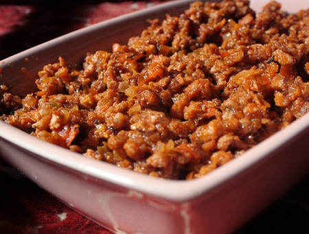 Receita
Como preparar a Proteína Vegetal Texturizada -
 Arqueologia
Livro de Enoque é um livro profético?
Tags